geo.wikisort.org - Island
Kat O (Chinese: 吉澳) also named Crooked Island, is an island in Northeast Hong Kong. Administratively, it is part of North District.
吉澳 | |
|---|---|
 The pier of Kat O | |
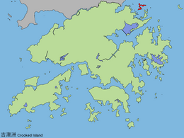 Location of Kat O in Hong Kong | |
| Geography | |
| Location | North District |
| Area | 2.35 km2 (0.91 sq mi) |
| Highest elevation | 122 m (400 ft) |
| Highest point | Kai Kung Leng (雞公嶺) |
| Administration | |
| Kat O | |||||||||||||
|---|---|---|---|---|---|---|---|---|---|---|---|---|---|
| Traditional Chinese | 吉澳 | ||||||||||||
| Literal meaning | Crooked Island | ||||||||||||
| |||||||||||||

Geography

Kat O is located in the west of Mirs Bay.[1] With an area of 2.35 km²,[2] it is the largest island in North District, the second largest being Wong Wan Chau (Double Island).[3] Neighbouring islands include: Ap Chau, Ngo Mei Chau (Crescent Island), and Pak Sha Chau (Round Island). The village of Tung O (東澳) is located on its northwest coast.[3] Its highest point is Kai Kung Leng (雞公嶺), which is 122 m above sea level.[1]
O Pui Tong (澳背塘) is a bay surrounded by the crook-shaped Crooked Island and Yeung Chau.[4] O Pui Tong, together with the northwestern waters of Kat O, are two of the 26 designated marine fish culture zones in Hong Kong.[5]
History
Kat O was once a major fishing market in Hong Kong,[6] and long served as an important stopover for boats travelling between Hong Kong and the rest of China.[7]
During the Ming dynasty, a decree required all inhabitants to leave the island. Then in the 1660s, soon after the end of the dynasty, it was re-settled by Hakka people.[7] Other residents were Tanka fishermen.[6]
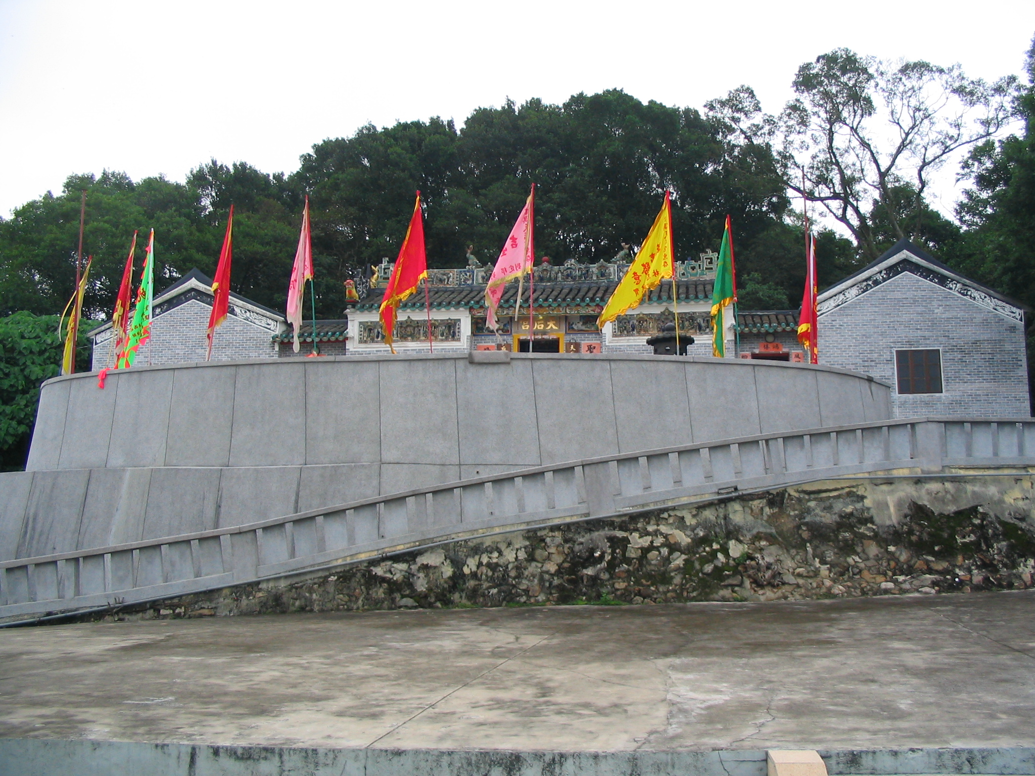
The Tin Hau Temple at Kat O was estimated to be built in 1763.[8] It is listed as a Grade III historic building.[9] Part of the temple building was used for the Tat O School until the school was moved to a new location in 1957.[6] A Pak Kung Shrine is also located in the vicinity.[10]
The island is home to three cannons. These are thought to have been made in the west, during the 19th century.[10]
Conservation
Kat O was part of the Plover Cove (Extension) Country Park since 1979.[11]
The Kat O Nature Trail spans 1 km long, stretching from the Kat O Ferry Pier to Ko Tei Teng (高地頂).[1]
The Kat O Geoheritage Centre (at No. 142 Kat O Main Street) was opened in 2010[12] by Kat O villagers, volunteer groups and the government to raise public awareness of geo-conservation, as part of the Hong Kong Geopark.[13]
See also
- Crooked Harbour
- Double Haven
- Pat Sin Leng Country Park
References
- Hong Kong Geopark: Kat O Nature Trail
- Survey and Mapping Office, Lands Department: Hong Kong geographic data sheet
- K.W. Lai, S.D.G. Campbell & R. Shaw, Geology of the Northeastern New Territories, p. 15, Civil Engineering Dept, Geotechnical Engineering Office, December 1996
- "O Pui Tong Fish Culture Zone". Project WATERMAN. The University of Hong Kong.
- "Marine fish culture, pond fish culture and oyster culture". Fisheries Branch. Agriculture, Fisheries and Conservation Department. 12 August 2019. Retrieved 16 December 2019.
- Antiquities Advisory Board. Historic Building Appraisal. Tin Hau Temple, Sai O, Kat O[dead link]
- HKFP Venture: Kat O, Hong Kong’s forgotten island – once its international gateway, HKFP, by Rhoda Kwan. 6 Sept 2020
- Welcome to 18 Districts - North District
- List of the 1,444 Historic Buildings with Assessment Results
- "Crooked Island". 2016-03-04. Archived from the original on 2016-03-04. Retrieved 2019-05-10.
- Agriculture, Fisheries and Conservation Department: Plover Cove Country Park Archived 2013-09-29 at the Wayback Machine
- Time Out Hong Kong: "Secret Hong Kong islands", 29 Apr 2014
- Hong Kong Geopark: Kat O Geoheritage Centre
External links
| Wikimedia Commons has media related to Crooked Island, Hong Kong. |
- Delineation of area of existing village Kat O (Sha Tau Kok) for election of resident representative (2019 to 2022)
- Kut-O Chinese Association (Kent area) Website
- Pictures of Kat O: ,
- Hong Kong Geopark: "Lee Yuk Ying Introduces the Cultural History of Kat O to Visitors".
- Webpage about Kat O
- Pictures of Tin Hau Temple, Sai O, Kat O
- How to visit two of Hong Kong's most remote islands in one day CNN.com
Другой контент может иметь иную лицензию. Перед использованием материалов сайта WikiSort.org внимательно изучите правила лицензирования конкретных элементов наполнения сайта.
WikiSort.org - проект по пересортировке и дополнению контента Википедии