geo.wikisort.org - Island
This article lists the islands in the River Thames, or at the mouth of a tributary (marked †), in England. It excludes human-made islands built as part of the building of forty-five two-gate locks which each accompany a weir, and islets subordinate to and forming part of the overall shape of another. The suffix -ey (pronounced today /iː/) is common across England and Scotland and cognate with ait and meaning island, a term – as ait or eyot – unusually well-preserved on the Thames. A small minority of list entries are referred to as Island, Ait or Eyot and are vestiges, separated by a depression in the land or high-water-level gully.
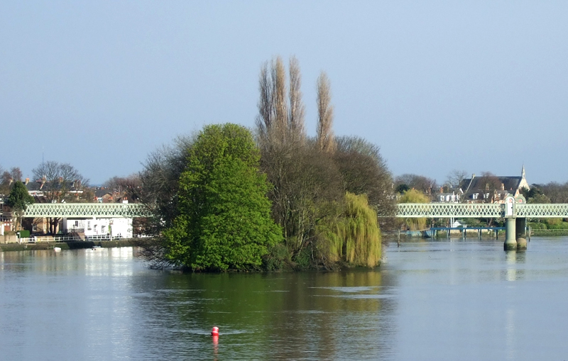
Most are natural; others were created by excavation of an additional or replacement navigation channel, such as to provide a shorter route, a cut. Many result from accumulation of gravel, silt, wildfowl dung and plant decay and root strengthening, particularly from willows and other large trees. Unlike other large rivers, all today are considered fixed. All in the reaches below Lechlade have been protected against erosion by various combinations of canalisation of the river, building up with dredged material from the river bed, water reeds, concrete, cement, wood or sheet piling.
List of former islands
- Frog Island†, Rainham
- Isle of Dogs, Poplar, London
- Isle of Grain, Kent
- Thorney (or Thorney Island)† covered a broad area surrounding Westminster Abbey
- Bermondsey†, land and grounds of Bermondsey Abbey, formed by an anabranch (corollary channel) naturally dredged by the mouth of the Neckinger; a vestige of the channel is St Saviour's Dock.
- Battersea Formerly bounded by the Heath Brook,Falcon Brook and Thames.
- Beyond the alluvium/silts of the estuary, by the English Channel and North Sea
- Isle of Thanet†, Kent
List of islands


The islands are listed in order upstream from the sea.
| Name | Area (acre) |
Area (ha) |
References |
|---|---|---|---|
| Isle of Sheppey† | 23,040 | 9,320 | [1] |
| Two Tree Island† (also known as Leigh Marshes) | 640 | 260 | |
| Canvey Island† | 4,556 | 1,844 | [2][3][4] |
| Lower Horse Island† on Holehaven† a sandbank of Holehaven Creek, Corringham | 31.1 | 12.6 | |
| Chiswick Eyot, Chiswick | 3.266 | 1.322 | [5] |
| Oliver's Island, Strand-on-the-Green | 0.90 | 0.36 | [6] |
| Brentford Ait, Brentford | 4.572 | 1.850 | [7] |
| Lot's Ait, Brentford | 1.724 | 0.698 | [8] |
| Isleworth Ait, Isleworth | 9.370 | 3.792 | [9] |
| Corporation Island, Richmond | 0.796 | 0.322 | [10] |
| Glover's Island, Twickenham | 0.536 | 0.217 | [11] |
| Eel Pie Island, Twickenham | 8.935 | 3.616 | [12] |
| Swan Island, Twickenham | 0.250 | 0.101 | [13] |
| Trowlock Island, Teddington | 3.700 | 1.497 | |
| Steven's Eyot, Kingston upon Thames | 0.372 | 0.151 | |
| Raven's Ait, Surbiton | 1.268 | 0.513 | [14] |
| Boyle Farm Island, Thames Ditton | 0.407 | 0.165 | [15] |
| Thames Ditton Island, Thames Ditton | 4.287 | 1.735 | [15] |
| Ash Island, East Molesey | 4.513 | 1.826 | [16] |
| Tagg's Island, Hampton | 3.681 | 1.490 | [16] |
| Garrick's Ait, Hampton | 0.798 | 0.323 | [17][18] |
| Benn's Island, Hampton | 0.1 | 0.040 | [19] |
| Platts Eyot, Hampton | 7.710 | 3.120 | [20] |
| Grand Junction Isle, Sunbury | 0.452 | 0.183 | [20] |
| Sunbury Court Island, Sunbury | 2.457 | 0.994 | [21] |
| Rivermead Island, Sunbury | 6.672 | 2.700 | [22] |
| Sunbury Lock Ait, Walton on Thames | 7.735 | 3.130 | [23] |
| Wheatley's Ait, Sunbury-on-Thames (also known as Wheatleys Eyot) | 11.928 | 4.827 | [24] |
| Desborough Island, Walton-on-Thames | 112.00 | 45.32 | [25] |
| D'Oyly Carte Island, Weybridge | 1.427 | 0.577 | [26] |
| Lock Island, Shepperton | 4.662 | 1.887 | [26] |
| Hamhaugh Island, Shepperton | 9.897 | 4.005 | [26] |
| Pharaoh's Island, Shepperton | 4.1 | 1.7 | [26][27] |
| Laleham Burway including Abbey Mead, Chertsey | 396 | 160 | |
| Penton Hook Island, Laleham | 11.443 | 4.631 | [28] |
| Truss's Island, Thorpe | 0.310 | 0.125 | |
| Church Island, Staines-upon-Thames | 2.069 | 0.837 | [29] |
| Hollyhock Island with Holm Island, Staines-upon-Thames | 2.429 | 0.983 | [29] |
| The Island (formerly marsh), Hythe End | 3.953 | 1.600 | [29] |
| Magna Carta Island, Runnymede | 1.706 | 0.690 | [29] |
| Unnamed island, Wraysbury | 0.690 | 0.279 | [29][30] |
| Pats Croft Eyot, Runnymede | 0.518 | 0.210 | [29] |
| Friary Island, Wraysbury | 7.309 | 2.958 | [31][32] |
| Friday Island, Old Windsor | 0.154 | 0.062 | [31] |
| Ham Island, Old Windsor | 126.0 | 51.0 | |
| Lion Island, Old Windsor | 0.353 | 0.143 | |
| Sumptermead Ait, Datchet | 5.180 | 2.096 | |
| Black Potts Ait, Windsor | 1.81 | 0.73 | [33] |
| Romney Island, Windsor | 6.304 | 2.551 | [33][34] |
| Cutlers Ait, Windsor | 0.955 | 0.386 | [33] |
| Firework Ait, Windsor | 0.022 | 0.0089 | [35] |
| Barry Avenue Island, Windsor | 0.641 | 0.259 | |
| Deadwater Ait, Windsor | 0.550 | 0.223 | [33] |
| Baths Island, Eton Wick | 3.42 | 1.38 | [33] |
| Bush Ait, Windsor | 1.118 | 0.452 | [33] |
| Queen's Eyot, Dorney | 4.209 | 1.703 | |
| Monkey Island, Bray | 5.276 | 2.135 | [36] |
| Pigeonhill Eyot, Bray | 2.625 | 1.062 | [36] |
| Headpile Eyot, Bray | 3.440 | 1.392 | [36] |
| Guards Club Island, Maidenhead (also known as Bucks Ait) | 0.640 | 0.259 | [36] |
| Bridge Eyot, Maidenhead | 2.262 | 0.915 | [36] |
| Grass Eyot, Maidenhead | 1.258 | 0.509 | [36] |
| Ray Mill Island, Maidenhead | 0.991 | 0.401 | [36][37] |
| Boulter's Island or Boulter's Lock Island, Maidenhead | 3.474 | 1.406 | [36] |
| Glen Island, Maidenhead | 4.104 | 1.661 | [36] |
| Bavin's Gulls, Maidenhead (also known as Sloe Grove Islands) | 1.856 | 0.751 | [38] |
| Formosa including manmade Mill and Sashes Islands, Cookham | 126.597 | 51.232 | [36] |
| Sheriff Island, Marlow | 2.410 | 0.975 | [36] |
| Gibraltar Islands, Marlow | 5.491 | 2.222 | [36] |
| Temple Mill Island, Hurley | 3.815 | 1.544 | [36] |
| Frog Mill Ait, Hurley | 4.213 | 1.705 | [39] |
| Black Boy Island, Hurley | 5.344 | 2.163 | [39][40] |
| Magpie Island, Medmenham | 3.1 | 1.3 | [41][39] |
| Hambleden Mill island | 1.584 | 0.641 | [42] |
| Temple Island, Remenham | 1.051 | 0.425 | [43] |
| Rod Eyot, Henley-on-Thames | 2.159 | 0.874 | [43] |
| Ferry Eyot, Harpsden | 1.482 | 0.600 | [43] |
| Poplar Eyot, Wargrave | 0.958 | 0.388 | [43] |
| Handbuck Eyot, Wargrave | 0.770 | 0.312 | [43] |
| Unnamed Eyot, Wargrave | 2.378 | 0.962 | [43] |
| Shiplake railway bridge island | 1.193 | 0.483 | [43] |
| Shiplake weir island | 1.579 | 0.639 | [43] |
| Phillimore Island, Charvil | 0.399 | 0.161 | [43] |
| The Lynch, Lower Shiplake | 3.248 | 1.314 | [43] |
| Hallsmead Ait, Lower Shiplake | 4.745 | 1.920 | [43][44] |
| Buck Ait, Sonning | 0.596 | 0.241 | [45] |
| Long Ait, Sonning | 2.623 | 1.061 | [43] |
| Sonning Eye, Sonning including Aberlash House island | 9.222 | 3.732 | [43] |
| Sonning Hill island, Sonning | 0.578 | 0.234 | [43] |
| Sonning Marsh, Caversham Lakes Island | 0.561 | 0.227 | [43] |
| Heron Island, Reading | 1.668 | 0.675 | [43][46] |
| View Island, Reading | 3.5 | 1.4 | [43][47] |
| De Bohun Island, Reading | 1.122 | 0.454 | [43] |
| Fry's Island, Reading (also known as De Montfort Island) | 3.561 | 1.441 | [43] |
| Pipers Island, Reading | 0.147 | 0.059 | [43] |
| St Mary's Island and the Lower Large, Reading | 0.958 | 0.388 | [43][48] |
| Appletree Eyot, Tilehurst | 0.730 | 0.295 | [43] |
| Poplar Island, Tilehurst | 0.740 | 0.299 | [43] |
| Mapledurham Mill Island | 1.322 | 0.535 | [43] |
| Whitchurch Mill Greater Island | 1.945 | 0.787 | [43] |
| Lower Basildon marsh island | 0.759 | 0.307 | [43] |
| Streatley Mill Greater Island | 1.977 | 0.800 | [43] |
| Cleeve Mill lower island, Goring | 1.945 | 0.787 | [43] |
| Cleeve Mill island, Goring | 0.979 | 0.396 | [43] |
| Cleeve Mill upper island, Goring | 1.416 | 0.573 | [43] |
| Cholsey Marsh island | 1.2 | 0.49 | [49][50][43] |
| Crowmarsh Mill Island | 3.160 | 1.279 | [43] |
| Little Wittenham Footbridge Island | 2.316 | 0.937 | [43] |
| Clifton Cut Island | 61.864 | 25.035 | [51] |
| Long Wittenham Backwater Island | 9.477 | 3.835 | [51] |
| Culham Cut Island | 70.638 | 28.586 | [51] |
| Sutton Pools Island, Sutton Courtney | 6.056 | 2.451 | [51] |
| Nag's Head Island, Abingdon | 1.876 | 0.759 | [51] |
| Andersey Island, Abingdon | 273 | 110 | [51] |
| Tiger Island (opposite the Abbey Grounds), Abingdon | 19.830 | 8.025 | [51] |
| Lock Wood Island, Nuneham Courtenay | 1.930 | 0.781 | [51] |
| Fiddler's Elbow, Sandford-on-Thames | 11.688 | 4.730 | [51][52] |
| Fidder's Elbow far northern section | 6.425 | 2.600 | |
| Swan Inn, Rose, Kennington or St Michael Isle, Kennington | 1.197 | 0.484 | [51] |
| Folly Island, Folly Bridge, Oxford | 0.65 | 0.26 | [53] |
| Osney Island, Oxford | 108.34 | 43.84 | [54][51] |
| Fiddler's Island, Oxford | 4.105 | 1.661 | [51] |
| Godstow Bridge Island | 2.181 | 0.883 | [51] |
| King's Lock Island | 2.558 | 1.035 | [51] |
| Pinkhill Lock Island | 3 | 1.2 | [55][51] |
| Shifford Cut Island, Chimney Meadows, Chimney, Oxfordshire | 110.832 | 44.852 | [51] |
| Radcot Bridge Lower Island, Radcot | 3.648 | 1.476 | [56] |
| Radcot Bridge Upper Island, Radcot | 5.746 | 2.325 | [56] |
| Swan Hotel Island, Radcot | 0.885 | 0.358 | [56] |
| St Mary's Mead, Buscot | 3.697 | 1.496 | [56] |
| St John's Bridge Island, Lechlade (borders Buscot) | 1.208 | 0.489 | [56] |
| Northern meadow, Castle Eaton | 27.875 | 11.281 | [56] |
| Cricklade north-east meadow | 7.747 | 3.135 | [56] |
| Island between High and Oaklake bridges†, Ashton Keynes | 51.72 | 20.93 | [56] |
| Manor stream island, Somerford Keynes and Kemble | 86.195 | 34.882 | [56] |
Oxford floodplain
In the Oxford area the river splits into several streams across the floodplain, which create numerous islands. On the right bank a large island is created by Seacourt Stream, Botley Stream and Bulstake Stream, and there are smaller islands, including the large mainly built-up island now known as Osney, created by streams between Bulstake Stream and the Thames, including Osney Ditch. The Oxford suburbs of Grandpont and New Hinksey are on an island created by Bulstake Stream, Hinksey Stream and Weirs Mill Stream. Iffley Meadows is an island west of Iffley Lock, between Weirs Mill Stream, Hinksey Stream and the Thames.
On the left bank Fiddler's Island followed downstream by the built-up island historically known as Osney lie between Castle Mill Stream and the Thames. Cripley Meadow is also on an island formed by Fiddler's Island Stream, Castle Mill Stream and Sheepwash Channel.
Eton and Dorney
The status of Eton, Berkshire combined with Dorney is controversial. These are two mainly pre-1900-built small villages and their outlying localities: Eton Wick, Boveney and Dorney Reach. Much of these areas of land in the 19th century was marked by the Ordnance Survey "liable to floods" which led to pressure on authorities for flood protection, along with the more densely populated right bank.
They have been, since 2002, on a more protected man-made island formed by the Jubilee River, which is sometimes seen as an advanced flood relief channel rather than a channel of the Thames. As the Jubilee River is maintained with flow at all times,[citation needed] they may be coming to be accepted by publications as on an island of the Thames, reflecting their objective strict geographical status.
Lock islands
The construction of almost all locks on the Thames involved one or more artificial lock islands separating the lock from the weirs. These may have been created by building an artificial island in the river or by digging an artificial canal to contain the lock and turning the land between that and the river into an island. In many cases the lock island contains the lock keeper's house and can be accessed across the lock gates. Such lock islands are only listed above if they have a specific name of their own: all Thames locks are listed in Locks on the River Thames.
See also
- Crossings of the River Thames
- Tributaries of the River Thames
- Eyots and Aits, Miranda Vickers, The History Press, pp 144, 2012.
Notes
- See article Isle of Sheppey for source. Its area is 36 sq mi (23,000 acres; 93 km2)
- See article: Canvey Island for source. Its area is 7 sq mi (4,500 acres; 18 km2)
- Its land forms the land part of a wider parish, which took in mud flats, saltings and eroded land to the south-east where the river is broad – its scope is stated to be 9055.442 acres per OS 25-inch map of 1898 Ordnance Survey Essex Sheet LXXVII SE revised 1895-1896, published 1898.
- http://www.visionofbritain.org.uk/unit/10244250/boundary Archived 17 December 2017 at the Wayback Machine boundary map of Canvey Island parish – Vision of Britain – The University of Portsmouth and others
- OS 25-inch map of 1910 Ordnance Survey Surrey II.10 revised 1910, published 1913.
- OS 25-inch map of 1896 Ordnance Survey London LXXXIV published 1897.
- OS 25-inch map of 1910 Ordnance Survey London sheet LXXXIV revised 1891-94, published 1897.
- OS 25-inch map of 1910 Ordnance Survey London sheet LXXXIV revised 1891-94, published 1897.
- OS 25-inch map of 1910 Ordnance Survey London sheet XCVI revised 1891-94, published 1897.
- approx.
- OS 25-inch map of 1894 Ordnance Survey London CXXII repeated on sheet CX published 1897.
- OS 25-inch map of 1894, Surrey sheet VI.7 revised 1893-1894, published 1898.
- OS 25-inch map of 1894 Ordnance Survey London CXXII published 1897.
- OS 25-inch map of 1894, Middlesex sheet XXV.12 revised 1893-1894, published 1898.
- OS 25-inch map of 1895, Surrey sheet XII.7 revised 1895, published 1897.
- OS 25-inch map of 1894 Ordnance Survey London CXXXIX published 1897.
- "Hampton Sailing Club". Archived from the original on 5 November 2008. Retrieved 9 December 2008.
During 1962 the clubhouse was built on the piles at Benn’s Island.
- OS 25-inch map of 1894 Surrey sheet VI.14 published 1897. Ordnance Survey
- approx.
- OS 25-inch map of 1894-5 Middlesex sheets XXV.6 & 10 published 1896
- OS 25-inch map of 1893-4 Surrey sheet VI13 published 1896. Ordnance Survey. C. Measured as 2.464 by own research using online map tools; as east end sheared off rest slightly extended
- Actual measurement. Compares to broader island OS 25-inch-to-mile map of Middlesex of 1912, sheet XXV.9 in four parcels, total 7.804 acres (3.158 ha). Published 1915.
- OS 25-inch-to-mile map of Middlesex of 1912, sheet XXV.9 in four parcels, total 7.804 acres (3.158 ha). Published 1915.
- OS 25-inch-to-mile map of Middlesex of 1912, sheet XXV.9, published 1915.
- approx
- OS 25-inch-to-mile map of Surrey of 1894, sheet XI.7 published 1896.
- Since this source island has been made thinner to south-west to obstruct less of the main flow of the river, stated acreage reference number Shepperton: 226, measuring 4.298 acres (1.739 ha), named Dog Ait
- OS 25-inch-to-mile map of Surrey of 1912, sheet V.14&15 published 1914
- OS 25-inch-to-mile map of Buckinghamshire of 1899, sheet LVIII.8 published 1899
- Acreage number 198, Wraysbury
- No trench visible. No longer an island
- OS 25-inch-to-mile map of Surrey of 1912, sheet IV.8 published 1914
- OS 25-inch-to-mile map of Buckinghamshire of 1897, sheet LVI.6 published 1899
- Romney Island is in three sections as broken by two short side weirs; it also has the long breakwater below Windsor Bridge called The Cobbler
- 1,000 square feet (90 m2) at most. This patch of less than six trees is too small to be shown on most maps of Windsor and Eton
- OS 25-inch-to-mile map of Buckinghamshire of 1897, sheet LVII published 1899
- Note: Ray Mill Island is fully attached to the bank on one side
- three main islands are marked 0.263, 0.888 and 0.705 acres (0.106, 0.359 and 0.285 ha) from north to south.
- OS Map sheet L1.11 of Bucks (county) revised 1897, published 1898.
- With Frog Mill Ait, forms archipelago of three, these are the largest two, that to the north measured 0.562 acres (0.227 ha)
- Formerly two islands plus islet trees to south now all one. Pre-20th century maps show a narrow channel (between these); total published area then excluding filled in area: 3.008 acres (1.217 ha)
- OS Map sheet L1.6 of Bucks (county) revised 1897, published 1898.
- OS 25-inch-to-mile map of Oxfordshire of 1897, sheets LIV.5, LVI.13, LVI.14 and LVI1.16 published 1898
- Marginally washed away at upper end since last Ordnance Survey out-of-copyright published measurement given
- Greatly washed away at upper end since last Ordnance Survey out-of-copyright published measurement given
- Heron Island was and island and downstream islet, marsh in 1898; one island below these former two islands was 0.512 acres (0.207 ha) and has been given over to the river
- Was 4.079 acres (1.651 ha) in map cited however has been cut back to raise marshy 3.112-acre (1.259 ha) eastern bulk and broaden main channel to south
- as to the Lower Large
- approx.
- Former three separate aits merged by in-fill of channels 0.316, 0.315 and 0.249 acres (0.128, 0.127 and 0.101 ha) per published maps
- OS 25-inch-to-mile map of Oxfordshire of 1897, sheets XLV.16, XXXII.10 and XXXIX.2 published 1898
- Fiddler’s Elbow breaks into a 1.956 northern section (broken from the 8.631 remainder) by a minor, weired meandering creek in its northern part)
- A small island transected by Abingdon Road that lies between two spans of Folly Bridge.
- Note: Osney is given as its narrowest definition; its larger west parts of the city would more than treble this measurement
- approx.
- OS 25-inch-to-mile map of Oxfordshire of 1898, sheets XXXVII.13 published 1899
На других языках
[de] Liste der Inseln in der Themse
Dieser Artikel verzeichnet die Inseln in der Themse in England. Nicht aufgeführt werden die kleinen Schleuseninseln, die bei dem Bau dieser Schleusen entstanden und einige sehr kleine, die sich unmittelbar an größere anschließen. Die Isle of Dogs und die Isle of Grain sind keine Inseln mehr, auch wenn sie ihren Namen behalten haben. Westminster war eine Insel, die Thorney Island hieß. Einige weitere Inseln sind nur noch Vorsprünge, die durch einen kleinen Graben gekennzeichnet sind.- [en] Islands in the River Thames
[fr] Liste des îles de la Tamise
Cet article répertorie les îles de la Tamise, ou à l'embouchure d'un affluent, en Angleterre. Il exclut les îles artificielles construites dans le cadre de la construction de quarante-cinq écluses à deux portes qui s'accompagnent chacune d'un déversoir. Une petite minorité des îles de la liste sont appelées Ait ou Eyot et sont des vestiges, séparés par un creux dans la terre ou un ravin de haut niveau.Другой контент может иметь иную лицензию. Перед использованием материалов сайта WikiSort.org внимательно изучите правила лицензирования конкретных элементов наполнения сайта.
WikiSort.org - проект по пересортировке и дополнению контента Википедии