geo.wikisort.org - Island
Hornos Island (Spanish: Isla Hornos) is a Chilean island at the southern tip of South America. The island is mostly known for being the location of Cape Horn. It is generally considered South America's southernmost island, but the Diego Ramírez Islands are farther south. The island is one of the Hermite Islands, part of the Tierra del Fuego archipelago.
Native name: Isla Hornos | |
|---|---|
 The Hornos Island | |
 Hornos Island | |
| Geography | |
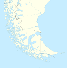
| Coordinates | 55.944078°S 67.280925°W |
| Archipelago | Tierra del Fuego |
| Adjacent to | Pacific ocean / Atlantic ocean |
| Area | 25.1 km2 (9.7 sq mi) |
| Administration | |
Chile | |
| Region | Magallanes |
| Province | Antártica |
| Commune | Cabo de Hornos |
| Demographics | |
| Population | 5 (2019) |
| Additional information | |
| NGA UFI= -884347 | |
The Chilean Navy maintains a station on the island, consisting of a residence, utility building, chapel, and lighthouse.[1] A short distance from the main station is a memorial, including a large sculpture featuring the silhouette of an albatross, in honour of the sailors who died while attempting to "round the Horn".[2]
The island is within the Cabo de Hornos National Park.
Ecology
The island is dominated by Megallanic moorlands. Exposed locations are dominated by bunch grasses and short shrubs, low to the ground to avoid wind. Short trees found only in wind protected areas. The world's southernmost tree, a Nothofagus betuloides, is found on Hornos Island.[3]
The island has extensive penguin colonies along the coast, with no land predators present. Several raptors live on the island and prey on penguins.
People
In 2019, the island had a population of five, consisting of the lighthouse keeper, his wife, and their three children.[4]
The island is also the southernmost extension of pre-industrial humanity. The world's southernmost archaeological site, consisting of harpoon points, butchered bones, and a hearth or cooking camp, was found in 2019.[5]
Geology
The composition of the island is mainly of Cretaceous granite with Jurassic volcanic rocks in the northwest. The lower areas of the island are filled with peat moss.
Climate
This section does not cite any sources. (August 2022) |
- Mean temperature: 5.3 °C (41.54 °F)
- Maximum temperature: 20.5 °C (68.9 °F) (February 1996)
- Minimum temperature: −14.5 °C (5.9 °F) (June 1992)
- Mean relative humidity: 86.4%
- Mean wind direction: 264°
- Mean wind speed: 84 knots
- Maximum wind speed: 119 knots (August 1995)
- Rainfall (yearly mean): 697.5 mm
- Maximum rainfall: 1263.2 mm (1990)
References
- Isla Hornos Lighthouse, from Lighthouse Depot. Retrieved 18 November 2014.
- Cape Horn Memorial Archived 2005-09-26 at the Wayback Machine, by Roberto Benavente; from Fundacion Caphorniers Chile. Retrieved February 5, 2006.
- Craig Welch (May 13, 2021). "The tree at the bottom of the world—and the wind-blasted trek to find it". National Geographic.
- "Chilean family lives surrounded by the wildest seas on the planet". www.efe.com.
- "Antiquity announcement: Isla Hornos/Isla Lököshpi".
| Authority control |
|
|---|
This Magallanes and Antártica Chilena Region location article is a stub. You can help Wikipedia by expanding it. |
На других языках
[de] Hornos (Chile)
Hornos (spanisch Isla Hornos) ist eine etwa 6 km lange und 2 km breite Insel im chilenischen Teil von Feuerland, an deren Südspitze sich das berühmte Kap Hoorn befindet. Die Insel gehört zu den Hermite-Inseln und liegt unmittelbar im Norden der Drakestraße zwischen dem Archipel Feuerland und dem antarktischen Grahamland.- [en] Hornos Island
[es] Isla Hornos
La isla Hornos[Nota 1] forma parte del grupo de las islas Hermite, en la región más austral de Chile, por lo que pertenece a la Región de Magallanes y de la Antártica Chilena. [1][fr] Île Horn
L'île Horn (en espagnol : Isla Hornos) est l'île la plus méridionale de l'archipel L'Hermite, archipel chilien de la Terre de Feu. Elle est surtout connue pour abriter le cap Horn et est souvent considérée comme la terre la plus méridionale d'Amérique même si ce titre revient aux îles Diego Ramirez, à 105 kilomètres à l'ouest-sud-ouest de l'île Horn. La ville d'Ushuaïa se trouve à 138 km au nord-nord-ouest.[it] Isla Hornos
L'isla Hornos è un'isola del Cile meridionale tra l'oceano Pacifico e l'Atlantico. Appartiene alla regione di Magellano e dell'Antartide Cilena, alla provincia dell'Antartica Cilena e al comune di Cabo de Hornos. L'isola è principalmente conosciuta per Capo Horn (in spagnolo: Cabo de Hornos), generalmente considerato il punto più meridionale del Sud America, in verità le isole Diego Ramírez sono più a sud, mentre il punto continentale più a sud è Capo Froward nello stretto di Magellano.[ru] Горн (остров)
Горн (исп. Isla Hornos) — остров в южной части архипелага Огненная Земля, принадлежит Чили и входит в провинцию чилийская Антарктика. На острове находится знаменитый мыс Горн. Остров известен как самая южная часть Южной Америки однако на самом деле таковыми являются острова Диего-Рамирес. Остров Горн принадлежит к группе островов Эрмит (исп. Islas Hermite) относящихся к архипелагу Огненная Земля.Другой контент может иметь иную лицензию. Перед использованием материалов сайта WikiSort.org внимательно изучите правила лицензирования конкретных элементов наполнения сайта.
WikiSort.org - проект по пересортировке и дополнению контента Википедии