geo.wikisort.org - Island
The Diego Ramírez Islands (Spanish: Islas Diego Ramírez) are a small group of subantarctic islands located in the southernmost extreme of Chile.
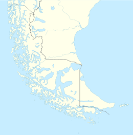
 Map of Diego Ramirez Islands | |
 Diego Ramírez Islands Islas Diego Ramírez Location south of the South American Mainland | |
| Geography | |
|---|---|
| Coordinates | 56°29′S 68°44′W |
| Area | 1 km2 (0.39 sq mi) |
| Highest point | 179 m (587 ft)[1] |
| Administration | |
| Region | |
| Province | Antártica Chilena |
| Commune | Cabo de Hornos |
| Demographics | |
| Population | Chilean Navy station |
| Additional information | |
| NGA UFI=-879674 | |
History
The islands were first sighted on 12 February 1619 by the Spanish Garcia de Nodal expedition, and named after the cosmographer of the expedition, Diego Ramírez de Arellano.[2] They were cited as the southernmost land mass plotted as of that time, and retained the distinction for 156 years, until the discovery of the South Sandwich Islands in 1775.
In 1892, the Chilean government rented the islands to Pedro Pablo Benavides for fishing and on condition that a lighthouse, a port, and a school would be built.[3] Later the rent was transferred to Koenigswerther and Pasinowich.
The Chilean Navy established a meteorological station above Caleta Condell, a small cove on the northeastern side of Isla Gonzalo (Gonzalo Island), in 1957, and resupplies it several times each year.[4] This is the southernmost inhabited outpost outside Antarctica. The next most southerly inhabited outpost is the lighthouse of Cape Horn. Cruise ships occasionally pass by on their way to and from Antarctica.
Geography
The islands lie about 105 km (65 mi) west-southwest of Cape Horn and 93 km (58 mi) south-southeast of Ildefonso Islands, stretching 8 km (5 mi) north-south. They are divided into a smaller northern group with six islets, and a larger southern group, separated by a passage 3 km (1.9 mi) wide. The two largest islands, Isla Bartolomé and Isla Gonzalo, both lie in the southern group. Águila Islet (Islote Águila), the southernmost land of the group, is at latitude and longitude coordinates 56°32'9"S. They lie about 350 km north of Sars Bank, a seamount that once may have been an island.[5]
 View of the Diego Ramirez Islands
 The Chilean station on Isla Gonzalo, with the beacon visible at highest point of the island


Climate
The islands have a tundra climate (ET) with abundant precipitation. Temperatures remain chilly to cool throughout the entire year.
| Climate data for Diego Ramírez Islands (Isla Gonzalo) 42 m asl (1981–2010 normals) | |||||||||||||
|---|---|---|---|---|---|---|---|---|---|---|---|---|---|
| Month | Jan | Feb | Mar | Apr | May | Jun | Jul | Aug | Sep | Oct | Nov | Dec | Year |
| Record high °C (°F) | 20.0 (68.0) |
19.4 (66.9) |
21.3 (70.3) |
19.3 (66.7) |
13.0 (55.4) |
15.5 (59.9) |
14.0 (57.2) |
13.0 (55.4) |
14.0 (57.2) |
14.0 (57.2) |
16.0 (60.8) |
19.6 (67.3) |
21.3 (70.3) |
| Average high °C (°F) | 9.5 (49.1) |
9.8 (49.6) |
9.2 (48.6) |
8.0 (46.4) |
6.6 (43.9) |
5.5 (41.9) |
5.3 (41.5) |
5.4 (41.7) |
6.1 (43.0) |
6.7 (44.1) |
7.6 (45.7) |
8.7 (47.7) |
7.4 (45.3) |
| Daily mean °C (°F) | 7.6 (45.7) |
7.9 (46.2) |
7.2 (45.0) |
6.1 (43.0) |
4.8 (40.6) |
3.7 (38.7) |
3.5 (38.3) |
3.5 (38.3) |
4.1 (39.4) |
4.8 (40.6) |
5.7 (42.3) |
6.7 (44.1) |
5.5 (41.9) |
| Average low °C (°F) | 5.6 (42.1) |
5.9 (42.6) |
5.1 (41.2) |
4.2 (39.6) |
2.9 (37.2) |
1.9 (35.4) |
1.6 (34.9) |
1.5 (34.7) |
2.1 (35.8) |
2.9 (37.2) |
3.6 (38.5) |
4.7 (40.5) |
3.5 (38.3) |
| Record low °C (°F) | −3.0 (26.6) |
−2.0 (28.4) |
−3.0 (26.6) |
−4.2 (24.4) |
−5.0 (23.0) |
−8.0 (17.6) |
−7.0 (19.4) |
−9.0 (15.8) |
−6.8 (19.8) |
−4.0 (24.8) |
−3.4 (25.9) |
−3.8 (25.2) |
−9.0 (15.8) |
| Average precipitation mm (inches) | 136.8 (5.39) |
96.4 (3.80) |
111.0 (4.37) |
122.9 (4.84) |
114.1 (4.49) |
90.6 (3.57) |
89.4 (3.52) |
93.6 (3.69) |
76.6 (3.02) |
114.2 (4.50) |
114.5 (4.51) |
102.0 (4.02) |
1,262.1 (49.72) |
| Average precipitation days | 21.30 | 17.68 | 18.92 | 17.50 | 16.29 | 15.71 | 17.41 | 17.96 | 15.76 | 19.01 | 20.41 | 18.84 | 216.79 |
| Source 1: Météo climat stats[6] | |||||||||||||
| Source 2: Météo Climat[7] | |||||||||||||
Environment
Important Bird Area
The islands have been designated as an Important Bird Area (IBA) by BirdLife International for their significant seabird breeding populations. These include colonies of macaroni and southern rockhopper penguins, grey-headed and black-browed albatrosses, and blue petrels.[8]
In 2022, Ricardo Rozzi et al. identified the Subantarctic rayadito (Aphrastura subantarctica) as a new bird species endemic to the Diego Ramírez Islands. Subantarctic rayadito individuals had been formerly idenfitied as belonging to the species Aphrastura spinicauda (thorn-tailed rayadito).[9]
See also
References
- United States Hydrographic Office, South America Pilot (1916), page 256
- Dingwall, P.R., ed. (1995). Progress in Conservation of the Subantarctic Islands, p. 107. The World Conservation Union. ISBN 2-8317-0257-7.
- Octavio Errázuriz Guilisasti and Germán Carrasco Domínguez, Historia de las Relaciones Exteriores de Chile, Arbritaje británico de 1899-1903, Editorial Andrés Bello, 1968, Santiago de Chile, page 93
- Dingwall (1995), p. 109.
- Martinic B., Mateo (2019). "Entre el mito y la realidad. La situación de la misteriosa Isla Elizabeth de Francis Drake" [Between myth and reality. The situation of the mysterious Elizabeth Island of Francis Drake]. Magallania (in Spanish). 47 (1): 5–14. doi:10.4067/S0718-22442019000100005. Retrieved December 21, 2019.
- "Moyennes 1981-2010 Chili" (in French). Retrieved 11 November 2019.
- "Météo Climat stats for Iles Diego Ramirez". Météo Climat. Retrieved 11 November 2019.
- "Islas Diego Ramírez y Rocas Norte". BirdLife Data Zone. BirdLife International. 2020. Retrieved 13 December 2020.
- Rozzi, Ricardo; Quilodrán, Claudio S.; Botero-Delgadillo, Esteban; Napolitano, Constanza; Torres-Mura, Juan C.; Barroso, Omar; Crego, Ramiro D.; Bravo, Camila; Ippi, Silvina; Quirici, Verónica; Mackenzie, Roy; Suazo, Cristián G.; Rivero-de-Aguilar, Juan; Goffinet, Bernard; Kempenaers, Bart; Poulin, Elie; Vásquez, Rodrigo A. (2022-08-26). "The Subantarctic Rayadito (Aphrastura subantarctica), a new bird species on the southernmost islands of the Americas". Scientific Reports. Springer. 12 (1). doi:10.1038/s41598-022-17985-4. ISSN 2045-2322.
External links
| Authority control |
|
|---|
На других языках
[de] Diego-Ramírez-Inseln
Die Diego-Ramírez-Inseln (spanisch Islas Diego Ramírez) sind eine Gruppe kleiner Inseln, die etwa 100 km südwestlich von Kap Hoorn und 93 km südsüdöstlich der Ildefonso-Inseln liegen und zu Chile gehören.- [en] Diego Ramírez Islands
[es] Islas Diego Ramírez
El archipiélago de las islas Diego Ramírez es un grupo de pequeñas islas e islotes de Chile, localizado a unos 100 km al suroeste del cabo de Hornos y a 93 km al sur-suroeste de las islas Ildefonso, en el Paso Drake, y a unos 790 km al nor-noroeste de las islas Shetland del Sur (Antártida). Comprenden unos 8 km de norte a sur, llegando hasta la latitud 56º32,2'S.[fr] Îles Diego Ramirez
Les îles Diego Ramirez (en espagnol : Islas Diego Ramírez) sont un ensemble de petites îles situé dans le Sud-Est de l'océan Pacifique sud, à l'extrémité nord-ouest du passage de Drake et à 105 kilomètres à l'ouest-sud-ouest du cap Horn. L'archipel appartient à la commune de Cabo de Hornos de la province de l'Antarctique chilien, dans la région de Magallanes, au Chili.[it] Isole Diego Ramírez
Le isole Diego Ramírez (in spagnolo Islas Diego Ramírez) sono un gruppo di piccole isole ed isolotti appartenenti al Cile, si trovano circa Km 100 sud-ovest del Capo Horn, nello Stretto di Drake (56°30′S 68°43′W), e circa Km 790 nord-ovest dall'Isole Shetland Meridionali (Antartide), e sono considerate il punto più meridionale del continente americano, essendo anche la terra più vicina al territorio antartico nel mondo.[ru] Диего-Рамирес
Диего-Рамирес (исп. Islas Diego Ramírez) — группа небольших островов (общая площадь более 1 км²) в проливе Дрейка примерно в 100 км к юго-западу от мыса Горн, протянувшаяся примерно на 8 км с севера на юг. Это — самая южная точка Чили и Америки как части света. В архипелаге можно выделить две группы островов — малую северную и большую южную.Другой контент может иметь иную лицензию. Перед использованием материалов сайта WikiSort.org внимательно изучите правила лицензирования конкретных элементов наполнения сайта.
WikiSort.org - проект по пересортировке и дополнению контента Википедии