geo.wikisort.org - Island
East Linga is one of the Shetland Islands. It lies between Whalsay (to the west), and Grif Skerry to the east.
| Scottish Gaelic name | Unknown |
|---|---|
| Old Norse name | Possibly Lingey |
| Meaning of name | "east heather island" |
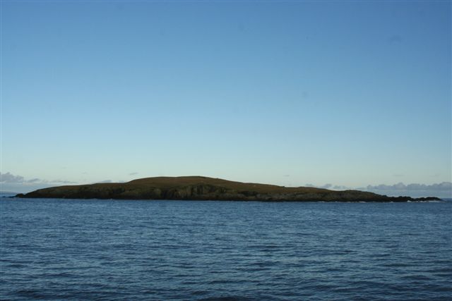 East Linga viewed from the south | |
| Location | |
 East Linga East Linga shown within Scotland | |
| OS grid reference | HU615623 |
| Coordinates | 60.34°N 0.88°W |
| Physical geography | |
| Island group | Shetland |
| Area | 30 hectares (0.12 sq mi) |
| Highest elevation | 27 metres (89 ft) |
| Administration | |
| Sovereign state | United Kingdom |
| Country | Scotland |
| Council area | Shetland |
| Demographics | |
| Population | nil |
| References | [1] |
Geography and geology
The bed rock is gneiss with granite veins.
There are many skerries and rocks in the channel south of Whalsay and East Linga, some of which have disputed names, i.e. one local version, and a different one on Admiralty Charts and/or Ordnance Survey maps. For example, "Muckla Billan" is listed on the latter, but is known locally as "Peerie Fladdacap".[1][2]
In December 2008 the corpses of eighteen grey seals were discovered on the island, some of them apparently clubbed to death. Police have charged a forty-seven-year-old man in connection with the discovery. According to Scottish Natural Heritage, about thirty grey seals are born on East Linga each year.[3]
The smaller Calf of Linga lies to the north and is connected to East Linga at low tide.[1] West Linga lies on the other side of Whalsay.
References
- "Get-a-map" Ordnance Survey
- Haswell-Smith, Hamish (2004). The Scottish Islands. Edinburgh: Canongate. p. 455. ISBN 978-1-84195-454-7.
- "Man charged with seal slaughter " Shetland Marine News. Retrieved 14 December 2008.
External links
![]() Media related to East Linga at Wikimedia Commons
Media related to East Linga at Wikimedia Commons
This Shetland location article is a stub. You can help Wikipedia by expanding it. |
На других языках
- [en] East Linga
[fr] East Linga
East Linga est une île inhabitée du Royaume-Uni située en Écosse, dans les Shetland, à l'est de Whalsay. Elle est entourée par le récif de Rumble au sud, l'île de Grif Skerry à l'est et les îles de Isbister Holm, Mooa et Nista au nord-ouest. L'îlot de Calf of Linga et le rocher de Stack of Wirrgeo se trouvent à proximité d'East Linga, respectivement au nord-est et à l'est. L'ile est baignée par la mer du Nord. De forme grossièrement circulaire, elle culmine à 27 mètres d'altitude et compte trois criques : Wirr Geo au nord-est, Gun Geo au sud et Brae Geo à l'ouest.Другой контент может иметь иную лицензию. Перед использованием материалов сайта WikiSort.org внимательно изучите правила лицензирования конкретных элементов наполнения сайта.
WikiSort.org - проект по пересортировке и дополнению контента Википедии