geo.wikisort.org - Island
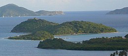
Buck Island is a privately owned island of the British Virgin Islands in the Caribbean.
 Buck Island, British Virgin Islands | |
 Buck Island The location of Buck Island within the British Virgin Islands  Buck Island Buck Island (Caribbean) | |
| Geography | |
|---|---|
| Location | Caribbean Sea |
| Coordinates | 18.424°N 64.558°W |
| Archipelago | Virgin Islands |
| Administration | |
| British Overseas Territory | British Virgin Islands |
| Additional information | |
| Time zone |
|
| ISO code | VG |

History


Buck Island was purchased and developed by Carl & Sharon Nilsen from 1998-2008.[1] The couple spent 10 years building the roads and multi-structure buildings that resemble a castle made from the natural stones on the property. Hurricane Irma and Maria hit the British Virgin Islands in 2017 causing considerable damage to the territory. [2]
The private island has since been purchased by serial entrepreneur and humanitarian Britnie Faith Turner and is used as what is coined as Force for Good. The island is designed to elevate people and their purpose.[3] Hosting very out-of-the-box summits and attracting people who aim to make the world a better place, what is now called The Aerial BVI is changing the way travel is even done.[4]
New owner, Britnie Turner married Veteran Green Beret Jeremy Locke as the first wedding on the island January 8, 2022.[5] The couple use the island as a space of healing for veterans, caretakers and survivors of various kinds of abuse as well as work with local non-profits to host educational programs for gardening and equine therapy.[4]
The island has a long strip of flat land which was the BVI’s first airstrip.[6]
References
- "2017 property tax assessment list all districts" (PDF). bvi.gov.vg. Retrieved 18 July 2022.
- "BVI Strong - A Story of Resilience and Recovery". bvi.gov.vg. 23 January 2018. Retrieved 18 July 2022.
- "Introducing the Aerial, the BVI's Newest Wellness Retreat". elitetraveler.com. 6 May 2021. Retrieved 18 July 2022.
- Lauren Jade Hill,"Inside The New Private Island Retreat, Aerial BVI". forbes.com. 23 November 2021. Retrieved 18 July 2022.
- "Locke Wedding – Rebuild The Shelter In BVI". aerialglobalcommunity.org. Retrieved 18 July 2022.
- Charlotte Hawkins,"British Virgin Islands: my own private Treasure Island". telegraph.co.uk. 6 November 2013. Retrieved 18 July 2022.
External links
![]() Media related to Buck Island (British Virgin Islands) at Wikimedia Commons
Media related to Buck Island (British Virgin Islands) at Wikimedia Commons
На других языках
- [en] Buck Island (British Virgin Islands)
[fr] Buck Island (îles Vierges britanniques)
Buck Island est une île de l'archipel des îles Vierges britanniques. Elle est située à l'est de l'île principale Tortola. Elle est accessible à marée basse.Другой контент может иметь иную лицензию. Перед использованием материалов сайта WikiSort.org внимательно изучите правила лицензирования конкретных элементов наполнения сайта.
WikiSort.org - проект по пересортировке и дополнению контента Википедии