geo.wikisort.org - Island
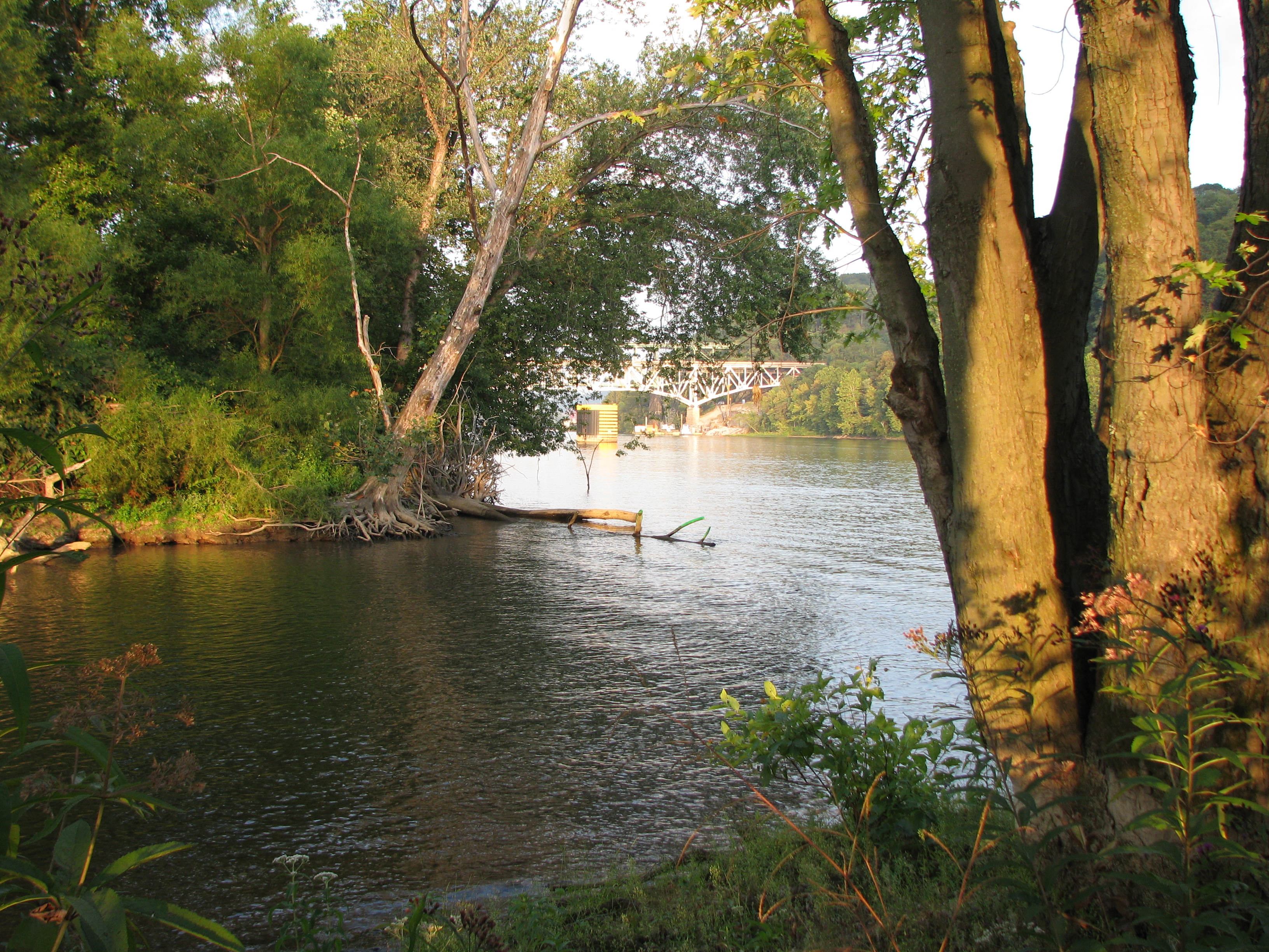
Allegheny Islands State Park is a 43-acre (17 ha) Pennsylvania state park in Harmar Township, Allegheny County, Pennsylvania in the United States. The undeveloped park is composed of three alluvial islands located in the middle of the Allegheny River northeast of Pittsburgh.[2] The islands are just north of the boroughs of Oakmont and Plum, and southwest of Cheswick.[3][4] Bridges for the Pennsylvania Turnpike (Interstate 76) and the Bessemer and Lake Erie Railroad Branch of the Canadian National Railway cross the Allegheny River at the middle island.[5]
| Allegheny Islands State Park | |
|---|---|
IUCN category V (protected landscape/seascape) | |
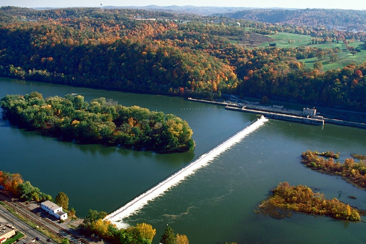 The eastern part of Allegheny Islands State Park and the C. W. Bill Young Lock and Dam (No. 3) on the Allegheny River | |
  | |
| Location | Allegheny County, Pennsylvania |
| Coordinates | 40°32′09″N 79°49′44″W[1] |
| Area | 43 acres (17 ha) |
| Elevation | 735 feet (224 m)[1] |
| Established | 1980 |
| Named for | Allegheny River islands |
| Administrator | Pennsylvania Department of Conservation and Natural Resources |
| Allegheny Islands State Park | |
| Pennsylvania State Parks | |
Islands
The park land on the islands has a total area of 43 acres (17 ha), with two islands downstream of the Allegheny River Lock and Dam Three (officially named the C. W. Bill Young Lock and Dam), and the other island upstream.[2] Twelve Mile Island is the farthest downstream (west) and has a number of houses and buildings on the western four-fifths of the island (the park land is the eastern end).[5][6] The remaining two islands are both uninhabited and have no structures on them. They were originally one island named Fourteen Mile Island, but were split into two parts by the construction of the dam.[7] Today the name Fourteen Mile Island is given to the middle island, just downstream (west) of the dam, and it is the site of the highway and railroad bridges.[5][6] According to the USGS GNIS, the last island (which was once part of Fourteen Mile Island) is unnamed (although it is still labeled "Fourteen Mile Island" on the U.S. Army Corps of Engineers navigation maps of the Allegheny River.)[1][8] This unnamed island is the easternmost and the only one upstream of the dam. There are also five to seven shoals near the islands, which are occasionally exposed.[1]
Twelve Mile Island and Fourteen Mile Island are named for their distances, 12 miles (19 km) and 14 miles (23 km), up the Allegheny River from the confluence of the Allegheny and Monongahela Rivers to form the Ohio River in downtown Pittsburgh. They are two of six alluvial islands in the Allegheny River near Pittsburgh (for comparison, near Pittsburgh the Ohio River has only three islands and the Monongahela River has none). "The large number of islands in the Allegheny is a reflection of the large amount of glacially-derived sediment that was moved by the river."[9]
Facilities
Allegheny Islands State Park was established on December 31, 1980. As of 2007[update], it is undeveloped so that there are no facilities, and also no plans for future development. The park can only be accessed by boat. Camping is allowed on the islands and they are open for visits by groups such as the Boy Scouts and Venture Outdoors. Allegheny Islands State Park is administered from the Region 2 Office in Prospect, Pennsylvania.[2]
Nearby state parks
The following state parks are within 30 miles (48 km) of Allegheny Islands State Park:[10][11]
- Hillman State Park (Washington County)
- Keystone State Park (Westmoreland County)
- Point State Park (Allegheny County)
References
- Geographic Names Information System, United States Geological Survey (August 27, 2007). "Geographic Names Information System Feature Detail Report: Allegheny Islands State Park". Retrieved August 28, 2007.
- "Allegheny Islands State Park". Pennsylvania Department of Conservation and Natural Resources. Retrieved September 17, 2006.
- 2007 General Highway Map Allegheny County Pennsylvania (PDF) (Map). 1:65,000. Pennsylvania Department of Transportation, Bureau of Planning and Research, Geographic Information Division. Retrieved July 27, 2007.[permanent dead link] Note: shows Allegheny River and its islands
- "The Mainline Canal Greenway: Pittsburgh Trail Map" (PDF). Greenways Incorporated. Retrieved September 17, 2006. [dead link] Note: shows Allegheny Islands State Park
- Allegheny River Chart No. 5 (Pennsylvania, Allegheny County): Twelve Mile Island, Fourteen Mile Island, C.W. Bill Young Lock & Dam Pool (PDF) (Map). 1' - 1500". United States Army Corps of Engineers, Pittsburgh District. January 2004. Archived from the original (PDF) on June 11, 2007. Retrieved August 25, 2008.
- USGS New Kensington West (PA) Topo Map (Map). 1:24,000. Cartography by United States Geological Survey. TopoQuest. Retrieved July 5, 2008.
- Pennsylvania Environmental Council. "Three Rivers Conservation Plan, Chapter One: Project Area Characteristics" (PDF). Pennsylvania Department of Conservation and Natural Resources. Retrieved April 11, 2008.
- Allegheny River Chart No. 6 (Pennsylvania, Allegheny County): Springdale, New Kensington (PDF) (Map). 1' - 1500". United States Army Corps of Engineers, Pittsburgh District. January 2004. Archived from the original (PDF) on 2006-12-10. Retrieved 2007-08-25.
- "Site: PGHBW 4-3, A View of the Point from Grandview Avenue, Pittsburgh, PA". University of Pittsburgh, Department of Geology. Archived from the original on 15 July 2007. Retrieved August 25, 2007.
- Michels, Chris (1997). "Latitude/Longitude Distance Calculation". Northern Arizona University. Archived from the original on 11 April 2008. Retrieved April 15, 2008.
- "Find a Park by Region (interactive map)". Pennsylvania Department of Conservation and Natural Resources. Retrieved 2011-11-12.
External links
| Wikimedia Commons has media related to Allegheny Islands State Park. |
Protected areas of Pennsylvania | |||||||||||||||||
|---|---|---|---|---|---|---|---|---|---|---|---|---|---|---|---|---|---|
| Federal |
| ||||||||||||||||
| State |
| ||||||||||||||||
| Other |
| ||||||||||||||||
| |||||||||||||||||
Authority control | |
|---|---|
| General |
|
| National libraries | |
Другой контент может иметь иную лицензию. Перед использованием материалов сайта WikiSort.org внимательно изучите правила лицензирования конкретных элементов наполнения сайта.
WikiSort.org - проект по пересортировке и дополнению контента Википедии