geo.wikisort.org - Insel
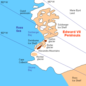
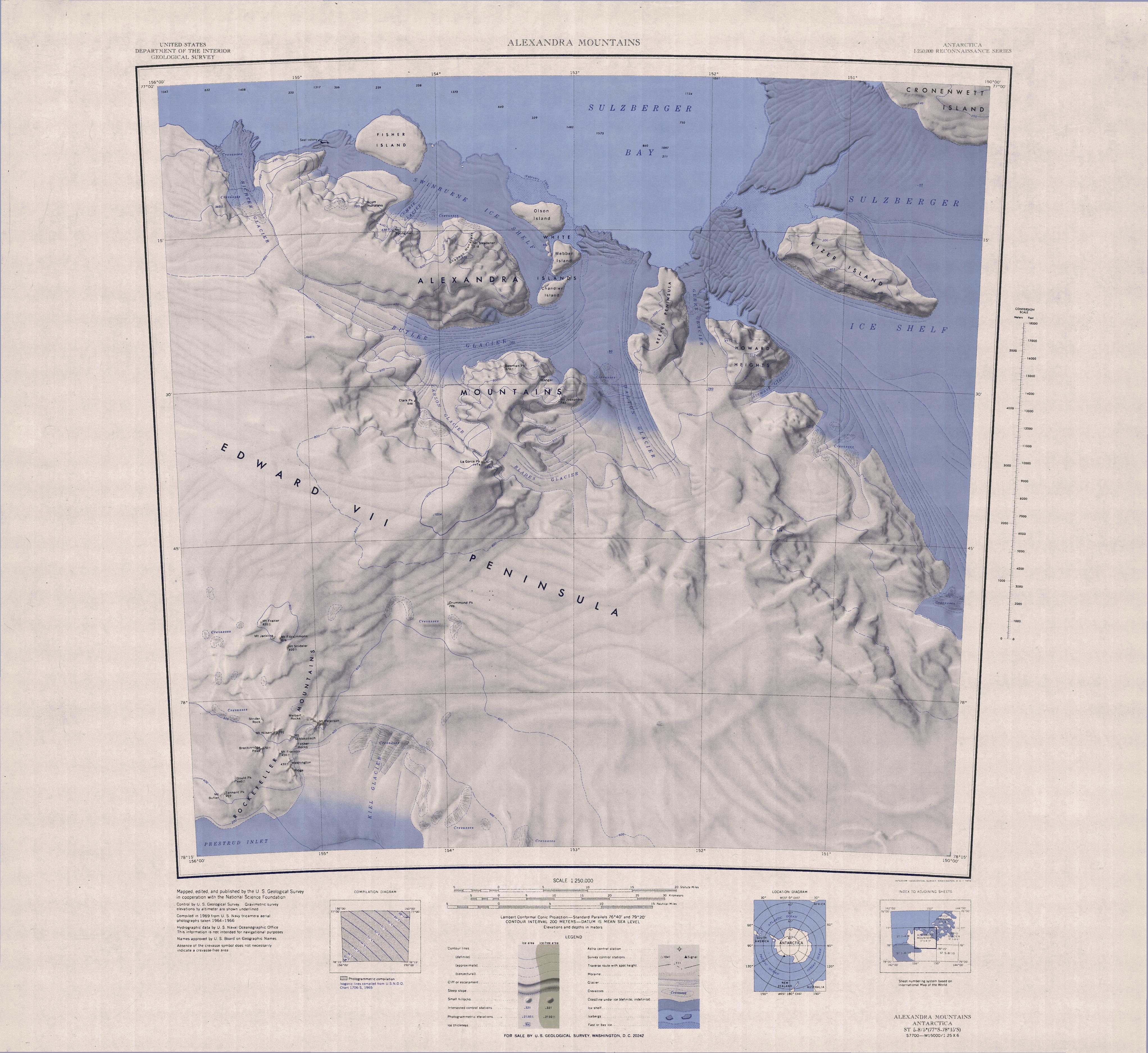
Der Marshall-Archipel umfasst eine weitläufige Gruppe großer, eisbedeckter Inseln inmitten des Sulzberger-Schelfeises vor der Saunders-Küste des westantarktischen Marie-Byrd-Landes.
| Marshall-Archipel | ||
|---|---|---|
 | ||
| Gewässer | Sulzberger-Schelfeis | |
| Geographische Lage | 77° 0′ S, 148° 30′ W | |
| ||
| Anzahl der Inseln | 10 | |
| Hauptinsel | Cronenwett-Insel | |
| Einwohner | unbewohnt | |

Zahlreiche der Inseln wurden durch die vom US-amerikanischen Polarforscher Richard Evelyn Byrd geleiteten Expeditionen in den Jahren 1928 bis 1930, 1933 bis 1935 und 1939 bis 1941 entdeckt. Die geografische Ausdehnung des Archipels wurde durch Arbeiten des United States Geological Survey und durch Luftaufnahmen der United States Navy in den Jahren 1959 bis 1965 erfasst. Auf Vorschlag Byrds wurde die Inselgruppe nach US-General George C. Marshall (1880–1959) benannt, der auf private Initiative hin die zweite Expedition Byrds finanziell unterstützt und ihr beratend zur Seite gestanden hatte.
Zum Marshall-Archipel gehören unter anderem die Cronenwett-Insel, die Steventon-Insel und die Grinder-Insel.
Karten
 |
|
 |
 |
Weblinks
- Marshall Archipelago im Geographic Names Information System des United States Geological Survey (englisch). (englisch)
- Marshall Archipelago auf geographic.org (englisch)
На других языках
- [de] Marshall-Archipel
[en] Marshall Archipelago
The Marshall Archipelago is an extensive group of large ice-covered islands within the Sulzberger Ice Shelf off Antarctica. Several of the islands were discovered and plotted by the Byrd Antarctic Expeditions (1928–30 and 1933–35) and by the United States Antarctic Service (1939–41), all led by Admiral Richard E. Byrd. The full extent of the archipelago was mapped by the United States Geological Survey from surveys and U.S. Navy air photos (1959–65). The name was proposed by Admiral Byrd for General of the Army George C. Marshall, who made financial contributions as a private individual and also, on the same basis, provided advisory assistance to the Byrd expedition of 1933–35.[1][it] Arcipelago Marshall
L'arcipelago Marshall è un gruppo di diverse isole rocciose e completamente ricoperte dai ghiacci situate all'interno della baia di Sulzberger, davanti alla costa di Saunders, nella Terra di Marie Byrd, in Antartide. A parte le più occidentali, che sono in parte bagnate dal mare, le isole dell'arcipelago, che sono racchiuse tra la penisola Guest, a nord, e la penisola di Edoardo VII, a sud, sono completamente circondate dai ghiacci che compongono la piattaforma glaciale Sulzberger.[1]Другой контент может иметь иную лицензию. Перед использованием материалов сайта WikiSort.org внимательно изучите правила лицензирования конкретных элементов наполнения сайта.
WikiSort.org - проект по пересортировке и дополнению контента Википедии