geo.wikisort.org - Costa
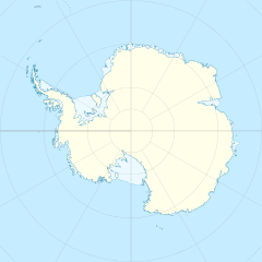
La costa di Hobbs (centrata alle coordinate 74°50′S 132°00′W) è una porzione della costa della Terra di Marie Byrd, in Antartide. In particolare, la costa di Hobbs si estende tra il punto più orientale della isola Dean (74°42′S 127°05′W), a est, e capo Burks (74°45′S 136°50′W), che segna il confine orientale della baia di Hull, a ovest, e confina a est con la costa di Bakutis e a ovest con la costa di Ruppert.[1]
Storia
La costa di Hobbs è stata osservata per la prima volta da membri del Programma Antartico degli Stati Uniti d'America tra il 1939 e il 1941. L'intera costa fu infine mappata dallo United States Geological Survey grazie a ricognizioni al suolo e a fotografie aeree scattate dalla marina militare statunitense tra il 1959 e il 1966.
La costa fu battezzata con il suo attuale nome in onore del professor William Herbert Hobbs, glaciologo dell'Università del Michigan specializzato in geografia e storia dell'Antartide.[2]
Note
- Costa di Hobbs, su geonames.org, GeoNames.Org (cc-by), 20 gennaio 2008. URL consultato il 3 aprile 2017.
- (EN) Costa di Hobbs, in Geographic Names Information System, USGS.
Collegamenti esterni
- (EN) Costa di Hobbs, su Geographic Names Information System per l'Antartico, USGS.
На других языках
[en] Hobbs Coast
Hobbs Coast (.mw-parser-output .geo-default,.mw-parser-output .geo-dms,.mw-parser-output .geo-dec{display:inline}.mw-parser-output .geo-nondefault,.mw-parser-output .geo-multi-punct{display:none}.mw-parser-output .longitude,.mw-parser-output .latitude{white-space:nowrap}74°50′S 132°0′W) is that portion of the coast of Marie Byrd Land, Antarctica extending from Cape Burks to a point on the coast opposite eastern Dean Island, at 74°42′S 127°05′W, or between the Ruppert Coast in the west and the Bakutis Coast in the east. It stretches from 136°50′W to 127°35′. The coast was discovered by the US Antarctic Service (1939–1941) and named for Professor William H. Hobbs of the University of Michigan, a glaciologist specializing in polar geography and history. The United States Geological Survey completely mapped the coast from ground surveys and U.S. Navy air photos, 1959–1965.[1]- [it] Costa di Hobbs
Другой контент может иметь иную лицензию. Перед использованием материалов сайта WikiSort.org внимательно изучите правила лицензирования конкретных элементов наполнения сайта.
WikiSort.org - проект по пересортировке и дополнению контента Википедии
