geo.wikisort.org - Costa
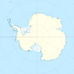
La costa di Bakutis (centrata alle coordinate 74°45′S 120°00′W) è una porzione della costa della Terra di Marie Byrd, in Antartide. In particolare, la costa di Bakutis si estende tra la capo Herlacher (73°45′S 114°12′W), sulla penisola di Martin, a est, e il punto più orientale della isola Dean (74°42′S 127°05′W), a ovest, e confina a est con la costa di Walgreen e a ovest con la costa di Hobbs.[1]
Davanti alla costa sono presenti sia la piattaforma di ghiaccio Getz che diverse isole completamente ricoperte dai ghiacci.
Storia
La costa di Bakutis è stata osservata per la prima volta da membri del Programma Antartico degli Stati Uniti d'America tra il 1939 e il 1941 e mappata solo parzialmente grazie a fotografie aeree scattate durante l'operazione Highjump, 1946-47, al comando del contrammiraglio Richard Evelyn Byrd. L'intera costa fu infine mappata dallo United States Geological Survey grazie a ricognizioni al suolo e a fotografie aeree scattate dalla marina militare statunitense tra il 1959 e il 1966.
La costa fu battezzata con il suo attuale nome dal Comitato consultivo dei nomi antartici in onore del contrammiraglio Fred E. Bakutis, comandante della forza navale di supporto statunitense in Antartide dal 1965 al 1967.[2]
All'incirca 500 km nell'entroterra è presente la Stazione Byrd che dal 1972 risulta abbandonata e che, nel 1957, fu la base di riferimento per l'operazione Deep Freeze II. La base fu anche il luogo in cui, nel 1968, si riuscì a perforare completamente la calotta glaciale antartica.
Note
- Costa di Bakutis, su geonames.org, GeoNames.Org (cc-by), 20 gennaio 2008. URL consultato il 3 aprile 2017.
- (EN) Costa di Bakutis, in Geographic Names Information System, USGS.
Collegamenti esterni
- (EN) Costa di Bakutis, su Geographic Names Information System per l'Antartico, USGS.
| Controllo di autorità | VIAF (EN) 236558088 · GND (DE) 4561226-2 |
|---|
На других языках
[en] Bakutis Coast
The Bakutis Coast is that part of the coast of Marie Byrd Land, West Antarctica, extending from a point opposite eastern Dean Island, at 74°42′S 127°05′W, to Cape Herlacher, or between Hobbs Coast in the west and Walgreen Coast in the east. It stretches between 127°05'W and 114°12'W. The coast in this area is bounded by several large ice-covered islands and the very extensive Getz Ice Shelf. This coast was sighted by members of the US Antarctic Service, 1939–1941, and was charted in part from air photos taken by Operation Highjump, 1946–1947, both expeditions led by Admiral Richard E. Byrd. The United States Geological Survey completely mapped the coast from ground surveys and U.S. Navy air photos, 1959–1966.- [it] Costa di Bakutis
Другой контент может иметь иную лицензию. Перед использованием материалов сайта WikiSort.org внимательно изучите правила лицензирования конкретных элементов наполнения сайта.
WikiSort.org - проект по пересортировке и дополнению контента Википедии
