geo.wikisort.org - Coast
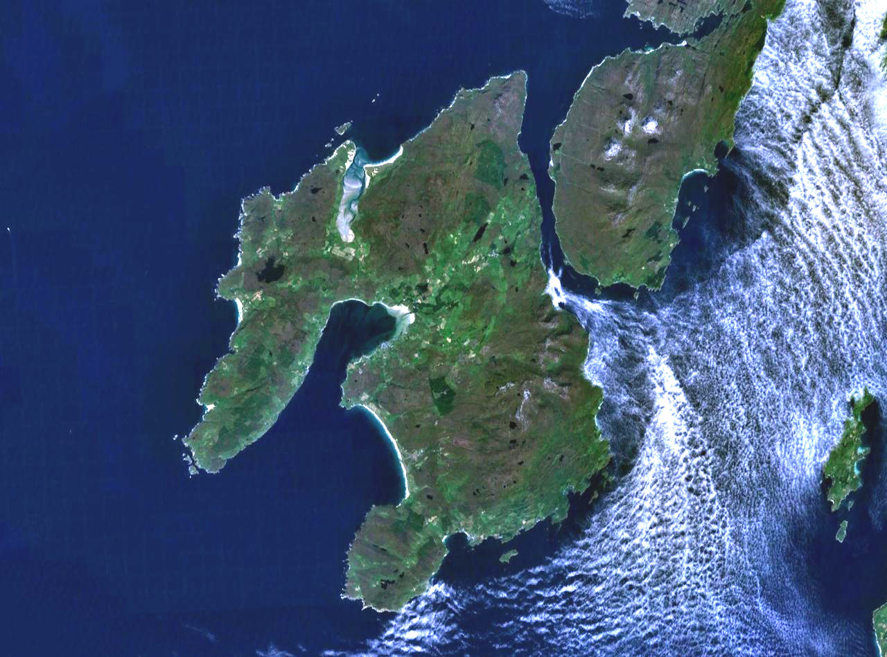
The Rinns of Islay (Scottish Gaelic: Na Roinn Ìleach; alternative English spelling Rhinns of Islay) is an area on the west of the island of Islay in the Inner Hebrides of Scotland.

 | |
 | |
| Location | Orsay, Rinns of Islay, Argyll and Bute, Kilchoman, United Kingdom |
|---|---|
| OS grid | NR1634551414 |
| Coordinates | 55°40′23″N 6°30′48″W |
| Tower | |
| Constructed | 1825 |
| Built by | Robert Stevenson |
| Construction | masonry tower |
| Automated | 31 March 1998 |
| Height | 29 m (95 ft) |
| Shape | cylindrical tower with balcony and lantern[1][2] |
| Markings | white tower, black lantern, ochre trim |
| Power source | solar power |
| Operator | Northern Lighthouse Board |
| Heritage | category A listed building |
| Light | |
| Focal height | 46 m (151 ft) |
| Intensity | 600,000 candela |
| Range | 24 nmi (44 km; 28 mi) |
| Characteristic | Fl W 5s |
Ramsar Wetland | |
| Official name | Rinns of Islay |
| Designated | 25 April 1990 |
| Reference no. | 466[3] |
It is a peninsula that is attached to the main body of the island by a narrow isthmus towards its northern end. The main population centres are Port Charlotte and Portnahaven, based on the A847 that runs along its eastern coast.
It is designated a Special Protection Area due to its importance for a number of breeding and wintering birds, particularly Greenland white-fronted goose and chough. The significance of the area owes much to its wide variety of habitats including bog, moorland, dune grassland, maritime grassland, marsh and extensively-farmed agricultural land.
The Rinns of Islay lighthouse is located on the island of Orsay.
The Rhinns complex, a deformed igneous complex that is considered to form the basement to the Colonsay Group of metasedimentary rocks takes its name from the Rhinns of Islay.
See also
- List of lighthouses in Scotland
- List of Northern Lighthouse Board lighthouses
References
- Rowlett, Russ. "Lighthouses of Scotland: Argyll and Bute". The Lighthouse Directory. University of North Carolina at Chapel Hill. Retrieved 20 May 2016.
- Rinns of Islay Northern Lighthouse Board. Retrieved 20 May 2016
- "Rinns of Islay". Ramsar Sites Information Service. Retrieved 25 April 2018.
External links
- Special Protection Area designation
- Northern Lighthouse Board
- Map sources for Rinns of Islay
| Villages |
|  |
|---|---|---|
| Geographical features |
| |
| History and architecture |
| |
| Islay whisky |
| |
| Other Islay related articles |
| |
Authority control | |||
|---|---|---|---|
| General |
| ||
| Additional |
| ||
This article about a Site of Special Scientific Interest in Scotland is a stub. You can help Wikipedia by expanding it. |
This Argyll and Bute location article is a stub. You can help Wikipedia by expanding it. |
На других языках
[de] Rhinns of Islay
Als Rhinns of Islay (gälisch: Na Roinn Ileach[1]), auch Rinns of Islay geschrieben, wird eine Halbinsel der schottischen Insel Islay bezeichnet. Ihr Name leitet sich von Gälisch Roinn für Kap, Vorsprung ab.[2] Der höchste Punkt der Halbinsel ist der 232 m hohe Hügel Beinn Tart a’Mhill. Entlang der Westküste befinden sich die Buchten Lossit Bay, Kilchiaran Bay und Machir Bay.- [en] Rinns of Islay
Другой контент может иметь иную лицензию. Перед использованием материалов сайта WikiSort.org внимательно изучите правила лицензирования конкретных элементов наполнения сайта.
WikiSort.org - проект по пересортировке и дополнению контента Википедии