geo.wikisort.org - Coast
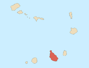
Ponta Bicuda is a headland in the northern part of the island of Santiago, Cape Verde. It is 3 km (1.9 mi) east of Ponta Moreia, the northernmost point of Santiago, and 8 kilometres (5.0 mi) northeast of Tarrafal. In the 1747 map by Jacques-Nicolas Bellin, the point was mentioned as "Pt. Bikkude".[1]
| Ponta Bicuda | |
|---|---|
 Cape Verde | |
| Location | Northern Santiago, Tarrafal Municipality |
| Coordinates | 15°20′06″N 23°42′48″W |
| Offshore water bodies | Atlantic Ocean |
References
Текст в блоке "Читать" взят с сайта "Википедия" и доступен по лицензии Creative Commons Attribution-ShareAlike; в отдельных случаях могут действовать дополнительные условия.
Другой контент может иметь иную лицензию. Перед использованием материалов сайта WikiSort.org внимательно изучите правила лицензирования конкретных элементов наполнения сайта.
Другой контент может иметь иную лицензию. Перед использованием материалов сайта WikiSort.org внимательно изучите правила лицензирования конкретных элементов наполнения сайта.
2019-2025
WikiSort.org - проект по пересортировке и дополнению контента Википедии
WikiSort.org - проект по пересортировке и дополнению контента Википедии
