geo.wikisort.org - Sea
Baía do Inferno (Portuguese for "bay of hell", also: Baía de Santa Clara) is a bay on the southwest coast of the island of Santiago in Cape Verde in the Atlantic Ocean. The bay is completely within the municipality of Santa Catarina. It is a large and relatively sheltered bay, characterised by steep cliffs, more than 400 m high in some places.[1] The nearest settlement is Entre Picos de Reda, 3 km inland. Rincão lies 4 km north along the coast, Porto Mosquito 6 km southeast.
| Baía do Inferno | |
|---|---|
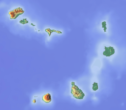
 Satellite photograph of Santiago; the coastal indentation at lower left is the Baia do Inferno | |
 Baía do Inferno | |
| Location | Southwest of Pico da Antónia, south of Porto Rincão on the island of Santiago, Cape Verde |
| Coordinates | 15.0203°N 23.7236°W |
| Max. length | 5 km (3.1 mi) |
| Max. width | 3 km (1.9 mi) |
Wildlife
The bay forms a part of the Important Bird Area "Coastal cliffs between Porto Mosquito and Baia do Inferno", which covers 160 ha and about 8 km of coastline. The site has been identified as an IBA by BirdLife International because the cliffs support 25–30 breeding pairs of red-billed tropicbirds. It also supports the largest colony of brown booby in Cape Verde.[1] The adjacent marine area (13 km2, maximum depth 244 m) has also been identified as an IBA, because of its importance for the red-billed tropicbird.[2]
References
- "Coastal cliffs between Porto Mosquito and Baia do Inferno". Important Bird Areas factsheet. BirdLife International. 2018. Retrieved 2018-08-29.
- "Coastal cliffs between Porto Mosquito and Baia do Inferno - Marine". Important Bird Areas factsheet. BirdLife International. 2018. Retrieved 2018-08-29.
The island of Santiago | ||
|---|---|---|
| Mountains |  | |
| Streams | ||
| Points and promontories |
| |
| Other geographic features |
| |
| Transportation |
| |
| Other topics |
| |
| ||
Другой контент может иметь иную лицензию. Перед использованием материалов сайта WikiSort.org внимательно изучите правила лицензирования конкретных элементов наполнения сайта.
WikiSort.org - проект по пересортировке и дополнению контента Википедии