geo.wikisort.org - Sea
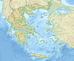
The Strymonian or Strymonic Gulf (Greek: Στρυμονικός Κόλπος, romanized: Strymonikos Kolpos), also known as the Orfano Gulf (Greek: Κόλπος Ορφανού, romanized: Kolpos Orfanou), is a branch of the Thracian Sea—itself part of the Aegean Sea—lying east of the Chalcidice peninsula and south of the Serres regional unit. It was formerly known as the Gulf of Rendina, in reference to the ancient colony of Eion along the gulf's shores.
| Strymonian Gulf | |
|---|---|
 View of Strymonian Gulf from Paralia Orfiniou | |
| Location | Central Macedonia |
| Coordinates | 40°40′N 23°50′E |
| Type | Gulf |
| Native name | Στρυμονικός Κόλπος (Greek) |
| Part of | Aegean Sea |
| River sources | Strymon |
| Basin countries | Greece, Bulgaria |
The river Struma/Strymon empties into the gulf.
The largest towns on the Strymonic Gulf, with their respective administrative divisions, are:
- Asprovalta, Stavros, Nea Vrasna (Thessaloniki regional unit, Central Macedonia);
- Orfani (Kavala regional unit, East Macedonia and Thrace);
- Olympiada, Stratoni (Chalkidiki regional unit, Central Macedonia);
- Nea Kerdylia, Amfipoli (Serres regional unit, Central Macedonia).
Three mountains form the natural border of the Gulf: Pangaio to the north-east, Kerdylio to the north, and Stratoni to the south.
External links
На других языках
- [en] Strymonian Gulf
[ru] Орфанос
Орфано́с[1], Орфа́ну[2], Орфанский залив (греч. Κόλπος Ορφανού ή Ορφανοΰ κόλπος), Стримонико́с[1][3], Стримонский залив[4] (Στρυμονικός Κόλπος) — залив Фракийского моря, которое является частью Эгейского моря, у северо-восточного побережья Греции к северо-востоку от полуострова Халкидики и к юго-западу от горы Пангеон.Текст в блоке "Читать" взят с сайта "Википедия" и доступен по лицензии Creative Commons Attribution-ShareAlike; в отдельных случаях могут действовать дополнительные условия.
Другой контент может иметь иную лицензию. Перед использованием материалов сайта WikiSort.org внимательно изучите правила лицензирования конкретных элементов наполнения сайта.
Другой контент может иметь иную лицензию. Перед использованием материалов сайта WikiSort.org внимательно изучите правила лицензирования конкретных элементов наполнения сайта.
2019-2025
WikiSort.org - проект по пересортировке и дополнению контента Википедии
WikiSort.org - проект по пересортировке и дополнению контента Википедии
