geo.wikisort.org - Sea
Prachuap Bay (Thai: อ่าวประจวบ, RTGS: Ao Prachuap, pronounced [ʔàːw prā.t͡ɕùə̯p]) is a bay in the west side of the Gulf of Siam or Gulf of Thailand.[1] It lies off Prachuap Khiri Khan town, Prachuap Khiri Khan Province.
| Prachuap Bay | |
|---|---|
 Prachuap Bay | |
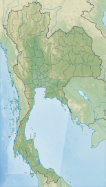 Prachuap Bay Location off the coast of Thailand | |
| Coordinates | 11°48′50″N 99°48′50″E |
| Type | Marine bay |
| Native name | อ่าวประจวบ (Thai) |
| Primary outflows | Gulf of Siam |
| Basin countries | Thailand |
| Max. length | 8 km (5.0 mi) |
| Settlements | Prachuap Khiri Khan |
Geography
Prachuap Bay lies north of Ao Manao and south of Ao Noi. It is open towards the east and is bound by steep limestone outcrops forming peninsulas to the north, at Khao Ta Mong Lai and to the south at Khao Lom Muak.[2] There are four islands in the bay area, Ko Lak, Ko La, and Ko Rom towards the southern end of the mouth of the bay, and larger Ko Raet further off-shore.[3]
Ko Lak Island in Prachuap Bay was the historic center of administration of Prachuap Khiri Khan Province and its silhouette appears on the provincial seal.
See also
References
- GoogleEarth
- Ao Prachuap Khiri Khan - Mapcarta
- Hydrographic Service of the Royal Thai Navy, Chart 001
External links
 Prachuap Khiri Khan travel guide from Wikivoyage
 Media related to Prachuap Bay at Wikimedia Commons
This Thailand location article is a stub. You can help Wikipedia by expanding it. |
Другой контент может иметь иную лицензию. Перед использованием материалов сайта WikiSort.org внимательно изучите правила лицензирования конкретных элементов наполнения сайта.
WikiSort.org - проект по пересортировке и дополнению контента Википедии