geo.wikisort.org - Sea
Ao Manao (Thai: อ่าวมะนาว), meaning "Lime Bay", is a bay in the west side of the Gulf of Thailand. It is five kilometres to the south of Prachuap Khiri Khan in Prachuap Khiri Khan Province.
| Ao Manao อ่าวมะนาว | |
|---|---|
 Ao Manao from the beach with the northern headland on the left and the southern on the right, as well as Ko Lueam and Ko Aen islands. | |
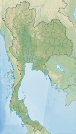 Ao Manao อ่าวมะนาว Location off the coast of Thailand | |
| Coordinates | 11°46′30″N 99°48′20″E |
| Type | Marine bay |
| Primary outflows | Gulf of Siam |
| Basin countries | Thailand |
Geography
The bay lies south of Prachuap Bay. It is open towards the east and is bounded by steep limestone outcrops forming peninsulas to the north and to the south. There are two islands in the bay, Ko Lueam about 3.6 km offshore,[1] and smaller Ko Aen, about 1.5 km off the beach within the bay.
Ao Manao has a good beach which is a popular tourist destination. It can be reached by road through the Wing 5 Royal Thai Air Force base.
Besides, at Khao Lommuak, a viewpoint hill of this place. It is also a habitat for over 200 dusky leaf monkeys. They behave politely, not as aggressive as the monkeys or langurs in other tourist spots, tourists can feed them.[2]
See also
- Battle of Prachuap Khiri Khan
- List of islands of Thailand
References
- Ko Lueam - Mapcarta
- "น่ารัก...หน้าทะเล้น "เจ้าค่างแว่น" เขาล้อมหมวก" [Cutie...cheeky face "spectacled langur" Khao Lommuak]. PPTV HD (in Thai). 2019-12-25. Retrieved 2020-02-23.
External links
 Prachuap Khiri Khan travel guide from Wikivoyage
 Media related to Ao Manao at Wikimedia Commons
This Thailand location article is a stub. You can help Wikipedia by expanding it. |
Другой контент может иметь иную лицензию. Перед использованием материалов сайта WikiSort.org внимательно изучите правила лицензирования конкретных элементов наполнения сайта.
WikiSort.org - проект по пересортировке и дополнению контента Википедии