geo.wikisort.org - Sea
Krenkel Bay (Russian: Бухта Кренкеля, Bukhta Krenkelya),[2] is a bay in Severnaya Zemlya, Krasnoyarsk Krai, Russia.[1]
| Krenkel Bay | |
|---|---|
| Бухта Кренкеля | |
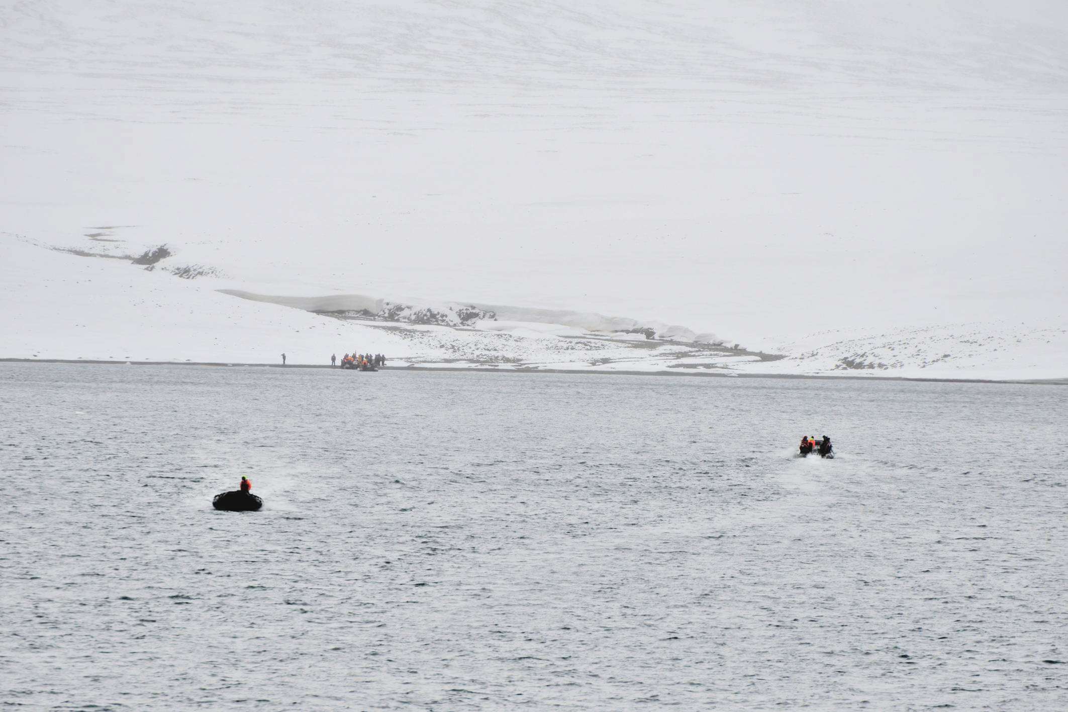
 View of the shore of Krenkel Bay | |
 Landsat image of Komsomolets island | |
 Krenkel Bay Location in Krasnoyarsk Krai | |
| Location | Komsomolets Island, Severnaya Zemlya, Krasnoyarsk Krai |
| Coordinates | 80°30′N 97°50′E |
| Ocean/sea sources | Laptev Sea |
| Basin countries | Russia |
| Max. length | 11 km (6.8 mi)[1] |
| Max. width | 25 km (16 mi) |
| Islands | Ozerny Island |
History
This bay was discovered by the 1930–1932 expedition to the archipelago led by Georgy Ushakov and Nikolay Urvantsev. Decades later, in 1973, this bay was named after Soviet Arctic explorer and radio operator Ernst Krenkel (1903–1971).[3]
Geography
Krenkel Bay is a body of water in the northeastern area of Komsomolets Island, the northernmost island of Severnaya Zemlya.[4]
The bay is open to the southeast. It is regular in shape and has a width of about 25 km (16 mi). The edge of the massive Academy of Sciences Glacier runs all along the western shore, while the northern shoreline is bound by a stretch of unglaciated area.[1] Ozerny Island lies close to the northeastern headland of the bay.[5]
See also
- List of fjords of Russia
References
- GoogleEarth
- "Bukhta Krenkelya". Mapcarta. Retrieved 24 December 2016.
- Архипелаг Северная Земля — один из наиболее крупных районов оледенения на территории России
- Map U-47-XXXI,XXXII,XXXIII бух. Кренкеля. Scale: 1 : 200 000. Состояние местности на 1988 год. Издание 1992 г.
- Russian map T-48-VII,VIII,IX - Т-47,48
External links
 Media related to Krenkel Bay at Wikimedia Commons
- Eurasian Arctic Tectonics - DiVA
This Russian location article is a stub. You can help Wikipedia by expanding it. |
На других языках
- [en] Krenkel Bay
[ru] Бухта Кренкеля
Бу́хта Кре́нкеля — крупный залив моря Лаптевых (Северный Ледовитый океан) у юго-восточного побережья острова Комсомолец (Красноярский край, Россия)[1][2].Другой контент может иметь иную лицензию. Перед использованием материалов сайта WikiSort.org внимательно изучите правила лицензирования конкретных элементов наполнения сайта.
WikiSort.org - проект по пересортировке и дополнению контента Википедии