geo.wikisort.org - Sea
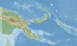
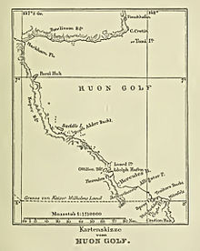
Huon Gulf is a large gulf in eastern Papua New Guinea. It is bordered by Huon Peninsula in the north. Both are named after French explorer Jean-Michel Huon de Kermadec. Huon Gulf is a part of the Solomon Sea. Its northern boundary is marked by Cape Cretin, southern by Cape Longerue. The coast, which quickly increases in elevation from the beach, is bordered by the Rawlinson Range to the north and the Kuper Range to the west, which rises to about 600 m (2,000 ft). Lae, capital of the Morobe Province, is located on the northern coast of the gulf.
This article does not cite any sources. (December 2009) |
| Huon Gulf | |
|---|---|
 Huon Gulf seen from space (false color) | |
 Huon Gulf | |
| Location | Morobe Province |
| Coordinates | 7°00′S 147°27′E |
| Type | Gulf |
| River sources | Markham |
| Ocean/sea sources | Solomon Sea |
| Basin countries | Papua New Guinea |
| Max. length | 150 km (93 mi) |
| Max. width | 100 km (62 mi) |
| Settlements | Lae and Salamaua |
Markham Bay forms the north-western corner of Huon Gulf, where the Markham River ends.

На других языках
- [en] Huon Gulf
[ru] Хьюон (залив)
Хью́он[1][2] (англ. Huon Gulf) — залив на восточном побережье острова Новая Гвинея, Папуа — Новая Гвинея.Текст в блоке "Читать" взят с сайта "Википедия" и доступен по лицензии Creative Commons Attribution-ShareAlike; в отдельных случаях могут действовать дополнительные условия.
Другой контент может иметь иную лицензию. Перед использованием материалов сайта WikiSort.org внимательно изучите правила лицензирования конкретных элементов наполнения сайта.
Другой контент может иметь иную лицензию. Перед использованием материалов сайта WikiSort.org внимательно изучите правила лицензирования конкретных элементов наполнения сайта.
2019-2025
WikiSort.org - проект по пересортировке и дополнению контента Википедии
WikiSort.org - проект по пересортировке и дополнению контента Википедии