geo.wikisort.org - Sea
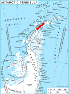
Hughes Bay is a bay lying between Cape Sterneck and Cape Murray along the west coast of the Antarctic Peninsula.[1] It is 42 kilometres (26 mi) wide and lies south of Chavdar Peninsula and north of Pefaur (Ventimiglia) Peninsula, indenting the Danco Coast on the west side of Graham Land for 20 kilometres (12 mi).
History
The name has appeared on maps for over 100 years, and commemorates Edward Hughes, master of the Sprightly, a sealing vessel owned by the London whaling company Samuel Enderby & Sons, which explored in this area in 1824–25.[1][2][3]
Hughes Bay may have been site of the first landing on the Antarctic mainland, by sealers from the U.S. sealing vessel Cecilia under Captain John Davis on February 7, 1821.[4]
Glaciers
The glaciers Tumba Ice Cap, Sikorsky, Mouillard, Cayley, Gregory, Breguet, Blériot, Agalina, Krapets and Zimzelen feed the bay.
See also
- Roget Rocks
Maps
- Antarctic Digital Database (ADD). Scale 1:250000 topographic map of Antarctica. Scientific Committee on Antarctic Research (SCAR), 1993–2016.
References
- "Hughes Bay". Geographic Names Information System. United States Geological Survey, United States Department of the Interior. Retrieved 2012-07-02.
- Alberts, Fred G., ed. (June 1995). Geographic Names of the Antarctic (PDF) (second ed.). United States Board on Geographic Names. p. 352. Retrieved 2012-04-05.
- "Gazetteer - AADC". data.aad.gov.au. Retrieved 2017-09-15.
- Hughes Bay. SCAR Composite Antarctic Gazetteer.
![]() This article incorporates public domain material from "Hughes Bay". Geographic Names Information System. United States Geological Survey.
This article incorporates public domain material from "Hughes Bay". Geographic Names Information System. United States Geological Survey.
This Danco Coast location article is a stub. You can help Wikipedia by expanding it. |
На других языках
[de] Hughes-Bucht (Antarktika)
Die Hughes-Bucht (englisch Hughes Bay oder Hughes Gulf) ist eine bis zu 42 km breite Bucht an der Danco-Küste des Grahamlands auf der Antarktischen Halbinsel. Sie zwischen Kap Murray und Kap Sterneck an der Gerlache-Straße. Die Brialmont-Bucht im Nordosten und die Salvesen Cove im Südwesten sind ihre beiden größten Nebenbuchten.- [en] Hughes Bay
Другой контент может иметь иную лицензию. Перед использованием материалов сайта WikiSort.org внимательно изучите правила лицензирования конкретных элементов наполнения сайта.
WikiSort.org - проект по пересортировке и дополнению контента Википедии