geo.wikisort.org - Sea
The Buor-Khaya Gulf or Buor-Khaya Bight (Russian: Губа Буор-Хая) is one of the most important gulfs of the Laptev Sea. Administratively the Buor-Khaya Gulf belongs to the Sakha Republic (Yakutia) of the Russian Federation.
| Buor-Khaya Gulf | |
|---|---|
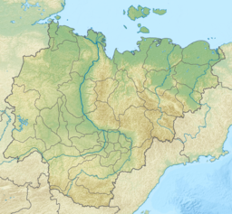 Buor-Khaya Gulf Location of the Buor-Khaya Gulf | |
 | |
| Location | Far North |
| Coordinates | 71°20′N 130°50′E |
| Native name | Губа Буор-Хая (Russian) |
| River sources | Omoloy River |
| Ocean/sea sources | Laptev Sea |
| Basin countries | Russia |
There is an abandoned polar station in the shores of the Buor-Khaya Gulf.[1]
Geography
It lies at the western end of the Yana-Indigirka Lowland, between the eastern side of the Lena delta on its western side and Cape Buor-Khaya at its NE end. Tiksi Bay and the Bykovsky Peninsula are on the western shores of the Buor-Khaya Gulf.[2]
Heavily eroded Muostakh Island, the remainder of an ancient great plain, is located roughly in the midst of the gulf.[3]
The Omoloy River is the only large river flowing into the Buor-Khaya Gulf, its mouth is located halfway up the eastern coast. The sea in this gulf is frozen for about nine months every year and often clogged with ice floes.
See also
- List of research stations in the Arctic
References
External links
- Kalinenko, V. V. (2001). "Clay Minerals in Sediments of the Arctic Seas". Lithology and Mineral Resources. 36 (4): 362–372. doi:10.1023/A:1010414305264. S2CID 126442389.
- Sekretov, Sergey B. (2002). "Structure and tectonic evolution of the Southern Eurasia Basin, Arctic Ocean". Tectonophysics. 351 (3): 193–243. Bibcode:2002Tectp.351..193S. doi:10.1016/S0040-1951(01)00278-5.
- Seismic Arctic Earthquakes
| Authority control |
|
|---|
This Sakha Republic location article is a stub. You can help Wikipedia by expanding it. |
На других языках
- [en] Buor-Khaya Gulf
[ru] Буор-Хая (губа)
Буо́р-Хая́ — губа в южной части моря Лаптевых, к юго-востоку от дельты реки Лена. Длина — 120 км, ширина у входа — 110 км, глубина до 18 м. Порт Тикси. Расположен на территории Республики Якутия России.Другой контент может иметь иную лицензию. Перед использованием материалов сайта WikiSort.org внимательно изучите правила лицензирования конкретных элементов наполнения сайта.
WikiSort.org - проект по пересортировке и дополнению контента Википедии