geo.wikisort.org - Sea
Arcachon Basin or alternatively Arcachon Bay (French: Bassin d'Arcachon) is a bay of the Atlantic Ocean on the southwest coast of France, situated in Pays de Buch between the Côte d'Argent and the Côte des Landes, in the region of Aquitaine. The bay covers an area of 150 square kilometres (60 sq mi) at high tide and 40 km2 (15 sq mi) at low tide. Some of its geological features are natural preservation areas.[2]
Arcachon Bay
Bassin d'Arcachon | |
|---|---|
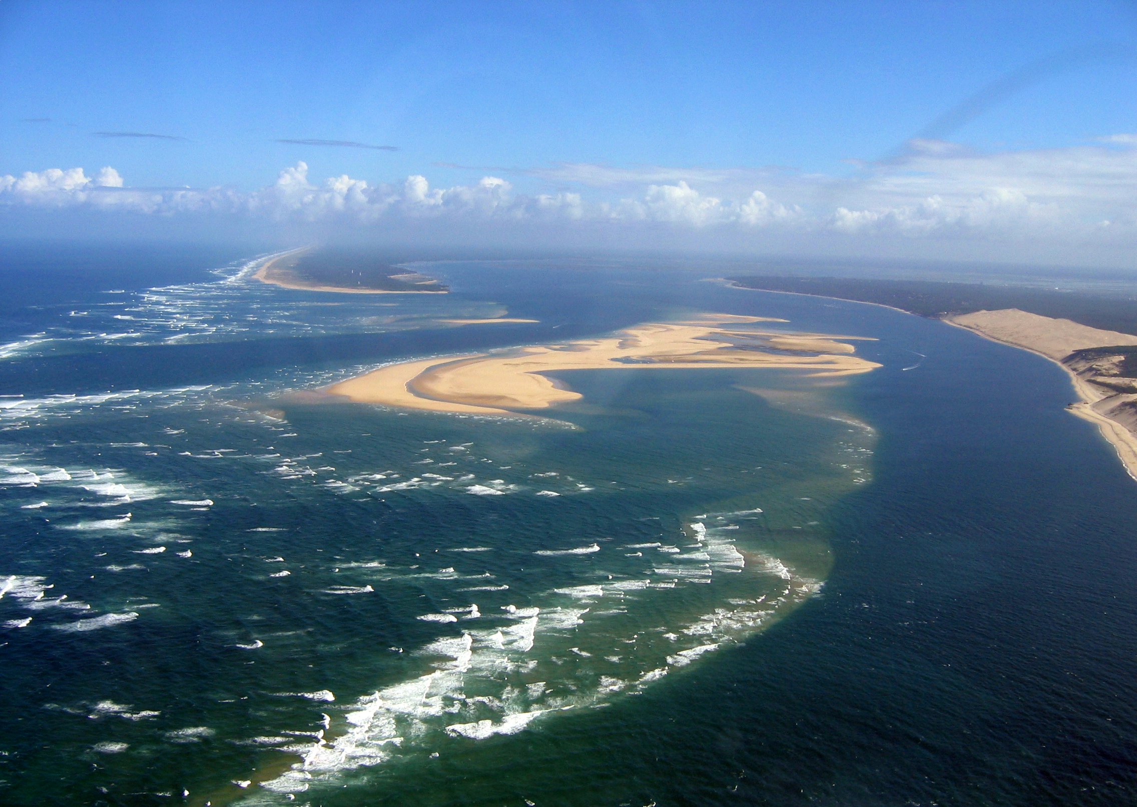 Arcachon Bay and the Dune of Pilat (on the right) | |
Ramsar Wetland | |
| Official name | Bassin d'Arcachon - Secteur du delta de l'Eyre |
| Designated | 27 October 2011 |
| Reference no. | 1996[1] |
The general shape of the Bassin d'Arcachon is that of an equilateral triangle pointing north, the southwest corner of which is open to the sea, between Cap Ferret and the town of Arcachon (more specifically, one of the suburbs of La Teste-de-Buch, Pyla-sur-Mer), through a three-kilometre-long (2 mi) narrow channel (Les Passes). On the north shore is the town of Arès, then Andernos-les-Bains on the northeast. Just south of the entrance is the Dune of Pilat. Nearly in the middle of the bay is a very particular island: L'île aux Oiseaux (Isle of the Birds).[2]
Development
In the past, similar areas became lakes (called in French lacs or étangs) and are nowadays filled with fresh water. On the French Atlantic coast, running north–south between the Gironde estuary to the Adour River mouth, are the Lac d'Hourtin-Carcans, the Lac de Lacanau, the Étang de Cazaux et de Sanguinet, the Étang de Biscarrosse et de Parentis, the Étang d'Aureilhan, the Étang de Léon, the Étang de Soustons, Étang Hardy, Étang Blanc and the Étang de Garros. Arcachon Bay is the last water area that remains open to the ocean.[2]
The Bassin still has a link to the sea perhaps because of the Eyre River that runs from the Landes forest and has its mouth (Delta de l'Eyre) in its southeast corner. Otherwise the Bassin would have become blocked by the sandbanks built up by the tides.[2]
 Cabanes tchanquées on the Isle of Birds, near Arcachon
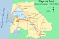 Map of the Bassin d'Arcachon
 Formation of the Bassin d'Arcachon at 4000 BC, 400 BC, 700 AD, 1300 AD, 1708 AD and today. Green areas are mud and sand bars. Beige areas are sand dunes.


References
- "Bassin d'Arcachon - Secteur du delta de la Leyre". Ramsar Sites Information Service. Retrieved 25 April 2018.
- Nicola Williams, Oliver Berry, Stuart Butler, Jean-Bernard Carillet, Kerry Christiani, Gregor Clark, Emilie Filou, Catherine Le Nevez & Daniel Robinson (2015). Lonely Planet France (Travel Guide) Paperback – 13 Mar 2015 by Lonely Planet.
Authority control | |
|---|---|
| General |
|
| National libraries | |
| Other |
|
На других языках
- [en] Arcachon Bay
[ru] Аркашон (лагуна)
Лагуна Аркашон[1] или Аркашонский залив[2], также Басен-д’Аркашон[3] (фр. Bassin d’Arcachon или Laca d’Arcaishon на гасконском наречии) — приливная лагуна[4] на территории природной области Гасконских Ландов, во французском департаменте Жиронда региона Аквитании, между городами Ла-Тест-де-Бюш на юге, Леж-Кап-Ферре на западе и дельтой реки Лер на востоке. Только Аркашонская лагуна прерывает длинную полоску береговых дюн так называемого Серебряного берега длиной 250 километров, который начинается от эстуария Жиронды и заканчивается у реки Адур. В отличие от Больших озёр Ландов, лагуна Аркашон сообщается с Атлантическим океаном посредством аркашонских проходов (фарватеров) и по сути является небольшим внутренним морем, имея площадь 155 км² при полной воде прилива и 40 км² при малой воде.Другой контент может иметь иную лицензию. Перед использованием материалов сайта WikiSort.org внимательно изучите правила лицензирования конкретных элементов наполнения сайта.
WikiSort.org - проект по пересортировке и дополнению контента Википедии