geo.wikisort.org - Река
Тана — самая длинная река Кении. Протяжённость составляет 800 км. Её именем назван один из округов страны. Наибольший приток Таны — Тика.
| Тана | |
|---|---|
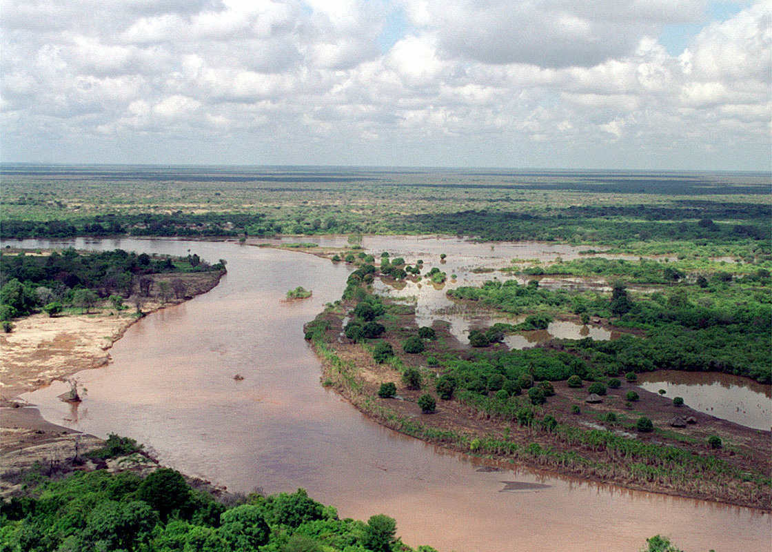 Река Тана в 1998 году Река Тана в 1998 году | |
| Характеристика | |
| Длина | 800 км |
| Водоток | |
| Исток | |
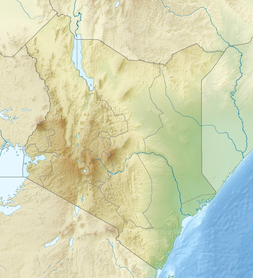
| • Местоположение | гора Кения |
| • Координаты | 0°25′33″ ю. ш. 37°12′12″ в. д.HGЯO |
| Устье | Формоза |
| • Высота | 0 м |
| • Координаты | 2°35′56″ ю. ш. 40°20′19″ в. д.HGЯO |
| Расположение | |
| Водная система | Индийский океан |
|
|
|
| Страна |
|
| Регионы | Центральная провинция, Восточная провинция, Прибрежная провинция |
|
|
|
|
|
|
Река берёт своё начало в горах Абердэр к востоку от Ньери. Сначала русло идёт на восток и поворачивает на юг вокруг горного массива Кения. Затем река переходит в водохранилища Массинга и Киамбере, созданные дамбой Киндарума. Ниже дамбы река поворачивает на север и течёт в направлении с севера на юг в направлении границы между Меру и Северной Китуи и Бисанади, национальными заповедниками Кора и Раболи. В заповедниках река поворачивает на восток и затем на юго-восток. Протекает через города Гарисса, Хола и Гарсен, впадая в залив Формоза, относящийся к бассейну Индийского океана.[1].
На реке Тана расположена гидроэлектростанция Гитару.
Литература
- Географический энциклопедический словарь: Географические названия / Гл. ред А. Ф. Трёшников; Ред. кол.: Э. Б. Алаев, П. М. Алампиев, А. Г. Воронов и др. — М.: Сов. энциклопедия, 1983. — С. 418. — 538 с. — 100 000 экз.
Примечания
- Лист карты A-37-Г (Ю. П.) Кипини. Масштаб: 1 : 500 000.
В статье есть список источников, но не хватает сносок. |
На других языках
[de] Tana (Fluss)
Der Tana ist Kenias größter Fluss. Über seine Länge gibt es unterschiedliche Angaben zwischen 700 und 1000 Kilometern – eine Folge der Tatsache, dass sein Beginn im Gebiet des ganzjährig von Schnee bedeckten Mount-Kenya-Massivs nicht eindeutig feststellbar ist.[en] Tana River (Kenya)
The ca. 1000 km long Tana River is the longest river in Kenya, and gives its name to the Tana River County.[1] Its catchment covers ca. 100,000 km² and can be divided into the headwaters and the lower Tana consisting of the section downstream of Kora where the river flows for ca. 700 km through semi-arid plains.[2] Its tributaries include the Thika, Ragati River from Mt.Kenya as well as several smaller rivers that flow only during the rainy season. The river rises in the Aberdare Mountains to the west of Nyeri. Initially it runs east before turning south around the massif of Mount Kenya. A series of hydroelectric dams (the Seven Forks Hydro Stations or the Seven Forks Scheme) has been constructed along the river. These include (in order of cascading) the Masinga Dam (commissioned in 1981 with an installed capacity of 40MW), the Kamburu Dam (1974, 94.20MW), the Gitaru Dam (1978, 225.25MW), the Kindaruma Dam (1968, 72MW) and the Kiambere Dam (1988, 168MW).[3][4] en [5][6] The Masinga Reservoir and the Kiambere Reservoir, created by the Masinga and Kiambere dams respectively, serve a dual purpose: hydro-electric power (HEP) generation and agricultural irrigation. The other three are used exclusively for HEP generation. A 2003 study reported that two-thirds of Kenya's electrical needs were supplied by the series of dams along the Tana River. Many people believe this river has groundwater underneath it, but it doesn't.[7] The electricity is then supplied to the national grid system and distributed countrywide through a series of substations, transformers and cables.[8][it] Tana (fiume)
Il Tana, lungo 780 chilometri, è il più lungo fiume del Kenya e dà il nome al Distretto omonimo. Il fiume nasce sui Monti Aberdare, a ovest di Nyeri. Inizialmente scorre verso est, prima di dirigersi a sud girando attorno al massiccio del Monte Kenya. In seguito attraversa i laghi artificiali di Masinga e di Kiambere, creati dalla diga di Kindaruma. Oltrepassata la diga il fiume si dirige a nord e fa da confine alle riserve di Meru e North Kitui e di Bisanadi, Kora e Rabole. All'interno delle riserve il fiume svolta ad est e in seguito a sud-est. Prima di sfociare nell'Oceano Indiano, nella Baia di Ungwana, attraversa le città di Garissa, Hola e Garsen.- [ru] Тана (река, впадает в Формозу)
Другой контент может иметь иную лицензию. Перед использованием материалов сайта WikiSort.org внимательно изучите правила лицензирования конкретных элементов наполнения сайта.
WikiSort.org - проект по пересортировке и дополнению контента Википедии