geo.wikisort.org - Fiume
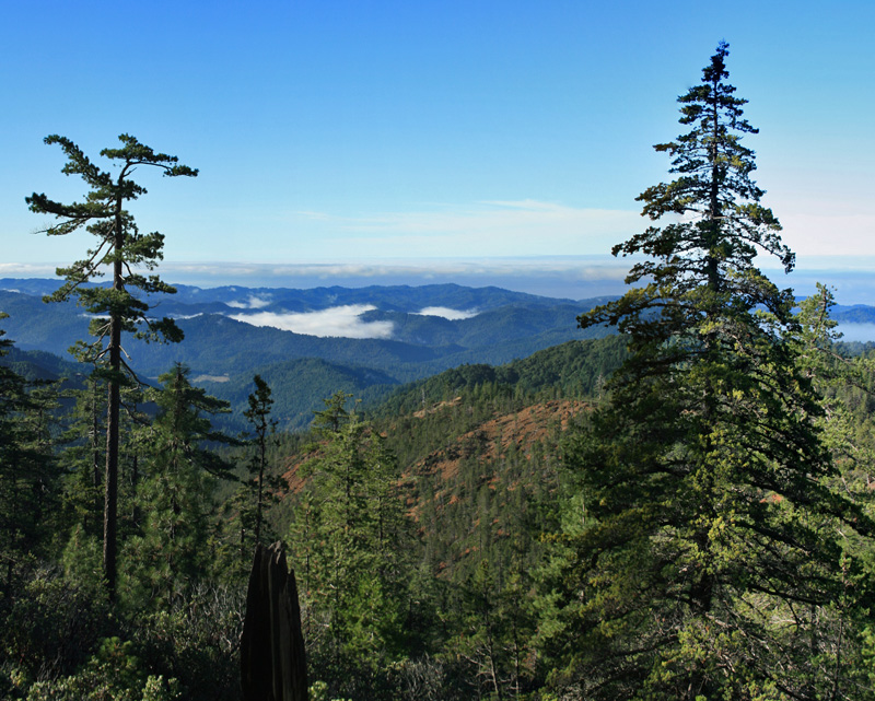
Il South Fork Eel River è il maggiore affluente dell'Eel River, nella California centro-settentrionale, negli USA. Il fiume è lungo 169 km, nasce sulle Iron Mountain nell'ovest della contea di Mendocino e termina il suo corso, immettendosi nell'Eel River, nei pressi della cittadina di Dyerville. Il bacino del South Fork drena una parte lunga e stretta della Catena Costiera della California, tra le contee di Mendocino e quella di Humboldt.
| South Fork Eel River | |
|---|---|
 | |
| Stato | |
| Stati federati | |
| Lunghezza | 169 km |
| Portata media | 352,2 m³/s |
| Bacino idrografico | 1 785 km² |
| Altitudine sorgente | 762 m s.l.m. |
| Nasce | Catena Costiera Pacifica |
| Sfocia | Eel River |
 | |
La U.S. Route 101 segue il corso del fiume per molta della sua lunghezza.[1]
La tribù dei Kai Pomo appartenente al popolo Pomo, un tempo viveva lungo il corso superiore del fiume[2], mentre i Kato vivevano nei pressi della confluenza coll'Eel River. Prima dello sviluppo industriale del XIX secolo, molte tribù indiane utilizzavano il fiume per pescarvi salmoni e trote. Nel 1921, una compagnia privata costruì la Benbow Dam, una diga che bloccò la migrazione dei pesci in una vasta area del bacino.[3]
Note
- South Fork Eel River Basin, su California Coastal Watershed Program, coastalwatersheds.ca.gov. URL consultato il 4 luglio 2009 (archiviato dall'url originale il 3 luglio 2009).
- Barrett, p. 279
- Big Problem, Little Dam, su North Coast Journal, www.northcoastjournal.com, 5 luglio 2001. URL consultato il 4 luglio 2009.
Bibliografia
- Barrett, Samuel Alfred (1908). The ethno-geography of the Pomo and neighboring Indians. Harvard University: The University Press.
- Durham, David L. (2001). Durham's Place Names of the California North Coast: Includes Del Norte, Humbolt, Lake, Mendocino & Trinity Counties. Quill Driver Books. ISBN 1-884995-26-8.
- Pike, Charlie (2001). Paddling Northern California. Globe Pequot. ISBN 1-56044-968-3.
Collegamenti esterni
- Corsi d'acqua della costa della California, su coastalwatersheds.ca.gov. URL consultato il 14 settembre 2015 (archiviato dall'url originale il 10 luglio 2009).
- Mappa dei fiumi della costa settentrionale della California, su coastalwatersheds.ca.gov. URL consultato il 14 settembre 2015 (archiviato dall'url originale l'11 luglio 2009).
На других языках
[de] South Fork Eel River (Kalifornien)
Der South Fork Eel River ist der bedeutendste linke Nebenfluss des Eel River im Nordwesten des US-Bundesstaates Kalifornien. Der 169 km lange Fluss entwässert ein Areal von 1784 km².[en] South Fork Eel River
The South Fork Eel River is the largest tributary of the Eel River in north-central California in the United States. The river flows 105 miles (169 km) north from Laytonville to Dyerville/Founders' Grove where it joins the Eel River. The South Fork drains a long and narrow portion of the Coast Range of California in parts of Mendocino and Humboldt counties. U.S. Route 101 follows the river for much of its length.[3]- [it] South Fork Eel
Другой контент может иметь иную лицензию. Перед использованием материалов сайта WikiSort.org внимательно изучите правила лицензирования конкретных элементов наполнения сайта.
WikiSort.org - проект по пересортировке и дополнению контента Википедии