geo.wikisort.org - Fiume
Il Knik (Knik River) è un fiume dell'Alaska a nord di Anchorage.
| Fiume Knik | |
|---|---|
 | |
| Stati | Alaska |
| Lunghezza | 40 km |
| Portata media | 42 - 1,700 m³/s |
| Nasce | Ghiacciaio Knik 61°24′24.84″N 148°33′33.48″W |
| Sfocia | Baia di Knik 61°28′57.72″N 149°18′51.12″W |
 | |
Etimologia
Knik è la parola dei nativi per "fuoco".[1]
Dati fisici
Il fiume è lungo 40 km. In genere è poco profondo ed è considerato poco galleggiabile. La portata è molto variabile: in estate può raggiungere 140 - 170 m al secondo; mentre le inondazioni sono considerate rare.[2]

Percorso
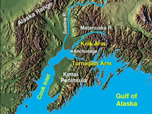
Nasce dall'omonimo ghiacciaio Knik (Knik Glacier) nei monti Chugach (Chugach Mountains), scorre in direzione ovest e si svuota nella parte finale della baia di Knik (Knik Arm), uno dei due bracci della baia di Cook (Cook Inlet). La foce è vicinissima a quella del fiume Matanuska (Matanuska River) tanto che entrambi quasi formano un unico delta. La parte centrale del percorso è caratterizzata da una larga pianura con un letto di ghiaia finemente macinata, sabbia e silt (o limo).
Strade e ponti
Sono due i ponti (e le strade) che l'attraversano: quello dell'autostrada Glenn (Glenn Highway) (61°28′49″N 149°15′10″W) presso Hayflats e più a est quello della Old Glenn Highway (61°30′14″N 149°02′03″W), presso la cittadina di Butte. Quest'ultimo ponte si trova dopo che la strada si divide nella Knik River Road.[3] Buona parte del percorso del fiume è parallelo alla strada Old Glenn Highway. Il fiume stesso fa più o meno da confine tra il borgo Matanuska-Susitna (Matanuska-Susitna Borough) e il comune di Anchorage (Municipality of Anchorage).
Galleria d'immagini
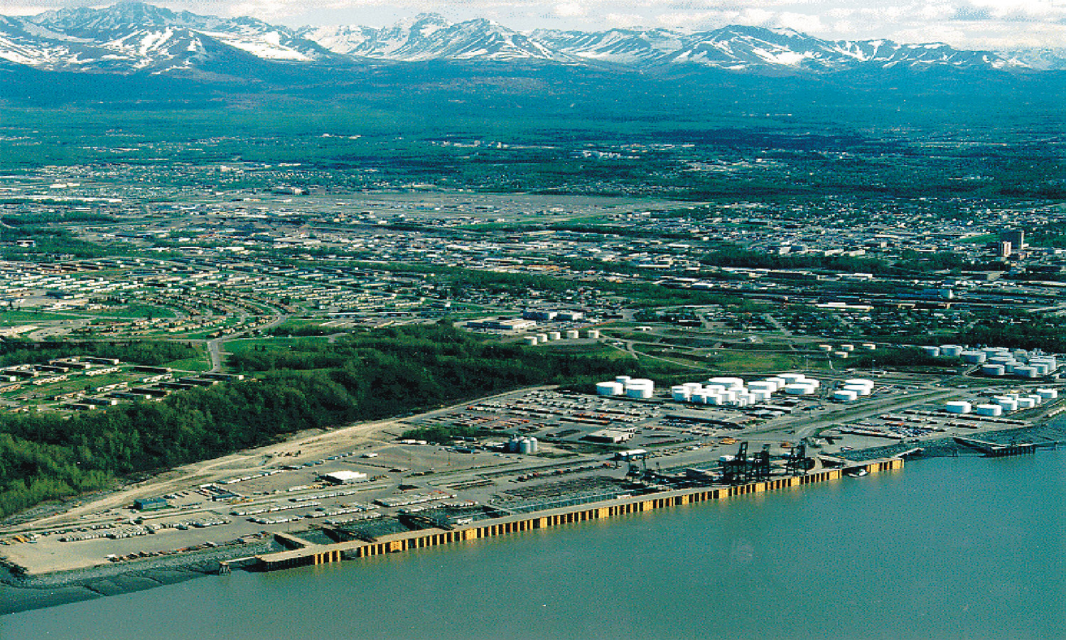
 Il porto di Anchorage sulla baia di Knik
 Distese di fango sulla baia di Knik
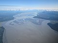 Il fiume Knik all'imbocco della baia
 Il vecchio ponte sul fiume Knik a sud di Plamer
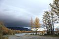 Il fiume Knik a sud di Palmer
 Il fiume in settembre


Note
- United States. Congress, Congressional edition, vol. 4366, Public domain, Government Printing Office, 1901, pp. 245, 300–.
- T. C. Fuglestad, Alaska. Division of Geological and Geophysical Surveys e Alaska Railroad Corporation, The Alaska Railroad between Anchorage and Fairbanks: guidebook to permafrost and engineering problems, State of Alaska, Dept. of Natural Resources, Division of Geological and Geophysical Surveys in cooperation with Alaska Railroad Corporation, 1986. URL consultato il 29 aprile 2012.
- National Research Council (U.S.). Committee on the Alaska Earthquake, The great Alaska earthquake of 1964, National Academies, 1968, p. 994. URL consultato il 29 aprile 2012.
Bibliografia
- Jim Dufresne, Alaska, in Lonely planet, Torino, EDT srl, Ottobre 2009, ISBN 978-88-6040-464-0.
Voci correlate
- Ghiacciaio Knik
- Baia di Knik
- Monti Chugach
Altri progetti
 Wikimedia Commons contiene immagini o altri file su Knik
Collegamenti esterni
- (EN) Knik, su Geographic Names Information System, USGS.
На других языках
[de] Knik River
Der Knik River ist ein etwa 40 km langer Fluss im südlichen Zentralalaska.[en] Knik River
The Knik River /kˈnɪk/ (Dena'ina: Skitnu) is a 25-mile-long (40 km) river in the U.S. state of Alaska. Its source is at Knik Glacier, from which it flows northwest and west and empties into the head of Cook Inlet's Knik Arm, near the mouth of the Matanuska River. It is bridged twice (old and new bridges) where the Old Glenn Highway crosses it near the Butte,[1] and also bridged on the Hayflats.- [it] Knik
[ru] Кник (река)
Кник (англ. Knik River) — река на Аляске. Длина — около 40 км.Другой контент может иметь иную лицензию. Перед использованием материалов сайта WikiSort.org внимательно изучите правила лицензирования конкретных элементов наполнения сайта.
WikiSort.org - проект по пересортировке и дополнению контента Википедии