geo.wikisort.org - River
The Úhlava (German: Angel) is a 104 kilometres (65 mi) long river in the Czech Republic, a right tributary of the Radbuza. Its source is situated on a slope of Pancíř mountain in the Šumava mountains, Klatovy District at an elevation of 1,214 metres (3,983 ft). It passes the villages and towns Nýrsko, Janovice, Bezděkov, Klatovy, Švihov, Lužany, and Přeštice before flowing into the river Radbuza at the south edge of Plzeň. Its major affluent is the Chodská Úhlava. The basin area of the Úhlava is 919 square kilometres (355 sq mi).
| Úhlava | |
|---|---|
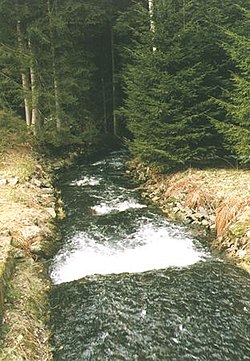 Úhlava in the Šumava mountains | |
| Location | |
| Country | Czech Republic |
| Physical characteristics | |
| Source | |
| • location | Šumava |
| • elevation | 1,110 m (3,640 ft) |
| Mouth | |
• location | Radbuza in Plzeň |
• coordinates | 49°43′14″N 13°23′19″E |
| Length | 104.0 km (64.6 mi) [1] |
| Basin size | 916 km2 (354 sq mi) [1] |
| Basin features | |
| Progression | Radbuza→ Berounka→ Vltava→ Elbe→ North Sea |
References
- Complete table of the Bavarian Waterbody Register by the Bavarian State Office for the Environment (xls, 10.3 MB)
Wikimedia Commons has media related to Úhlava.
Authority control | |
|---|---|
| General |
|
| National libraries | |
This Plzeň Region location article is a stub. You can help Wikipedia by expanding it. |
На других языках
[de] Úhlava
Die Úhlava, früher Bradavka, (deutsch Angel, Angelbach bzw. Bradawka, am Oberlauf Frischbach) ist ein rechter und der größte Nebenfluss der Radbuza in Tschechien.- [en] Úhlava
[ru] Углава (река)
У́глава[1][2] (чеш. Úhlava) — река в Чехии (Пльзеньский край), в бассейне реки Влтавы[3][1].Текст в блоке "Читать" взят с сайта "Википедия" и доступен по лицензии Creative Commons Attribution-ShareAlike; в отдельных случаях могут действовать дополнительные условия.
Другой контент может иметь иную лицензию. Перед использованием материалов сайта WikiSort.org внимательно изучите правила лицензирования конкретных элементов наполнения сайта.
Другой контент может иметь иную лицензию. Перед использованием материалов сайта WikiSort.org внимательно изучите правила лицензирования конкретных элементов наполнения сайта.
2019-2026
WikiSort.org - проект по пересортировке и дополнению контента Википедии
WikiSort.org - проект по пересортировке и дополнению контента Википедии