geo.wikisort.org - River
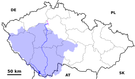
The Vltava (/ˈvʊltəvə, ˈvʌl-/ VU(U)L-tə-və,[1][2][3] Czech: [ˈvl̩tava] (![]() listen); German: Moldau [ˈmɔldaʊ̯]) is the longest river in the Czech Republic, running southeast along the Bohemian Forest and then north across Bohemia, through Český Krumlov, České Budějovice and Prague, and finally merging with the Elbe at Mělník. It is commonly referred to as the "Czech national river".[4]
listen); German: Moldau [ˈmɔldaʊ̯]) is the longest river in the Czech Republic, running southeast along the Bohemian Forest and then north across Bohemia, through Český Krumlov, České Budějovice and Prague, and finally merging with the Elbe at Mělník. It is commonly referred to as the "Czech national river".[4]
| Vltava | |
|---|---|
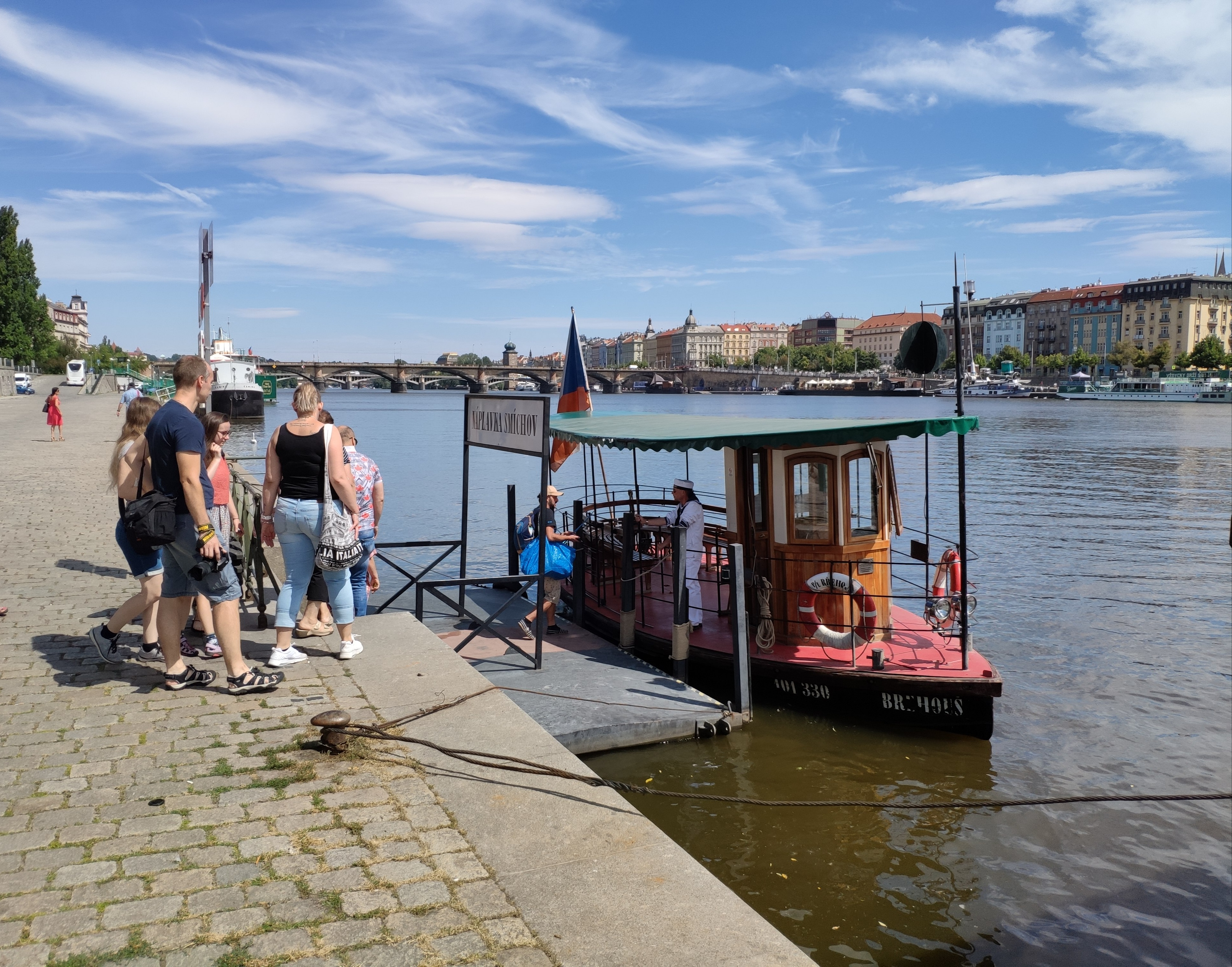
 Vltava in Prague | |
 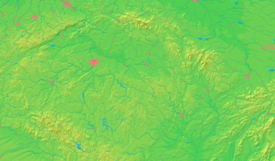 The course and drainage basin of the Vltava from its source to its confluence with the Elbe (magenta) | |
| Location | |
| Country | Czech Republic |
| Regions |
|
| Cities | |
| Physical characteristics | |
| Source | Černý potok |
| • location | Černá hora, Bohemian Forest |
| • coordinates | 48°58′29″N 13°33′39″E |
| • elevation | 1,172 m (3,845 ft) |
| Mouth | Elbe |
• location | Mělník |
• coordinates | 50°20′29″N 14°28′30″E |
• elevation | 155 m (509 ft) |
| Length | 430 km (270 mi) |
| Basin size | 28,090 km2 (10,850 sq mi) |
| Discharge | |
| • average | 149.9 m3/s (5,290 cu ft/s) |
| Basin features | |
| Progression | Elbe→ North Sea |
| Tributaries | |
| • left | Otava, Berounka |
| • right | Lužnice, Sázava |
Both the Czech name Vltava and the German name Moldau are believed to originate from the old Germanic words *wilt ahwa ("wild water"; compare Latin aqua).[5] In the Annales Fuldenses (872 AD) it is called Fuldaha; from 1113 AD it is attested as Wultha. In the Chronica Boemorum (1125 AD) it is attested for the first time in its Bohemian form, Wlitaua.[6]
Course

The Vltava river is 430.3 kilometres (267.4 mi) long and drains an area of 28,090 square kilometres (10,850 sq mi) in size, over half of Bohemia and about a third of the Czech Republic's entire territory.[7][6] As it runs through Prague, the river is crossed by 18 bridges (including the Charles Bridge) and covers 31 kilometres (19 mi) within the city.[8] The water from the river was used for drinking until 1912 when the Vinohrady Water Tower ceased pumping operations.[9] It is, however, the source of drinking water in case of failures of or repairs to the water supply from the Želivka and Kárané sources. The Podolí water processing plant is on standby for such cases with the long section of the river upstream of the Podolí plant under the stricter, second degree of pollution prevention regulations.
The height difference from source to mouth is about 1,016 metres (3,333 ft) and the largest stream at the source is named Černý Potok (Black Brook) or Teplá Vltava (Warm Vltava). The Vltava itself originates by a confluence of two streams, the Warm Vltava (Teplá Vltava), which is longer, and the Cold Vltava (Studená Vltava), sourcing in Bavaria. Along its course, Vltava receives many tributaries, the biggest being Otava and Berounka from the left and Lužnice and Sázava from the right side.
Navigation
Between the confluence with the Elbe at Mělník and Prague, the river is navigable by vessels of up to 1,000 tonnes (980 long tons; 1,100 short tons) displacement. Most of the river upstream of Prague as far as České Budějovice is currently navigable by craft of up to 300 tonnes (300 long tons; 330 short tons) displacement, but such vessels cannot pass the dams at Orlík and Slapy, and are also restricted by a low bridge at Týn nad Vltavou. Work is planned to complete boat lifts, planned for but never completed, at the two dams, and to rebuild the bridge, in order for them to navigate throughout. Much smaller craft, of up to 3.5 tonnes (3.4 long tons; 3.9 short tons) displacement and under 3 metres (9.8 ft) beam and 3 metres (9.8 ft) air draft, can avoid these obstacles.[10]
Upstream of České Budějovice, the river's section around Český Krumlov (specifically from Vyšší Brod to Boršov nad Vltavou) is a very popular destination for water tourism.[11][12]
Dams

Nine hydroelectric dams have been built on the Vltava south of Prague to regulate the water flow and generate hydroelectric power, starting in the 1930s. Beginning at the headwaters, these are: Lipno, Lipno II, Hněvkovice, Kořensko, Orlík, Kamýk, Slapy, Štěchovice and Vrané. The Orlík dam supports the largest reservoir on the Vltava by volume, while the Lipno dam retains the largest reservoir by area. The Štěchovice Reservoir is built over the site of St John's Rapids.
The river also features numerous weirs that help mitigate its flow from 1,172 metres (3,845 ft) in elevation at its source near the German border to 155 metres (509 ft) at its mouth in Mělník.
Floods
The Vltava basin has flooded multiple times throughout recorded history. Markers have been created along the banks denoting the water line for notable floods in 1784, 1845, 1890, 1940, and the highest of all in 2002.[13][14][15]
In August of that year, the basin was heavily affected by the 2002 European floods when the flooded river killed several people and caused massive damage and disruption along its length, including in Prague. It left the oldest bridge in Prague, Charles Bridge, seriously weakened, requiring years of work to repair.[14]
Prague was again flooded in 2013. Many locations within the Vltava and Elbe basins were left under water, including the Prague Zoo, but metal barriers were erected along the banks of the Vltava to help protect the historic city centre.[16][17]

References in culture, politics and science
One of the best-known works of classical music by a Czech composer is Bedřich Smetana's Vltava, sometimes called The Moldau in English. It is from the Romantic era of classical music and is a musical description of the river's course through Bohemia (listen).
A minor planet 2123 Vltava discovered in 1973 by Soviet astronomer Nikolai Stepanovich Chernykh is named after the river.[18]
Smetana's symphonic poem also inspired a song of the same name by Bertolt Brecht. An English version of it, by John Willett, features the lyrics Deep down in the Moldau the pebbles are shifting / In Prague three dead emperors moulder away.[19]
US First Lady Hillary Clinton and US Secretary of State Madeleine Albright met in Prague, strolled through Wenceslas Square with Václav Havel, and took a fourth of July cruise on the Vltava River in summer 1996 after the Velvet Revolution. [20]
See also
- Moldavite
References
- Wells, John C. (2008), Longman Pronunciation Dictionary (3rd ed.), Longman, ISBN 9781405881180
- "Vltava" (US) and "Vltava". Lexico UK English Dictionary. Oxford University Press. Archived from the original on 2020-03-22.
- "Vltava". Merriam-Webster Dictionary. Retrieved March 31, 2019.
- Mahoney, William (2001). The History of the Czech Republic and Slovakia. ABC-CLIO. p. 3. ISBN 0313363064.
- Šmilauer, Vladimír (1946). "O jménech našich řek" [Names of our rivers]. Naše řeč (in Czech). Institute of the Czech Language. 30 (9–10): 161–165. ISSN 0027-8203.
- "The Vltava River – Historical Communication Link in the Český Krumlov Region". Český Krumlov – UNESCO World Heritage. Retrieved 19 June 2015.
The length of its flow to the mouth of the river to the Labe river near Mělnik is 430.2 km. Down to Český Krumlov it has a catchment area of 1,339 km2, the whole basin of the Vltava river is 28,090 km2.
- Complete table of the Bavarian Waterbody Register by the Bavarian State Office for the Environment (xls, 10.3 MB)
- Source : Avantgarde Prague
- Water Tower of Vinohrady, stovezata.praha.eu, retrieved 14 November 2013
- "Upper Vltava navigation inaugurated in May" (PDF). IWI news. Inland Waterways International. July 2017. Archived (PDF) from the original on 3 March 2020. Retrieved 3 March 2020.
- Along the River Branna Nove Spoli - vltava-river.com
- American in Prague (2018 webpage)
- Papadaniil, Sofia; Schütze, Susann; Alukwe, Isaac (16 September 2007). "I. Flood Protection Measures of the City of Prague". Technische Universitat Dresden. Retrieved 19 June 2015.
Several flood marks along the river show the water levels of the different events in history and try to keep this danger of flooding in mind of the people.
- Yates, Ricky (9 February 2010). "Flooding in Prague". Ricky Yates – an Anglican in Prague. Retrieved 19 June 2015.
- Yates, Ricky (15 April 2012). "The Vltava River". Ricky Yates – an Anglican in Prague. Retrieved 19 June 2015.
- "Thousands flee as central Europe flood waters rise". BBC News. 3 June 2013. Retrieved 3 June 2013.
- "News". Radio Praha. 3 June 2013. Archived from the original on 2013-08-04. Retrieved 3 June 2013.
- Schmadel, Lutz D. (2003). Dictionary of Minor Planet Names (5th ed.). New York: Springer Verlag. p. 172. ISBN 3-540-00238-3. Retrieved 2009-10-09.
- "The song of the Moldau". Anti War Songs. 21 August 2012. Retrieved 25 September 2013.
- Albright, Madeleine with Bill Woodard. (2003). Madam Secretary: A Memoir, p. 220. NY, NY: Hyperion, Miramax Books.
External links
 Geographic data related to Vltava at OpenStreetMap
| Authority control: National libraries |
|---|
На других языках
[de] Moldau (Fluss)
Die Moldau (tschechisch Vltava Aussprache?/i, historisch Wulda – aus dem germanischen Wilth-ahwa (Bedeutung etwa: Wild-Ache, Wildach), was so viel wie „wildes, reißendes Wasser“ heißt), auch als „Böhmisches Meer“ bezeichnet, ist der längste Fluss in Tschechien und der größte Nebenfluss der Elbe. Der Name ist germanischen Ursprungs und wurde nach der tschechischen Landnahme im 6. Jahrhundert nach Chr. (Völkerwanderungszeit) zu Vltava. Aus dem tschechischen Vltava wurde erst ab dem 11. Jahrhundert im Zuge des deutsch-tschechischen Sprachkontaktes während der mittelalterlichen Ostsiedlung die heutige deutsche Bezeichnung Moldau abgeleitet.[4][5] Sie ist 430 Kilometer lang und entwässert ein Gebiet von 28.000 km² mit durchschnittlich 151 m³/s an der Mündung. Die Moldau ist beim Zusammenfluss mit der Elbe länger und wasserreicher als diese und stellt damit den hydrologischen Hauptfluss des Elbeflusssystems dar.- [en] Vltava
[es] Moldava
El Moldava (en checo: Vltava; en alemán: Moldau; en polaco: Wełtawa) es el río más largo de la República Checa. Nace en la parte checa de la Selva de Bohemia, pasa por Český Krumlov, České Budějovice y Praga, y finalmente se une con el Elba en Mělník. Su longitud es de 430 km y riega un área de aproximadamente 28 000 km²; en su confluencia lleva más agua que el Elba.[it] Moldava (fiume)
La Moldava (in italiano Mòldava o Moldàva;[1] in ceco: Vltava; in tedesco Moldau) è un fiume dell'Europa centrale che scorre interamente nella Repubblica Ceca, di cui è il maggior corso d'acqua.[ru] Влтава
Влта́ва (чеш. Vltava) — река в Чехии, левый приток реки Лабы. Длина — 446 км, площадь водосборного бассейна — 28 090 км².Другой контент может иметь иную лицензию. Перед использованием материалов сайта WikiSort.org внимательно изучите правила лицензирования конкретных элементов наполнения сайта.
WikiSort.org - проект по пересортировке и дополнению контента Википедии