geo.wikisort.org - River
The Lužnice (Czech pronunciation: [ˈluʒɲɪtsɛ] (![]() listen); German: Lainsitz) is a river in the Czech Republic (204 km) starting in Austria (4 km). It flows into the Vltava river in Týn nad Vltavou (approximately 50 km north of České Budějovice). The river drains 4,226 square kilometers.
listen); German: Lainsitz) is a river in the Czech Republic (204 km) starting in Austria (4 km). It flows into the Vltava river in Týn nad Vltavou (approximately 50 km north of České Budějovice). The river drains 4,226 square kilometers.
| Lužnice | |
|---|---|
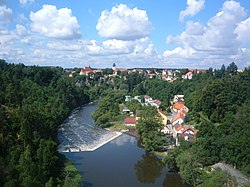
 The Lužnice near Bechyně | |
  The Lužnice and its watershed until it enters the Vltava (magenta) | |
| Location | |
| Countries |
|
| Cities | |
| Physical characteristics | |
| Source | |
| • location | Gratzen Mountains, Austria |
| • coordinates | 48°35′50.6″N 14°43′54″E |
| • elevation | 970 m (3,180 ft) |
| Mouth | Vltava |
• coordinates | 49°13′49.7″N 14°23′21″E |
| Length | 197.4 km (122.7 mi)[1] |
| Basin size | 4,226.2 km2 (1,631.7 sq mi) |
| Discharge | |
| • location | mouth |
| • average | 24.3 m3/s (860 cu ft/s) |
| Basin features | |
| Progression | Vltava→ Elbe→ North Sea |
| Tributaries | |
| • right | Nežárka |
The river was first mentioned in sources in the year 1179. The name is derived from an old Czech for water flowing through the meads. Several places on the river are popular destinations for recreation and canoeing.
Towns and cities on the Lužnice river
- Weitra (Austria)
- Gmünd (Austria)
- České Velenice
- Suchdol nad Lužnicí
- Třeboň
- Veselí nad Lužnicí
- Soběslav
- Planá nad Lužnicí
- Sezimovo Ústí
- Tábor
- Bechyně
- Týn nad Vltavou
References
- Niederösterreich Atlas (Lower Austria)
External links
Wikimedia Commons has media related to Lužnice.
- Basic information (in English)
- Detailed information (in Czech)
На других языках
[de] Lainsitz
Die Lainsitz, in Tschechien Lužnice, ist ein Nebenfluss der Moldau in Österreich und Tschechien. Die Gesamtlänge beträgt etwa 200 Kilometer, davon 43 in Österreich. Die deutsche Bezeichnung war in Böhmen jedoch nicht Lainsitz, sondern Luschnitz. Sie ist mit ihren Nebenflüssen, neben der Maltsch in OÖ, ein Flusssystem Österreichs (ausgenommen Vorarlberg), das zur Nordsee und nicht in die Donau entwässert.- [en] Lužnice (river)
[it] Lužnice (fiume)
Il Lužnice è un fiume che nasce sui monti Gratzen in Austria ma dopo circa 4 entra nel territorio della Repubblica Ceca, dove scorre per altri 200 circa per confluire nella Moldava, dopo un percorso totale di 208 chilometri . Fra i suoi affluenti si ricorda il Nežárka.[ru] Лужнице
Лу́жнице[1] (чеш. Lužnice) или Ла́йнзиц[1] (нем. Lainsitz) — река в Австрии (Верхняя Австрия) и Чехии (Южно-Чешский край). Длина — 208 км (43 км на территории Австрии)[источник не указан 131 день]. Приток реки Влтава.Текст в блоке "Читать" взят с сайта "Википедия" и доступен по лицензии Creative Commons Attribution-ShareAlike; в отдельных случаях могут действовать дополнительные условия.
Другой контент может иметь иную лицензию. Перед использованием материалов сайта WikiSort.org внимательно изучите правила лицензирования конкретных элементов наполнения сайта.
Другой контент может иметь иную лицензию. Перед использованием материалов сайта WikiSort.org внимательно изучите правила лицензирования конкретных элементов наполнения сайта.
2019-2025
WikiSort.org - проект по пересортировке и дополнению контента Википедии
WikiSort.org - проект по пересортировке и дополнению контента Википедии