geo.wikisort.org - River
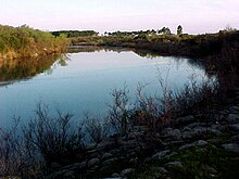
The Yí River (Spanish, Río Yí)[1] is a river in Uruguay. The Yí and the Tacuarembó Rivers are the principal tributaries of the Río Negro.
| Yí River | |
|---|---|
 | |
| Location | |
| Country | Uruguay |
| Physical characteristics | |
| Source | |
| • location | Cuchilla Grande highlands |
| Mouth | |
• location | Río Negro (Uruguay) |
| Length | 210 kilometres (130 mi) |

Geography
The Yí River originates in the Cuchilla Grande highlands. It flows generally west through central Uruguay to the Río Negro.
Various other rivers, including the Porongos River and Chamangá River, are tributaries of the Yí River.
Departmental boundaries
The Yí forms much of the boundary between Durazno Department and Florida Department.
Subsequently, it forms part of the boundary between Durazno Department and Flores Department, where the Chamangá River its tributary.
See also
- Geography of Uruguay#Topography and hydrography
- Porongos River#Fluvial system
- Chamangá River#Fluvial system
References
- Río Yí at GEOnet Names Server
- GNS coordinates adjusted using Google Maps, and GeoLocator
На других языках
[de] Río Yí
Der Río Yí ist ein Fluss im Zentrum Uruguays.- [en] Yí River
[it] Yí
Yí (Río Yí in lingua spagnola) è un fiume dell'Uruguay, affluente del Río Negro. Nasce nei pressi della località di Cerro Chato, nella catena collinare della Cuchilla Grande.[ru] Йи (река)
Йи (исп. Río Yí[1]) — река в Уругвае. Йи, наряду с Такуарембо, является одним из двух крупнейших притоков реки Рио-Негро.Текст в блоке "Читать" взят с сайта "Википедия" и доступен по лицензии Creative Commons Attribution-ShareAlike; в отдельных случаях могут действовать дополнительные условия.
Другой контент может иметь иную лицензию. Перед использованием материалов сайта WikiSort.org внимательно изучите правила лицензирования конкретных элементов наполнения сайта.
Другой контент может иметь иную лицензию. Перед использованием материалов сайта WikiSort.org внимательно изучите правила лицензирования конкретных элементов наполнения сайта.
2019-2025
WikiSort.org - проект по пересортировке и дополнению контента Википедии
WikiSort.org - проект по пересортировке и дополнению контента Википедии