geo.wikisort.org - River
The Westerbach is a right tributary of the Kahl in the northern Spessart in Lower Franconia, Bavaria, Germany.[citation needed]
| Westerbach | |
|---|---|
 The Westerbach beneath the Klotzenmühle | |
| Location | |
| Country | Germany |
| State | Bavaria |
| Reference no. | DE: 247722 |
| Physical characteristics | |
| Source | |
| • location | confluence of Querbach and Huckelheimer Bach in Huckelheim |
| • coordinates | 50°07′39″N 9°14′27″E |
| Mouth | |
• location | in Schöllkrippen in the Kahl |
• coordinates | 50°05′10″N 9°14′41″E |
| Length | 7.2 km (4.5 mi) [1] |
| Basin features | |
| Progression | Kahl→ Main→ Rhine→ North Sea |
It is 6.3 km (3.9 mi) long (7.2 km including Querbach) and begins at the confluence of Querbach and Huckelheimer Bach in Westerngrund. The Querbach rises in the Arzborn, a small opening in the mountainside on the Hoher Querberg, northeast of Huckelheim, near the border between Hesse and Bavaria. In Schöllkrippen the Westerbach empties in the Kahl.[citation needed]
Together with Sommerkahl, Reichenbach and Geiselbach, the Westernbach is one of the largest tributaries of the Kahl.[citation needed]
Tributaries
- Querbach (left headstream)
- Huckelheimer Bach (right headstream)
- Hombach (right)
- Schulzengrundbach (left)
- Dörnsenbach (right)
- Herzbach (left)
- Schneppenbach (right)
- Betzenbach (right)
 The Arzborn (Spring of Querbach)
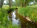 Between Unterwestern and Schneppenbach


See also
References
- Complete table of the Bavarian Waterbody Register by the Bavarian State Office for the Environment (xls, 10.3 MB)
| Wikimedia Commons has media related to Westerbach. |
| Authority control |
|
|---|
На других языках
[de] Westerbach (Kahl)
Der Westerbach oder auch die Westernkahl[6] genannt, ist ein 6,3 km langer, rechter Zufluss der Kahl, der den Westerngrund im Landkreis Aschaffenburg im bayerischen Spessart durchfließt. Er entsteht in der Gemarkung von Huckelheim durch den Zusammenfluss von Querbach und Huckelheimer Bach.- [en] Westerbach (Kahl)
Текст в блоке "Читать" взят с сайта "Википедия" и доступен по лицензии Creative Commons Attribution-ShareAlike; в отдельных случаях могут действовать дополнительные условия.
Другой контент может иметь иную лицензию. Перед использованием материалов сайта WikiSort.org внимательно изучите правила лицензирования конкретных элементов наполнения сайта.
Другой контент может иметь иную лицензию. Перед использованием материалов сайта WikiSort.org внимательно изучите правила лицензирования конкретных элементов наполнения сайта.
2019-2026
WikiSort.org - проект по пересортировке и дополнению контента Википедии
WikiSort.org - проект по пересортировке и дополнению контента Википедии