geo.wikisort.org - River
Tomlin's Creek is short creek in Toronto, which drained into Small's Pond.[1][2] Its headwaters seem to have been in the ravine that contains Glen Davis Crescent, because residents report small springs breaking out.
| Tomlin's Creek | |
|---|---|
 After it was buried, and converted into a sewer, tiny springs keep breaking out at the creek's old headwaters. | |
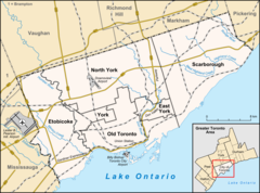 Historic location of the mouth of the creek in Toronto | |
| Location | |
| Country | Canada |
| State | Ontario |
| Municipality | Toronto |
| Physical characteristics | |
| Mouth | Small's Pond |
• coordinates | 43.6795°N 79.300°W |
| Length | 1 km (0.62 mi) |
In the 19th century Tomlin's Creek, a smaller creek with no name, and a larger creek that came to be known as Small's Creek, lay on a large parcel of land owned by Charles Coxwell Small, a gentleman farmer and prominent public official in Upper Canada. Just north of the present location of Queen Street, Small had a dam built to create a millpond to power sawmills. That millpond came to be known as Small's Pond.
Tomlin's Creek, and the other tributaries to Small's Pond, remained clean until the end of the 19th century.[3] The pond had become popular for swimming and fishing in the summer, and slabs of ice were harvested during the winter. But the surrounding area was annexed into the growing city of Toronto and, with increased urbanization, the creeks were quickly polluted, and the decision was made to bury the creeks and convert them to sewers.
Residents who live near the spring outcroppings fear the development of dangerous sinkholes.[1][2] During winter, the water from the springs flows down the street and freezes, making for dangerous driving conditions when all other streets are clear.
References
-
Bateman, Chris (2014-10-31). "How Tomlin's Creek was lost, found, and lost again". Spacing, Toronto magazine. Retrieved 2016-08-02.
Despite the encroachment of housing, Tomlin’s Creek refuses to die. The spring has surfaced in various locations since it was first buried, but most recently it was in the front yard of number 92, the water spilling into the gutter and flowing into the nearest drain.
-
Hudson, Andrew (2013-12-17). "Glen Davis water source a mystery". Beach Metro News. Retrieved 2016-08-02.
According to Lost Rivers, a Toronto Green Community project that tracks buried waterways, the eastern end of Glen Davis Crescent contained the source of Tomlin’s Creek, one of three waterways that fed Small’s Pond, a three-metre deep pond that stood at Queen Street and Kingston Road.
-
Cook, Michael (2010-10-18). "Beneath Toronto's East End: The East Toronto and Midway Sewer System". Vanishing Point. Retrieved 2016-08-01.
Streams flowed from Midway (Ashbridges Creek) and East Toronto (Smalls Creek and Tomlin's Creek) into Ashbridges Bay, but these along with the area's shallow wells were quickly disrupted and used up by intensifying residential development.
Другой контент может иметь иную лицензию. Перед использованием материалов сайта WikiSort.org внимательно изучите правила лицензирования конкретных элементов наполнения сайта.
WikiSort.org - проект по пересортировке и дополнению контента Википедии