geo.wikisort.org - River
The Tittabawassee River flows in a generally southeasterly direction through the Lower Peninsula of the U.S. state of Michigan. The river begins at Secord Lake in Clement Township, at the confluence of the East Branch and the Middle Branch.[3] From there it flows through Gladwin, Midland and Saginaw counties where, as a major tributary of the Saginaw River, it flows into it at Saginaw. Its tributaries include the Chippewa, Pine, Molasses, Sugar, and Tobacco rivers.
| Tittabawassee River | |
|---|---|
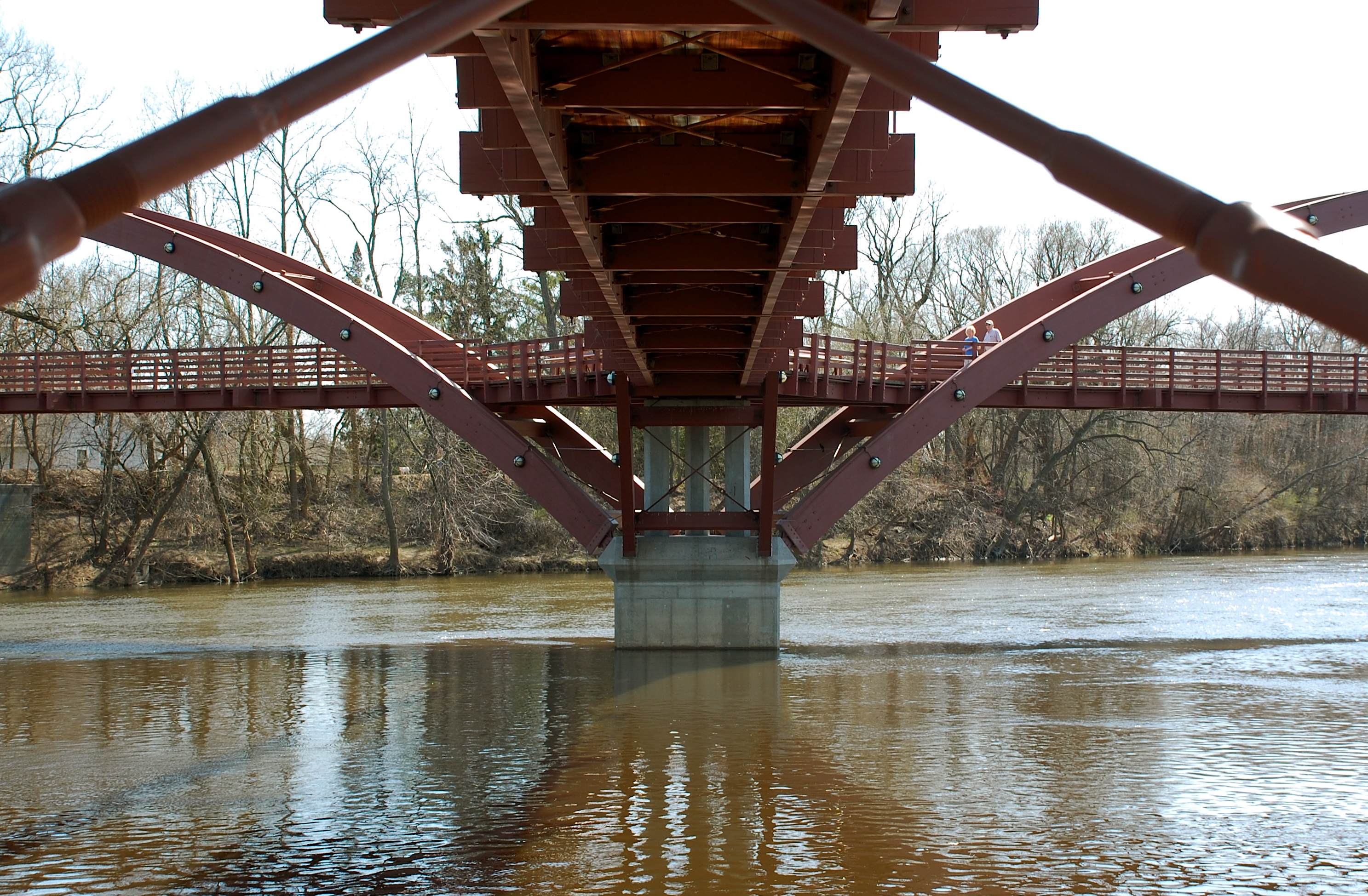
 Looking north from M-61 in Hay Township | |
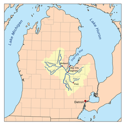 Saginaw River watershed | |
 Mouth location within the state of Michigan | |
| Physical characteristics | |
| Source | |
| • location | Edwards Township, Ogemaw County, Michigan |
| • coordinates | 44.09085°N 84.31361°W[1] |
| Mouth | |
• location | Saginaw River, Michigan |
• coordinates | 43.38669°N 83.96608°W |
| Length | 72 mi (116 km) |
| Basin size | 2,471 sq mi (6,400 km2) |
| Discharge | |
| • location | mouth |
| • average | 2,055.61 cu ft/s (58.208 m3/s) (estimate)[2] |
Significant communities on or near the Tittabawassee River include Saginaw, Midland, and Sanford. At Edenville, the river was impounded by the hydroelectric Edenville Dam to create Wixom Lake. It was also impounded by a hydroelectric dam in Sanford to create Sanford Lake prior to the dam failures and resulting flooding on May 19, 2020. In Saginaw County, the river flows through Tittabawassee Township, which is named for the river and contains the unincorporated community of Freeland.
The main river is 72.4 miles (116.5 km) long[3] and drains an area of 2,471 square miles (6,400 km2).[4]
Floods

On May 19, 2020, the Edenville Dam failed, followed by the Sanford Dam downstream being overtopped and a dike breaking at Poseyville, resulting in major flooding in Midland County.[5][6][7] 10,000 people were evacuated including a seniors home and a few hospital patients.[8][9] Two emergency shelters had to be relocated due to flooding and electrical power losses. Floodwater entered the Dow Chemical plant, forcing its shutdown and mixing with its containment ponds, leading to concern over pollution.[10] The next day, water levels were predicted to reach 38 feet: four feet higher than the flood of 1986.[11] National Guard units and a FEMA team were brought in to assist.
See also
- The Tridge
- Map of real-time streamflow compared to historical streamflow for the day of the year (Michigan)
References
- "Tittabawassee River". Geographic Names Information System. United States Geological Survey, United States Department of the Interior.
- United States Environmental Protection Agency. "Watershed Report: Tittabawassee River". WATERS GeoViewer. Archived from the original on July 5, 2021. Retrieved July 5, 2021.
- United States Geological Survey. "National Hydrography Dataset high-resolution flowline data". The National Map. Retrieved November 7, 2011.
- "Tittabawassee River Assessment" (PDF). Michigan Department of Natural Resources.
- Bryan, Whitney (May 19, 2020). "Residents told to evacuate immediately due to Edenville Dam failure, Sanford Dam expected failure". Saginaw, Michigan: WNEM-TV. Retrieved May 20, 2020.
- "Thousands evacuated as river dams break in central Michigan". Detroit Free Press. Associated Press. Retrieved May 20, 2020.
- Jordan, Heather (May 20, 2020). "More Midland County residents ordered to evacuate after dike on Poseyville breaks". MLive. Retrieved May 20, 2020.
- LeBlanc, Beth (May 20, 2020). "Whitmer seeks FEMA aid for Midland's widespread flooding". The Detroit News. Retrieved May 20, 2020.
- Hunter, George & Donnelly, Francis X. (May 20, 2020). "Flood evacuees wait to learn extent of damage to homes". The Detroit News. Retrieved May 20, 2020.
- Matheny, Keith (May 20, 2020). "Dow Chemical in Midland: Flood water mixed with our containment ponds". Detroit Free Press. Retrieved May 20, 2020.
- Schafer, Ashely (May 19, 2020). "Sanford Dam failure imminent; Midland residents evacuating". Midland Daily News. Retrieved May 20, 2020.
External links
- Michigan State University Wildlife Toxicology Lab Tittabawassee River Project
- State of Michigan DEQ Midland/Tittabawassee River Dioxin Information Page
Central/Mid-Michigan including the Tri-Cities and Thumb | |||||||
|---|---|---|---|---|---|---|---|
| Central cities | |||||||
| Counties |
| ||||||
| Geography | |||||||
| Transportation |
| ||||||
| Economy |
| ||||||
| |||||||
Authority control | |
|---|---|
| General |
|
| National libraries | |
На других языках
[de] Tittabawassee River
Der Tittabawassee River ist ein 116 km langer Fluss im US-Bundesstaat Michigan. Er entwässert ein Areal von 6400 km². Der mittlere Abfluss am Pegel USGS 04156000 bei Midland beträgt 47,6 m³/s.- [en] Tittabawassee River
[es] Río Tittabawassee
El río Tittabawassee fluye en una dirección generalmente del sudeste a través de la península inferior del estado estadounidense de Michigan. El río comienza en Secord Lake en el municipio de Clement, en la confluencia de East Branch y Middle Branch.[1] Desde allí fluye a través de los condados de Gladwin, Midland y Saginaw donde, como afluente principal del río Saginaw, desemboca en Saginaw. Sus afluentes incluyen los ríos Chippewa, Pine, Molasses, Sugar y Tobacco.Другой контент может иметь иную лицензию. Перед использованием материалов сайта WikiSort.org внимательно изучите правила лицензирования конкретных элементов наполнения сайта.
WikiSort.org - проект по пересортировке и дополнению контента Википедии