geo.wikisort.org - River
The Taedong River (Chosŏn'gŭl: 대동강)[lower-alpha 1] is a large river in North Korea. The river rises in the Rangrim Mountains of the country's north where it then flows southwest into Korea Bay at Namp'o.[3] In between, it runs through the country's capital, Pyongyang. Along the river are landmarks such as the Juche Tower and Kim Il-sung Square.
| Taedong River | |
|---|---|
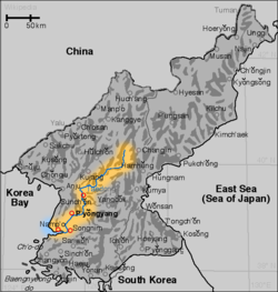 Map of the Taedong River | |
| Location | |
| Country | North Korea |
| Physical characteristics | |
| Source | |
| • location | Rangrim Mountains, South Hamgyong |
| Mouth | |
• location | West Korea Bay |
| Length | 439 kilometers (273 mi)[1] |
| Basin size | 20,344 km2 (7,855 sq mi) |
| Taedong River | |
| Chosŏn'gŭl | |
|---|---|
| Hancha | |
| Revised Romanization | Daedong-gang |
| McCune–Reischauer | Taedong-gang |
The river is 439 km or 272.7 mi in length, and is generally deep. It is the fifth-longest river on the Korean peninsula and the second-longest in North Korea. Pyongyang is approximately 110 km upstream from the mouth, Sunchon 192 km upstream, and Taehŭng 414 km upstream.[citation needed] Because of its depth, it is widely used for river transport; it is navigable by large ships up to 65 km inland, although most commercial traffic stops at Songrim.
History
The kingdom of Koguryo was founded on its shores. Many archeological sites dating to the neolithic and Bronze Ages have been found along the river, as well as relics and ruins from Koguryo. It was also once known as the Pae River (패수; 浿水; P’aesu).[4]
The Taedong River basin is believed to be the location of the Taedonggang Culture, the historical centre of the Korean nation, when its ancient civilization flourished in 3000 BC.
Dams and bridges
In 1986, the government completed the 8-km-long West Sea Barrage, with three locks and 36 sluices, at the mouth of the Taedong River near Namp'o.[3] The dam acts to control floodwater and to irrigate lands newly reclaimed from the Korea Gulf.[3] The dam prevents mixing of the outgoing river water with seawater, leading to an increase of contaminants concentration.[5] Other dams, such as the Nyongwon Power Station, have been built to provide energy to the country.[6]
In Pyongyang, there are six bridges on the Taedong, including the Okryu Bridge, Rungra Bridge, and Taedong Bridge.[7]
Gallery
 Yanggakdo Island in the middle of the river in Pyongyang
 The Taedong River flowing through Pyongyang
 An image of the Taedong River from 1889
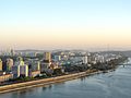 The Taedong in Pyongyang
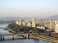 Another view of the river through Pyongyang
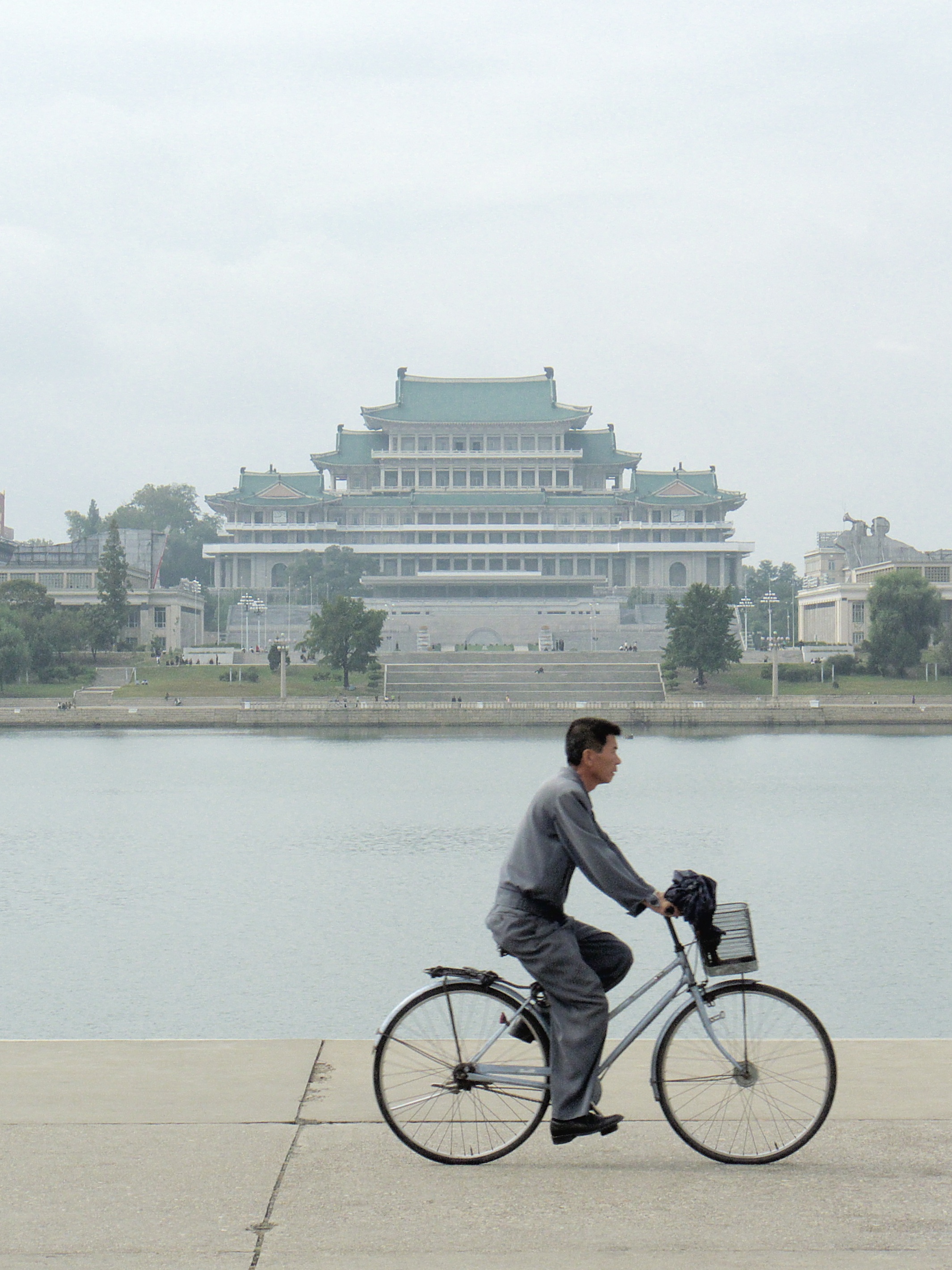
 The Grand People's Study House on the bank of the river.
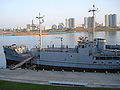 The captured USS Pueblo vessel moored on the Taedong (now tied up on the Botong River beside the Victorious Fatherland Liberation War Museum)
 The Taedong River in Nampo
 The river in Nampo


Notes
- In the 19th century, the Taedong was spelled Tai-tang in Western texts (the "Tai-tang River" or "Tai-tang Kang").[2]
References
Citations
- "Encyclopædia Britannica Online : Taedong River". Encyclopædia Britannica.
- EB (1878), p. 390.
- Suh, Dae-Sook (1987) "North Korea in 1986: Strengthening the Soviet Connection" Asian Survey 27(1): pp. 56-63, page 62
- (1973) Transactions of the Korea branch of the Royal Asiatic Society. vol. 48, page 59
- Tenenbaum, David J. (2005) "International Health: North Korean Catastrophe" Environmental Health Perspectives 113(1): p. A26, page A26
- (209) Korea Today No. 640[permanent dead link]
- "옥류교 [Okryu Bridge]", Doosan Encyclopedia, retrieved 2010-07-02[permanent dead link]
Bibliography
- , 'Encyclopædia Britannica, 9th ed., Vol. VI, New York: Charles Scribner's Sons, 1878, pp. 390–394.
See also
| Wikimedia Commons has media related to Taedong River. |
- Taedong River estuary Important Bird Area
- Taedonggang, a beer named after the river
- Rivers of Asia
- Rivers of Korea
- Geography of North Korea
На других языках
[de] Taedong-gang
Der Taedong ist ein Fluss in Nordkorea.- [en] Taedong River
[es] Taedong
Taedong (Hangul: 대동강, Hanja: 大同江) es un río que fluye íntegramente a través de Corea del Norte. Nace en las montañas Rangrim del norte del país. Recorre el país en dirección suroeste, desembocando en la bahía de Corea, en la ciudad de Nampo. Antes de su desembocadura atraviesa la capital, Pionyang. A lo largo del río hay puntos de referencia como la Torre Juche o la plaza Kim Il-sung. Antiguamente el río era también conocido con el nombre de río Pae, 浿江.[it] Taedong
Il Taedong (대동강?, 大同江?, Taedong-gangLR) è un fiume che scorre in Corea del Nord, lungo 439 km e generalmente profondo. Questo fiume attraversa la capitale Pyongyang. È il quinto fiume più lungo della Corea e il secondo della Corea del Nord. Grazie alla sua profondità è usato per il trasporto fluviale e può essere navigato anche da grandi navi.[ru] Тэдонган
Тэдонга́н[1] (кор. 대동강?, 大同江?) — река в КНДР. Берёт начало в горах Нанним на севере страны. Течёт на юго-запад и впадает в Корейский залив в районе города Нампхо. Протекает через столицу страны, Пхеньян. На берегу Тэдонгана расположены такие достопримечательности, как Монумент идей Чучхе и Площадь Ким Ир Сена. Ранее была известна под именем Пэган (浿江). На реке построена Тэдонганская ГЭС мощностью 200 МВт.Другой контент может иметь иную лицензию. Перед использованием материалов сайта WikiSort.org внимательно изучите правила лицензирования конкретных элементов наполнения сайта.
WikiSort.org - проект по пересортировке и дополнению контента Википедии