geo.wikisort.org - River
The Siak (Sungai Siak) is a river of Riau province, in the east of Sumatra, Indonesia, about 1000 km northwest of the capital Jakarta.[1] Approximately 370 kilometres in length, the Siak is a blackwater river which owes its brown color to dissolved organic matter (DOM) leached from surrounding, heavily disturbed peat soils; it is heavily polluted, notably by the petroleum industry. It flows through the town of Pekanbaru before emptying into the Strait of Malacca.[2]
| Siak Sungai Siak, Siak rivier | |
|---|---|
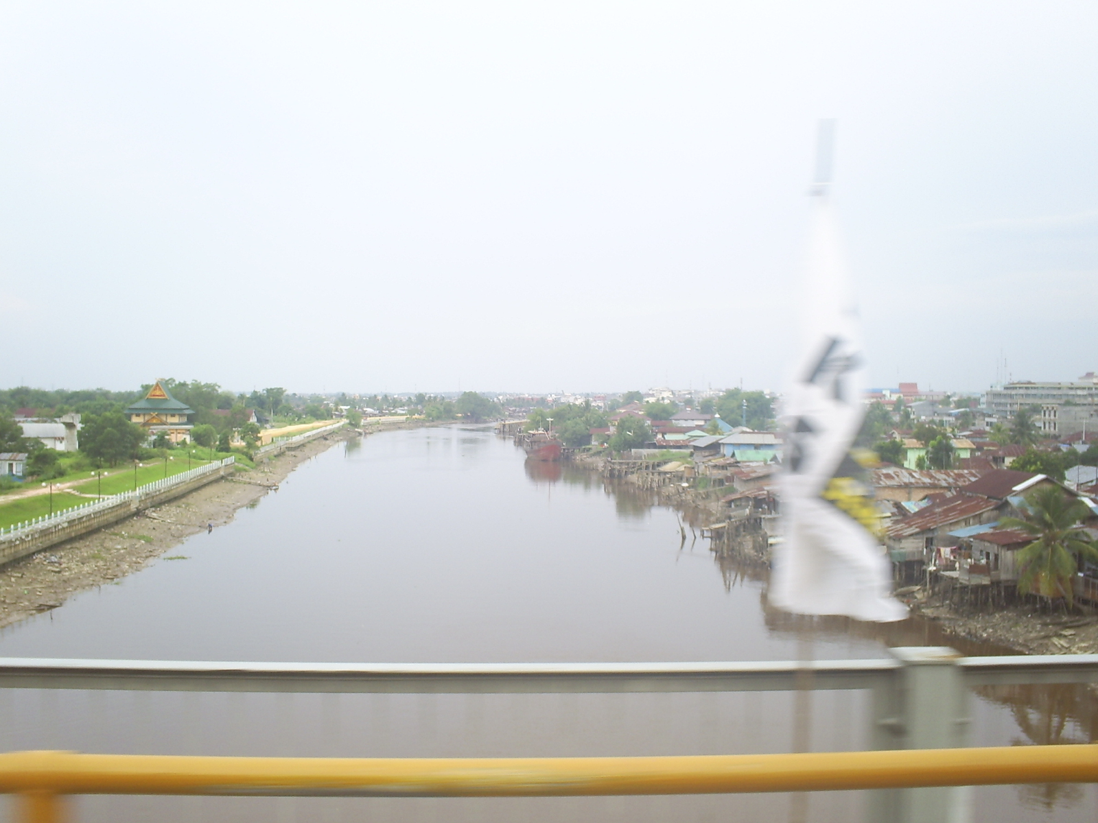 The Siak River as it flows through Pekanbaru | |
 Location of river mouth  Siak River (Indonesia) | |
| Location | |
| Country | Indonesia |
| Province | Riau |
| Physical characteristics | |
| Source | |
| • elevation | 0 m (0 ft) |
| Mouth | Malacca Strait |
| Length | 370 km (230 mi) |
| Basin size | 10,423 km2 (4,024 sq mi) |
| Discharge | |
| • location | Siak Delta, Malacca Strait |
| • average | (Period of data: 2009-2013)720 m3/s (25,000 cu ft/s) |
Geography
The river flows in the central area of Sumatra with predominantly tropical rainforest climate (designated as Af in the Köppen-Geiger climate classification).[3] The annual average temperature in the area is 23 °C. The warmest month is October, when the average temperature is around 25 °C, and the coldest is January, at 22 °C.[4] The average annual rainfall is 2673 mm. The wettest month is November, with an average of 418 mm rainfall, and the driest is January, with 106 mm rainfall.[5]
See also
References
- Sungai Siak at Geonames.org (cc-by); Last updated 2013-06-04; Database dump downloaded 2015-11-27
- John William Reed, John William King (1867). The China sea directory, Volume 1, Hydrographic Dept. Hydrographic office, Admiralty. p. 229.
{{cite book}}: CS1 maint: uses authors parameter (link) - Peel, M C; Finlayson, B L; McMahon, T A (2007). "Updated world map of the Köppen-Geiger climate classification". Hydrology and Earth System Sciences. 11 (5): 1633–1644. Bibcode:2007HESS...11.1633P. doi:10.5194/hess-11-1633-2007. Retrieved 30 January 2016.
- "NASA Earth Observations Data Set Index". NASA. 30 January 2016.
- "NASA Earth Observations: Rainfall (1 month - TRMM)". NASA/Tropical Rainfall Monitoring Mission. 30 January 2016.
| Authority control |
|
|---|
На других языках
[de] Siak
Der Siak (indonesisch Sungai Siak, deutsch „Fluss Siak“) ist ein Fluss in Indonesien im Osten der Insel Sumatra in der Provinz Riau.- [en] Siak River
[it] Siak
Il Siak (in indonesiano Sungai Siak, «fiume Siak») è un fiume indonesiano situato nella parte orientale dell'isola di Sumatra, nella provincia di Riau.[ru] Сиак (река)
Сиак — река в Индонезии, на острове Суматра. Длина 350 км[1]. Протекает в центральной части острова, впадает в Малаккский пролив. Берёт начало при слиянии рек Тапунг-Канан и Тапунг-Кири[2]. Сиак судоходен[1].Другой контент может иметь иную лицензию. Перед использованием материалов сайта WikiSort.org внимательно изучите правила лицензирования конкретных элементов наполнения сайта.
WikiSort.org - проект по пересортировке и дополнению контента Википедии