geo.wikisort.org - River
The Salinello (Latin: Zerninus)[1] is a river in Italy.[2] It is located in the province of Teramo in the Abruzzo region of southern Italy. The source of the river is in the Monti della Laga range southwest of Montagna dei Fiori.[3] The river flows eastward and curves northeast near Civitella del Tronto. The river then curves southeast near Sant'Egidio alla Vibrata and the border with the province of Ascoli Piceno. Finally, the river flows east near Sant'Omero and enters the Adriatic Sea near Giulianova and Tortoreto Lido.
| Salinello | |
|---|---|
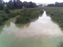 The Salinello near Tortoreto | |
| Location | |
| Country | Italy |
| Physical characteristics | |
| Source | |
| • location | Monti della Laga |
| Mouth | Adriatic Sea |
• coordinates | 42.7813°N 13.9550°E |
References
- Richard J.A. Talbert, ed. (2000). Barrington Atlas of the Greek and Roman World: Map-By-Map Directory. Vol. I. Princeton, NJ and Oxford, UK: Princeton University Press. p. 613. ISBN 0691049459.
- The Times Comprehensive Atlas of the World (13 ed.). London: Times Books. 2011. p. 77 L2. ISBN 9780007419135.
- Hammond World Atlas (6 ed.). Hammond World Atlas Corporation. 2010. p. 71. ISBN 9780843715606.
Authority control | |
|---|---|
| General |
|
| National libraries | |
This Abruzzo location article is a stub. You can help Wikipedia by expanding it. |
На других языках
- [en] Salinello
[it] Salinello
Il Salinello è un fiume dell'Abruzzo settentrionale conosciuto in epoca romana come Helvinus[1], ma anche come Serinus e, più raramente, come Salinum[2] per la presenza, in prossimità della foce, di alcune saline. Queste ultime diedero il nome a un pagus situato nelle immediate vicinanze (Ad Salinas)[3].Текст в блоке "Читать" взят с сайта "Википедия" и доступен по лицензии Creative Commons Attribution-ShareAlike; в отдельных случаях могут действовать дополнительные условия.
Другой контент может иметь иную лицензию. Перед использованием материалов сайта WikiSort.org внимательно изучите правила лицензирования конкретных элементов наполнения сайта.
Другой контент может иметь иную лицензию. Перед использованием материалов сайта WikiSort.org внимательно изучите правила лицензирования конкретных элементов наполнения сайта.
2019-2026
WikiSort.org - проект по пересортировке и дополнению контента Википедии
WikiSort.org - проект по пересортировке и дополнению контента Википедии