geo.wikisort.org - River
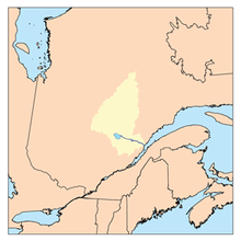
The Saguenay River (French: Rivière Saguenay) is a major river of Quebec, Canada. It drains Lac Saint-Jean in the Laurentian Highlands, leaving at Alma and running east; the city of Saguenay is located on the river. It drains into the Saint Lawrence River. Tadoussac, founded as a French colonial trading post in 1600, is located on the northeast bank at this site.
| Saguenay River | |
|---|---|
 Saguenay River, inside the Saguenay–St. Lawrence Marine Park | |
 | |
| Native name | Rivière Saguenay (French) |
| Location | |
| Country | Canada |
| Province | Quebec |
| Region | Saguenay–Lac-Saint-Jean |
| Physical characteristics | |
| Source | Lac Saint-Jean |
| • location | Alma, Saguenay–Lac-Saint-Jean |
| • coordinates | 48°32′28″N 71°36′54″W |
| • elevation | 102 m |
| Mouth | Saint Lawrence River |
• location | Tadoussac / Baie-Sainte-Catherine, Côte-Nord / Capitale-Nationale |
• coordinates | 48°07′45″N 69°42′13″W |
• elevation | 3 m |
| Length | 170 km (110 mi)[1] |
| Basin size | 88,000 km2 (34,000 sq mi)[2] |
| Discharge | |
| • location | Saint Lawrence River[2] |
| • average | 1,750 m3/s (62,000 cu ft/s) |
| Basin features | |
| Tributaries | |
| • left | (upstream) ruisseau du Lac de l'Aqueduc, outlet of Lac de l'Anse à l'Eau, outlet of Petit lac de la Pointe à la Croix, outlet of Lac de la Boule, stream Desgagnés, ruisseau de l'Anse Creuse, cours d'eau Paul-Simard, outlet of Lac à Charlie, outlet of Lac des Mouches, Sainte-Marguerite, stream Gagnon, outlet of Lac de l'Anse à René, outlet of Lac Betty Baldwin, ruisseau de l'Ermite, outlet of Lac de la Voile, stream Biscambi, stream Fortin, stream Lac à Thomas, lake Damiens, outlet of Le Grand Lac, outlet of lake Pluto, stream Rouge, ruisseau à la Mine, rivière de la Descente des Femmes, outlet of lake Poléon, stream Neil, Pelletier River, décharge du lac José, ruisseau des îles, ruisseau Glissant, ruisseau du Moulin, rivière aux Outardes, stream Lajoie, Valin River, Caribou River, stream Sauvage, ruisseau à Paul, Michaud River (Saguenay River), rivière aux Vases (Saguenay River), Shipshaw River, outlet of lake Virgule, rivière des Aulnaies, stream des Portes de l'Enfer, outlet of lake Marcelle, stream Duclos, stream Gauthier, ruisseau du Lac Lucie, ruisseau de la Savane, ruisseau Gervais, outlet of lake Cimon, cours d'eau Beaumont, cours d'eau Larouche, cours d'eau Bouchard, cours d'eau Desbiens, Mistouk River, rivière aux Harts, rivière aux Chicots, stream Rouge. |
| • right | (upstream) Petites Îles River, Saint-Étienne River, Saint-Athanase River, Petit Saguenay River, Saint-Jean River, Éternité River, stream Aimable, rivière à la Croix, ruisseau aux Cailles, Ha! Ha! River, rivière à Mars, rivière à Benjamin, rivière du Moulin, rivière aux Rats, Chicoutimi River, rivière aux Sables, La Petite Décharge. |
The river has a very high flow-rate and is bordered by steep cliffs associated with the Saguenay Graben. Tide waters flow in its fjord upriver as far as Chicoutimi (about 100 kilometres). Many Beluga whales breed in the cold waters at its mouth, making Tadoussac a popular site for whale watching and sea kayaking; Greenland sharks also frequent the depths of the river. The area of the confluence of the Saguenay and Saint Lawrence is protected by the Saguenay–St. Lawrence Marine Park, one of Canada's national parks.
History
The Saguenay River was used as an important trade route into the interior for the First Nations people of the area. During the French colonization of the Americas, the river became a major route for the fur trade. The French established Tadoussac, France's first trading post in Canada, in 1600. They named the river for the legendary Kingdom of Saguenay. It is the namesake of Saguenay Herald at the Canadian Heraldic Authority.
Beginning in the 19th century, the river was exploited for transport and power by the logging and pulp and paper industries. A dam on the upper Saguenay generates hydroelectricity for local industries, such as aluminum smelting and paper mills.[1]
Severe flooding of the Saguenay's tributary rivers from July 18 to 21, 1996, devastated the region in one of Canada's costliest natural disasters, the Saguenay Flood.[3] However, an unexpected effect of the flood was to cover the heavily contaminated sediments at the bottom of the river with 10 to 50 centimetres (3.9 to 19.7 in) of new, relatively clean sediments. Research has shown that the old sediments are no longer a threat to ecosystems.[4]
Geography
The Saguenay originates in Lac Saint-Jean at Alma. There are two channels: La Petite Décharge and La Grande Décharge, on which is built the dam Île Maligne hydroelectric plant.[5] The island formed by these two rivers is part of the municipality of Alma.[6] At this place, the water is freshwater. Three bridges cross the "Petite Décharge" and two others cross the "Grande Décharge". It is when these two rivers meet just east of Alma that the Saguenay really begins. It begins in the form of a reservoir several kilometers long, unlike the rapids and powerful falls that dotted the river before the erection of dams.
At Shipshaw, Quebec, the Saguenay splits again in two. On the northern watercourse, there is the Shipshaw hydroelectric station[7] and, on the south side, the Chute-à-Caron power plant.[8] It is here that the Aluminum Bridge is located.
Between Chicoutimi and Jonquière, the two spillway weirs come together to form the Saguenay as it is best known. It becomes accessible to navigation at this point. Moreover, Chicoutimi means "how deep is it" [9] in Montagnais. In downtown Chicoutimi, we find the Dubuc bridge and the Sainte-Anne bridge.
The salt water reaches Chicoutimi. At Tadoussac, a ferry provides the link between Tadoussac and Baie-Sainte-Catherine.
Tributaries
- Sainte-Marguerite River
- North-East Sainte-Marguerite River
- Saint-Jean River
- Ha! Ha! River
- Mars River
- Valin River
- Rivière du Moulin
- Chicoutimi River
- Shipshaw River
- Rivière aux Sables
- Rivière aux Écorces
- Lake Saint-Jean
- Peribonka River
- Manouane River
- Mistassini River
- Ashuapmushuan River
- Ouiatchouaniche River
- Métabetchouane River
- Peribonka River
Riverside municipalities
- Alma
- Saint-Charles-de-Bourget, Quebec
- Shipshaw, Quebec (amalgamated with Saguenay)
- Jonquière (amalgamated with Saguenay)
- Chicoutimi (amalgamated with Saguenay)
- Saint-Fulgence, Quebec
- La Baie, Quebec (at the bottom of Ha! Ha! Bay, amalgamated with Saguenay)
- Sainte-Rose-du-Nord, Quebec
- Rivière-Éternité, Quebec
- L'Anse-Saint-Jean, Quebec
- Petit-Saguenay, Quebec
- Sacré-Cœur, l'Anse de Roche
- Tadoussac, Quebec
- Baie-Sainte-Catherine, Quebec
See also
- List of longest rivers of Canada
- List of Quebec rivers
- List of National Parks of Canada
Notes
- Scheffel, Richard L.; Wernet, Susan J., eds. (1980). Natural Wonders of the World. United States of America: Reader's Digest Association, Inc. pp. 328–329. ISBN 0-89577-087-3.
- Natural Resources Canada, Atlas of Canada - Rivers
- The Saguenay Flood
- Project Saguenay
- Barrage Isle-Maligne
- Alma - Island on the Saguenay
- "Details".
- "Details".
- Pierre-Georges Roy, "The Geographical Names of the Province of Quebec", Lévis, Le Soleil, 1906, p. 130.
External links
![]() Media related to Saguenay River at Wikimedia Commons
Media related to Saguenay River at Wikimedia Commons
- "Saguenay River", The Canadian Encyclopedia
- Canadian Council for Geographic Education page with a series of articles on the history of the Saguenay River.
Authority control | |
|---|---|
| General |
|
| National libraries | |
| Other | |
На других языках
[de] Rivière Saguenay
Der Rivière Saguenay (englisch Saguenay River[3]) ist ein Fluss in der kanadischen Provinz Québec. Der Name bedeutet in der Montagnais-Sprache „Wo das Wasser heraus kommt“.- [en] Saguenay River
[es] Río Saguenay
El río Saguenay (en francés: 'Rivière Saguenay'); en inglés, Saguenay River es un río de la parte sureste de Canadá, un afluente de la margen izquierda del curso inferior del río San Lorenzo. El Saguenay discurre en su totalidad por la provincia de Quebec, por su parte sur. El río nace nominalmente en el lago Saint-Jean (1003 km²) y desagua en el San Lorenzo en Tadoussac, al norte de la ciudad de Quebec. Discurre en dirección sureste y desciende por una cascada de 90 m en un caudal turbulento en el primer tercio de sus 160 km de trayecto. Si se considera con su fuente más lejana, el sistema Saguenay-lago Saint-Jean-río Péribonka, tiene una longitud total de 698 km[it] Saguenay (fiume)
Il Saguenay è un fiume del Canada lungo 155 km.[ru] Сагеней (река)
Сагене́й[1] (фр. Saguenay) — полноводная река в Восточной Канаде, на территории провинции Квебек. Река вытекает из озера Сен-Жан, впадает в эстуарий реки Святого Лаврентия, образуя фьорд. Длина реки составляет 314 км, площадь водосборного бассейна — 90 тыс. км². Воды реки используются несколькими целлюлозно-бумажными и алюминиевыми заводами, а также каскадами ГЭС. Суровая северная природа долины реки — важный объект канадского экологического туризма.Другой контент может иметь иную лицензию. Перед использованием материалов сайта WikiSort.org внимательно изучите правила лицензирования конкретных элементов наполнения сайта.
WikiSort.org - проект по пересортировке и дополнению контента Википедии