geo.wikisort.org - River
The River Clun runs mostly through Shropshire, England and joins the River Teme at Leintwardine, Herefordshire. The Clun Valley is part of the Shropshire Hills AONB (Area of Outstanding Natural Beauty).[6]
| River Clun | |
|---|---|
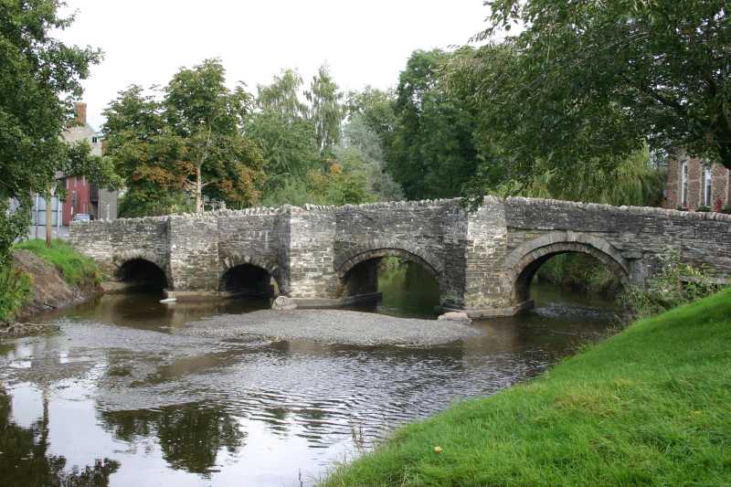 The river flowing through the town of Clun, in which the historic packhorse bridge is still the only vehicle-carrying bridge. | |
| Etymology | Colun (British)[1] |
| Location | |
| Country | England, United Kingdom |
| Region | West Midlands |
| County | Shropshire, Herefordshire |
| Cities | Newcastle, Clun, Clunton, Clungunford |
| Physical characteristics | |
| Source | |
| • location | Anchor, Shropshire |
| Mouth | Confluence with River Teme |
• location | Leintwardine, Herefordshire |
• coordinates | 52.3598°N 2.8785°W |
• elevation | 119 m (390 ft) |
| Length | 45.84[2][3][4] km (28.48 mi) |
| Basin size | 300[5] km2 (120 sq mi) |
| Discharge | |
| • location | Leintwardine |
| Basin features | |
| Tributaries | |
| • left | River Unk, River Kemp |
| • right | River Redlake |

Course
The River Clun has its source near the hamlet of Anchor (in a marshy area near the public house), close to the border of Wales.[7] It flows east through the small town of Clun until Aston on Clun where it flows roughly southwards — the river flows around the north of Clunbury Hill.[8] The river enters the lower valley — which widens and has a flatter floor (an extensive flood plain).[9]
The Folly Brook joins the Clun at Newcastle, and the River Unk flows into the Clun near Clun Castle, whilst the River Kemp flows into the river at Oaker near Aston. Near the end of the river's course, the River Redlake joins at Jay.[8]
Just south of Broadward (a Site of Special Scientific Interest for a stretch south of Broadward Bridge) the river flows into Herefordshire where it joins the River Teme.[10]
Features
Many settlements along the course of the river incorporate the river's name, including Clun, and the villages of Newcastle-on-Clun, Clunton, Clunbury, Aston on Clun, and Clungunford.[1] In Clun, the historic Clun Bridge still takes the A488 road over the river.[11] A number of other historic crossings — bridges and fords — exist over the river, including Broadward Bridge. [12]
Ecology
The River Clun is an ideal habitat for otters, salmon, white-clawed crayfish, European bullhead, grayling and brook lamprey.[5] The river is also noted as a habitat for the freshwater pearl mussel.[13] The Clun and one of its tributaries, the Unk, have suffered pollution and sediment build up, undermining the mussel's habitat.[5] The catchment area of the river is mostly rural and produces beef, lamb, potatoes and maize.[14]
The Clun is one of only eleven watercourses in England that is home to the mussel[13] and one of three English rivers that has been designated a European Special Area of Conservation.[15]
See also
- Clun Forest
- Offa's Dyke
References
- Ekwall, Eilert (1960). The concise Oxford dictionary of English place-names (4 ed.). Oxford: Clarendon Press. p. 113. ISBN 0-19-869103-3.
- "Clun - source to conf Folly Bk". environment.data.gov.uk. Environment Agency. Retrieved 10 April 2017.
- "Clun - conf Folly Bk to conf R Unk". environment.data.gov.uk. Environment Agency. Retrieved 10 April 2017.
- "Clun - conf R Unk to conf R Teme". environment.data.gov.uk. Environment Agency. Retrieved 10 April 2017.
- "River Clun SSSI/SAC" (PDF). shropshirehillsaonb.co.uk. Atkins. 29 March 2012. p. 5. Retrieved 10 April 2017.
- "Map Shropshire Hills AONB". www.shropshirehillsaonb.co.uk. Retrieved 10 April 2017.
- "214" (Map). Llanidloes & Newtown. 1:50,000. Explorer. Ordnance Survey. 2015. ISBN 9780319244074.
- "201" (Map). Knighton & Presteigne. 1:50,000. Explorer. Ordnance Survey. 2015. ISBN 9780319243947.
- "River Clun SSSI/SAC" (PDF). shropshirehillsaonb.co.uk. Atkins. 29 March 2012. p. 49. Retrieved 10 April 2017.
- "Magic Map Application Clun SAC". magic.defra.gov.uk. Retrieved 10 April 2017.
- "Clun Bridge closure after lorry crash". BBC News. 24 March 2014. Retrieved 10 April 2017.
- Historic England. "Broadward Bridge (Grade II) (1054983)". National Heritage List for England. Retrieved 10 April 2017.
- Starkey, Jerome (10 April 2017). "Fight to save prized pearl mussels". The Times. No. 72193. p. 21. ISSN 0140-0460.
- "Clun River - Summary". environment.data.gov.uk. Environment Agency. Retrieved 10 April 2017.
- "River Clun Recovery Project | shropshirehillsaonb.co.uk". www.shropshirehillsaonb.co.uk. Retrieved 10 April 2017.
External links
![]() Media related to River Clun at Wikimedia Commons
Media related to River Clun at Wikimedia Commons
| Unitary authorities |
|
|---|---|
| Major settlements |
|
| Rivers | |
| Canals | |
| Topics |
|
Другой контент может иметь иную лицензию. Перед использованием материалов сайта WikiSort.org внимательно изучите правила лицензирования конкретных элементов наполнения сайта.
WikiSort.org - проект по пересортировке и дополнению контента Википедии