geo.wikisort.org - River
The River Churn is a tributary of the River Thames in central England. It rises at Seven Springs in Gloucestershire and flows south for approximately 37.3 km (23.2 mi) to meet the Thames at Cricklade in Wiltshire. Its length from its source to the confluence with the Thames is greater than that of the Thames from Thames Head, though the Churn is regarded as a tributary rather than the main river.
| River Churn | |
|---|---|
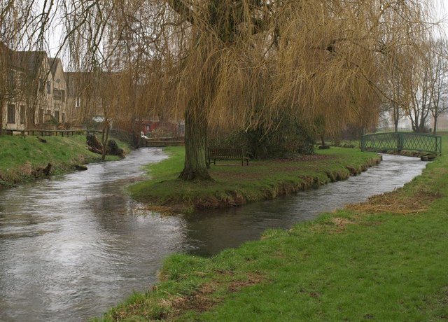 River Churn in Cirencester | |
| Location | |
| Country | England |
| Counties | Gloucestershire, Wiltshire |
| Towns | Cirencester, Cricklade |
| Physical characteristics | |
| Source | |
| • location | Seven Springs |
| • coordinates | 51.8511°N 2.0504°W |
| • elevation | 200 m (660 ft) |
| Mouth | River Thames |
• location | Cricklade, Wiltshire |
• coordinates | 51.6450°N 1.8533°W |
• elevation | 79 m (259 ft) |
| Length | 37.3 km (23.2 mi) |
| Discharge | |
| • location | Cerney Wick, South Cerney |
| • average | 0.86 m3/s (30 cu ft/s) |
| • minimum | 0.00 m3/s (0 cu ft/s)5 November 1995 |
| • maximum | 4.70 m3/s (166 cu ft/s)31 January 1971 |
| Discharge | |
| • location | Cirencester |
| • average | 0.77 m3/s (27 cu ft/s) |
| Discharge | |
| • location | Perrott's Brook |
| • average | 0.62 m3/s (22 cu ft/s) |
| Basin features | |
| River system | River Thames |
| Tributaries | |
| • left | Hilcot Brook, Gumstool Brook |
| • right | Elkstone Brook, Daglingworth Stream |
Description
The River Churn is the first tributary river of the River Thames. It rises in the Cotswolds at Seven Springs, south of Cheltenham, Gloucestershire, England and flows south across the Cotswold dip slope, passing through North Cerney and Cirencester, and joining the Thames in the parish of Cricklade in Wiltshire. Its length from source to confluence with the Thames is considerably greater than that of the Thames from Thames Head, and its flow is also more consistent than the winterbourne Thames, but the Churn is regarded as a tributary historically and therefore by most geography guides.
The length of the Churn is approximately 37.3 kilometres (23.2 mi).[1][2] It is classed as a main river and thus falls under the jurisdiction of the Environment Agency as opposed to the local authority.[3]
The main tributaries are the Elkstone Brook, which joins at Perrots Brook Farm, and the Daglingworth Stream, also known as the Dunt Stream or Duntisbourne, which joins at Barton Mill, Cirencester. Two smaller tributaries are the Hilcot Brook and the Gumstool Brook.
Etymology
The name Churn is ancient, certainly pre-Roman and probably from a Celtic language, possibly that spoken by the Dobunni tribe who controlled the area before the Roman conquest in the 1st century. The original name may have sounded similar to Korinn. It has also been suggested that the origin of the word is associated with the ancient British Cornovii tribe.[4] Cognate names and name elements from the area are Cerney, Ciren and Corin as found in the settlement names of North Cerney, Cirencester, South Cerney, and Cerney Wick (all on or close to the river). Cirencester's original recorded name of Corinium Dobunnorum also shares this root.
History
Much of the catchment basin of the Churn was a key Roman settlement in the second to fourth centuries AD, as Corinium Dobunnorum rose to likely status of capital of a division of Britain.[5]
The Churn and the Thames feed the waters of a western bisection of the Cotswold Water Park, converted since the 1970s from redundant gravel beds between Cirencester and Cricklade.
In 2006, the national government was engaged in a planning study to analyse methods of mitigating future flooding associated with the Churn.[6] However, the river is known to stop flowing completely at times; in September 2011 the river bed was completely dry at Latton.
Water quality
The Environment Agency measures the water quality of the river systems in England. Each is given an overall ecological status, which may be one of five levels: high, good, moderate, poor and bad. There are several components that are used to determine this, including biological status, which looks at the quantity and varieties of invertebrates, angiosperms and fish. Chemical status, which compares the concentrations of various chemicals against known safe concentrations, is rated good or fail.[7]
Water quality of the River Churn in 2019:
| Section | Ecological Status | Chemical Status | Overall Status | Length | Catchment | Channel |
|---|---|---|---|---|---|---|
| Churn (source to Perrots Brook)[8] | Moderate | Fail | Moderate | 16.936 km (10.524 mi) | 58.642 km2 (22.642 sq mi) | |
| Churn (Baunton to Cricklade)[9] | Moderate | Fail | Moderate | 20.414 km (12.685 mi) | 30.654 km2 (11.836 sq mi) | |
| Elkstone Brook[10] | Good | Fail | Moderate | 4.643 km (2.885 mi) | 19.793 km2 (7.642 sq mi) | |
| Daglingworth Stream (Source to Churn)[11] | Moderate | Fail | Moderate | 11.055 km (6.869 mi) | 22.369 km2 (8.637 sq mi) |
See also
- Tributaries of the River Thames
- List of rivers of England
References
- "Churn (source to Perrots Brook)". Catchment Data Explorer. Environment Agency. Retrieved 12 September 2020.
- "Churn (Baunton to Cricklade)". Catchment Data Explorer. Retrieved 12 September 2020.
- "River Churn Crossing and Data". Archived from the original on 5 April 2007. Retrieved 9 September 2019.
{{cite web}}: CS1 maint: unfit URL (link) - "Cirencester History Summary". Cirencester.co.uk. Retrieved 9 September 2019.
- Wacher, John (1995). The Towns of Roman Britain. London: B T Batsford.
- "United Kingdom Environment Agency River Churn Catchment, Autumn, 2006". Archived from the original on 11 January 2007. Retrieved 15 January 2007.
- "Glossary (see Biological quality element; Chemical status; and Ecological status)". Catchment Data Explorer. Environment Agency. 17 February 2016.
 Text was copied from this source, which is available under an Open Government Licence v3.0. © Crown copyright.
 - "Churn (source to Perrots Brook)". Catchment Data Explorer. Environment Agency.
- "Churn (Baunton to Cricklade)". Catchment Data Explorer. Environment Agency.
- "Elkstone Brook". Catchment Data Explorer. Environment Agency.
- "Daglingworth Stream (Source to Churn)". Catchment Data Explorer. Environment Agency.
External links
![]() Media related to River Churn at Wikimedia Commons
Media related to River Churn at Wikimedia Commons
| Road |
| ||||||||||||||
|---|---|---|---|---|---|---|---|---|---|---|---|---|---|---|---|
| Airports and Heliports |
| ||||||||||||||
| Rail |
| ||||||||||||||
| Buses |
| ||||||||||||||
| Waterways | |||||||||||||||
| Footpaths |
| ||||||||||||||
| Cycle paths |
| ||||||||||||||
На других языках
[de] River Churn
Der River Churn gilt als der am weitesten flussaufwärts gelegene Zufluss der Themse. Er entsteht in den Cotswolds bei Seven Springs nahe Cheltenham, in Gloucestershire, England. Er fließt in südlicher Richtung über den Streichen der Cotswolds, verläuft durch Cirencester und mündet in der Civil parish von Cricklade in Wiltshire in die Themse. Seine Länge von der Quelle bis zur Mündung ist größer als die der Themse von ihrer Quelle. Der Wasserfluss ist auch sehr viel beständiger als der der Themse, die zum Austrocknen neigt. Der River Churn wird jedoch historisch als ein Nebenfluss angesehen und dementsprechend in den Büchern geführt. Der Churn ist ungefähr 25 km lang.[1]- [en] River Churn
Другой контент может иметь иную лицензию. Перед использованием материалов сайта WikiSort.org внимательно изучите правила лицензирования конкретных элементов наполнения сайта.
WikiSort.org - проект по пересортировке и дополнению контента Википедии