geo.wikisort.org - River
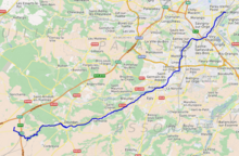
The Orge (French pronunciation: [ɔʁʒ] (![]() listen)) is a 54.1-kilometre (33.6 mi) long river in France, left tributary of the Seine.[1] Its source is in the village Saint-Martin-de-Bréthencourt. Its course crosses the départements of Yvelines and Essonne. It flows northwest through the towns of Dourdan, Saint-Chéron, Breuillet, Arpajon, and Savigny-sur-Orge, finally flowing into the Seine in Athis-Mons, south of Paris. The towns located on the banks of the river usually have s/ Orge added to their name (i.e. Épinay-sur-Orge, Longpont-sur-Orge, Villiers-sur-Orge). The Yvette is a tributary of the Orge.
listen)) is a 54.1-kilometre (33.6 mi) long river in France, left tributary of the Seine.[1] Its source is in the village Saint-Martin-de-Bréthencourt. Its course crosses the départements of Yvelines and Essonne. It flows northwest through the towns of Dourdan, Saint-Chéron, Breuillet, Arpajon, and Savigny-sur-Orge, finally flowing into the Seine in Athis-Mons, south of Paris. The towns located on the banks of the river usually have s/ Orge added to their name (i.e. Épinay-sur-Orge, Longpont-sur-Orge, Villiers-sur-Orge). The Yvette is a tributary of the Orge.
| Orge | |
|---|---|
 | |
 | |
| Location | |
| Country | France |
| Physical characteristics | |
| Mouth | |
• location | Seine |
• coordinates | 48°42′38″N 2°24′14″E |
| Length | 54 km (34 mi) |
| Basin features | |
| Progression | Seine→ English Channel |
Promenade de l'Orge
Many of the local councils maintain parks on the banks of the river. A syndicat has been formed to link the parks of 32 communes.[2] The result is a footpath that ends in Athis-Mons, where the Orge flows into the Seine. Bicycles are allowed on the footpath although pedestrians have right of way. Motorised vehicles are not allowed.
Gallery
 Viaduct over the Orge
 Signpost for the Promenade de l'Orge
 Confluence of the Orge and Seine in Athis-Mons


References
Authority control | |
|---|---|
| General |
|
| National libraries | |
This Île-de-France geographical article is a stub. You can help Wikipedia by expanding it. |
На других языках
[de] Orge (Seine)
Die Orge ist ein Fluss in Frankreich, der in der Region Île-de-France verläuft. Sie entspringt im Gemeindegebiet von Saint-Martin-de-Bréthencourt. Die Orge entwässert generell in nordöstlicher Richtung und mündet nach rund 54[2] Kilometern bei Athis-Mons, südöstlich des Flughafens Paris-Orly, als linker Nebenfluss in die Seine. Ein zweiter Mündungsarm erreicht die Seine rund vier Kilometer stromaufwärts, bei Viry-Châtillon. Auf seinem Weg durchquert der Fluss die Départements Yvelines und Essonne. Sein Unterlauf führt im Großraum von Paris durch ein dicht besiedeltes Gebiet mit etwa 370.000 Einwohnern.- [en] Orge
[it] Orge (fiume)
L'Orge /ɔʁʒ/ è un fiume dell'Île-de-France, affluente alla sinistra orografica della Senna. Lungo i 50,1 chilometri del suo corso, si snoda tra i dipartimenti delle Yvelines e dell'Essonne.[ru] Орж (река)
Орж[1] (фр. L’Orge) — река во Франции, её длина 54,1 км. Является левым притоком Сены, пересекает департаменты Ивелин и Эсон. Высота устья — 30 м над уровнем моря.[источник не указан 576 дней] Высота истока — 134 м над уровнем моря.[источник не указан 576 дней] Площадь водосборного бассейна — 951,9 км².[источник не указан 576 дней]Другой контент может иметь иную лицензию. Перед использованием материалов сайта WikiSort.org внимательно изучите правила лицензирования конкретных элементов наполнения сайта.
WikiSort.org - проект по пересортировке и дополнению контента Википедии