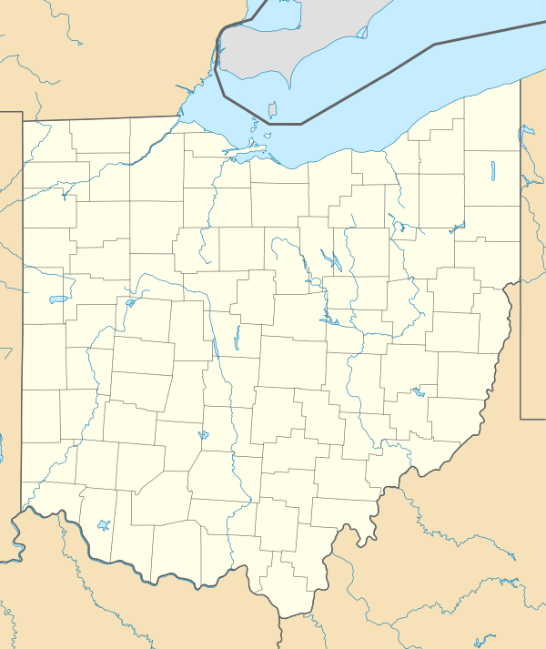
geo.wikisort.org - River
The Ohio and Erie Canal was a canal constructed during the 1820s and early 1830s in Ohio. It connected Akron with the Cuyahoga River near its outlet on Lake Erie in Cleveland, and a few years later, with the Ohio River near Portsmouth. It also had connections to other canal systems in Pennsylvania.
| Ohio and Erie Canal | |
|---|---|
 Part of the Ohio and Erie canal, 1902 | |
 | |
| Location | Independence and Valley View, Cuyahoga County, Ohio |
| Specifications | |
| Length | 308 miles (496 km) |
| Locks | 152 (originally 146) |
| Original number of locks | 146 |
| Status | closed |
| Geography | |
| Start point | Cleveland, Ohio on the lake Erie |
| End point | Portsmouth, Ohio |
Ohio and Erie Canal Historic District | |
U.S. National Register of Historic Places | |
U.S. National Historic Landmark District | |
| Location | Independence and Valley View, Cuyahoga County, Ohio |
| Area | 24.5 acres (99,000 m2)[1] |
| Built | 1825 |
| NRHP reference No. | 66000607 |
| Significant dates | |
| Added to NRHP | November 13, 1966[2] |
| Designated NHLD | November 13, 1966[3] |

The canal carried freight traffic from 1827 to 1861, when the construction of railroads ended demand. From 1862 to 1913, the canal served as a water source for industries and towns. During 1913, much of the canal system was abandoned after important parts were flooded severely.
Most of the surviving portions in the Akron-Cleveland area are managed by the National Park Service or Ohio Department of Natural Resources. They are used for various recreational purposes by the public, and still provide water for some industries. Parts of the canal are preserved, including the Ohio and Erie Canal Historic District, a National Historic Landmark. Portions further south are less well preserved, and a discontiguous set of locks and other canal resources roughly between Columbus and the Ohio River are listed on the National Register as the Ohio and Erie Canal Southern Descent Historic District.
History
Ohio, which achieved statehood during 1803, remained a sparsely populated region of 50,000 people who were scattered throughout the state and who had no means of transporting goods economically out of the state. Without easy access to distant markets, agriculture served only local needs and large-scale manufacturing was nearly non-existent.[4]
Agitation for a canal system (1787–1822)
As early as 1787, George Washington and Thomas Jefferson had discussed the desirability of a canal linking Lake Erie to the Ohio River as part of a national system of canals.[5] It wasn't until 1807 that Ohio's first Senator, Thomas Worthington offered a resolution in Congress asking Treasury Secretary Albert Gallatin to report to the Senate. In 1810, DeWitt Clinton was appointed to manage the Erie Canal Commission. He was unsuccessful in his attempt to get national aid for the construction of a canal connecting Lake Erie to the Hudson River, so he enlisted the aid of state legislators and Ohio's congressional delegation. On January 15, 1812, the Ohio General Assembly passed a resolution expressing its opinion that the connection of the Great Lakes with the Hudson River was a project of "national concern". President Madison was against the proposal, however, and the War of 1812 ended official discussion.
On December 11, 1816, Clinton, by then the Governor of New York, sent a letter to the Ohio Legislature indicating his state's willingness to construct the Erie Canal without national help, and asking the State of Ohio to join the endeavor. On January 9, 1817, the Ohio Legislature directed Ohio's Governor (and former Senator) Thomas Worthington to negotiate a deal with Clinton. Due to the cost, however, the Ohio Legislature dallied, and nothing happened for three years. Finally, in January 1822, the Ohio Legislature passed acts to fund the canal system (and the state's public education obligations).
Survey and design (1822)
On January 31, 1822, the Ohio Legislature passed a resolution to employ an engineer and appoint commissioners to survey and design the canal system as soon as possible. A sum not to exceed $6,000 was reserved for this purpose.
James Geddes, an engineer who had worked on the New York canals, was hired. Since most of Ohio's population lived along a line from Cleveland to Cincinnati, the main trunk of the canal needed to serve these areas. But no single river followed this line — canals are more cheaply and easily built along river valleys — making it difficult to design a suitable system. Specifically, the bridging of the Scioto and Miami river valleys required raising the canal to such an elevation that water from neither river could be used as a source. As a result, the canal was divided into two sections: the Ohio and Erie Canal, which connected Cleveland to Portsmouth via the Licking Divide and the Scioto River Valley, and the Miami and Erie Canal, which connected Cincinnati to Dayton. This second canal would ultimately be extended to the Maumee River at Toledo.
Copies of the original survey plat maps for the construction of both Ohio canals are available on-line[6] from the Ohio Department of Natural Resources.
Construction (1825–1832)
On February 4, 1825, the Ohio Legislature passed "An Act to provide for the Internal Improvement of the State of Ohio by Navigable Canals". The Canal Commission was authorized to borrow $400,000 during 1825, and not more than $600,000 per year thereafter. The notes issued were to be redeemable between 1850 and 1875.
On July 4, 1825, ground was broken for the canal at Licking Summit near Newark, Ohio.
The canals were specified to have a minimum width of 40 feet (12 m) at the top, 26 feet (8 m) at the bottom, and a depth of 4 feet (1.2 m) feet minimum. These limits were often exceeded, and indeed it was cheaper to do so in most cases. For example, it might be cheaper to build one embankment and then let the water fill all the way to a hillside parallel, perhaps hundreds of feet away, rather than build two embankments. By damming the rivers, long stretches of slackwater could be created which, with the addition of towpaths, could serve as portions of the canal. Where it made economic sense to do so, such as lock widths or portions of the canal through narrow rock or across aqueducts, the minimum widths were adhered to.[citation needed]
Contracts were let for the following tasks: Grubbing and clearing, Mucking and ditching, Embankment and excavation, Locks and culverts, Puddling, and Protection.
Initially, contractors in general proved to be inexperienced and unreliable. It was common for one job to receive 50 bids, many of them local to where the work was being performed. The chosen contractor, having underbid the contract, often would abscond leaving his labor force unpaid and his contract unfulfilled. This problem was so bad that many laborers refused to perform canal work for fear of not being paid. As the bidding process was improved, and more reliable contractors engaged, the situation improved.[citation needed]
Workers were initially paid $0.30 per day and offered a jigger of whiskey. As work progressed, and where labor was in shortage, workers could make as much as $15 per month. At that time, cash money was scarce in Ohio forcing much bartering. Working on the canal was appealing and attracted many farmers from their land.[citation needed]
On July 3, 1827 the first canal boat on the Ohio and Erie Canal left Akron, traveled through 41 locks and over 3 aqueducts along 37 miles (60 km) of canal, to arrive at Cleveland on July 4. While the average speed of 3 mph (4.8 km/h) may seem slow, canal boats could carry 10 tons of goods and were much more efficient than wagons over rutted trails.

During the next five years, more and more portions of the canal opened, with it finally being completed during 1832:
- 1828 opens from Akron to Massillon, Ohio. The canal is 65 miles (105 km) long.
- 1829 opens from Massillon to Dover, Ohio. The canal is 93 miles (150 km) long.
- 1830 opens from Dover to Newark, Ohio. The canal is 177 miles (285 km) long.
- 1831 opens from Newark to Chillicothe, Ohio. The canal is 258 miles (415 km) long.
During 1832, the Ohio and Erie Canal was completed. The entire canal system was 308 miles (496 km) long with 146 lift locks and a rise of 1,206 feet (368 m). In addition, there were five feeder canals that added 24.8 miles (39.9 km) and 6 additional locks to the system consisting of:
- Tuscarawas Feeder (3.2 miles)
- Walhonding Feeder (1.3 miles)
- Granville Feeder (6.1 miles)
- Muskinghum Side Cut (2.6 miles)
- Columbus Feeder (11.6 miles)
The canal's lock numbering system was oriented from the Lower Basin, near the southwest corner of the current Exchange and Main streets in Akron. North of the basin is Lock 1 North, and south of the basin is Lock 1 South. At this basin was the joining of the Pennsylvania and Ohio Canal.[7][8]
Operation (1833–1913)
The canals enjoyed a period of prosperity from the 1830s to the early 1860s, with maximum revenue between 1852 and 1855. During the 1840s, Ohio was the third most prosperous state, owing much of that growth to the canal.[9] Immediately after the Civil War, it became apparent that railroads would take the canal's business. From 1861 until 1879, after the canal had been badly flooded,[9] Ohio leased its canals to private owners who earned revenue from dwindling boat operation and the sale of water to factories and towns. When the state resumed ownership of the canals during 1879, it discovered that they had not been maintained well, and that state lands surrounding the canals had been sold illegally to private owners. In many cases, canals were filled in for "health reasons", with a newly laid railroad track on their right of way. Much state land was given away for free to politically savvy private owners. Nevertheless, some revenue was accrued into the early twentieth century from the sale of water rights as well as recovery and sale of land surrounding the canals.
Abandonment
After the maximum of the 1850s and a cessation of revenue due to the Civil War during the early 1860s the canal's expenditures started to outgrow its revenues due to increasing maintenance costs. By 1911, most of the southern portion of the canal had been abandoned.[9] The Great Dayton Flood of 1913 dumped an abnormally heavy amount of rain on the state, causing extensive flooding. This caused the reservoirs to spill over into the canals, destroying aqueducts, washing out banks, and devastating most of the locks. In Akron, Lock 1 was dynamited to allow backed up floodwater to flow.[10]
Notable persons associated with the canal
As a teenager during 1847, James Garfield worked as a "hoggee", driving mules to pull barges along the canal.[11] After repeatedly falling into the canal on the job Garfield became ill and decided to go to college instead.[12]
The canal presently

The Ohio and Erie Canal Historic District, a 24.5-acre (99,000 m2) historic district including part of the canal, was declared a National Historic Landmark during 1966.[1][3] It is a four-mile (6 km) section within the village of Valley View comprising three locks, the Tinkers Creek Aqueduct, and two other structures.[1]
A remaining watered section of the Ohio & Erie Canal is located in Summit County, Ohio. The Ohio & Erie Canal is maintained, to this day, as a water supply for local industries. After the flood, a few sections of the canal continued in use hauling cargo to local industries. Another watered section extends from the Station Road Bridge in Brecksville northwards into Valley View and Independence, all Cleveland suburbs.
The section of the Ohio & Erie Canal from the Brecksville Dam to Rockside Road in Cuyahoga County was transferred to the National Park Service during 1989 as part of the Cuyahoga Valley National Recreational Area (now known as the Cuyahoga Valley National Park).
A lease on the canal lands from the Cuyahoga Valley National Park to the terminus of the canal has been executed with the Cleveland Metroparks. The Metroparks manage the adjacent real estate and the surrounding Ohio & Erie Canal Reservation.
The section of the Ohio & Erie Canal still owned and maintained by the Division of Parks in southern Summit is referred to as the watered section. This section runs from downtown Akron, through Summit Lake south to Barberton, a distance of about 12 miles (19 km). Included in this section is the feeder canal from the Tuscarawas River and the hydraulics (flood control) at the Portage Lakes.
The Ohio & Erie Canal and its feeder reservoirs are maintained from Akron by a staff of three O.D.N.R. Ohio State Parks, Canal Hydraulic Operators. Like its sister canal, the Ohio & Erie Canal carries a large amount of stormwater. The canals were not designed to accommodate this great influx of stormwater. Most of the siltation and erosion problems experienced presently are the result of stormwater inappropriately piped into the canals over the years.
During late 1996, the canal from Zoar to Cleveland was designated a National Heritage Corridor. This designation was brought about through the efforts of many communities, civic organizations, businesses and individuals working in partnership.
A map showing the disposition of the canal lands[13] is available on-line from the Ohio Department of Natural Resources.
Points of interest
- Alexander's (a.k.a. Wilson's) Mill
- Richard Howe House (future site)
- Boston Store
- Canal Visitor Center
- Frazee House
- St. Helena III Historic Boat Ride in Canal Fulton
- Mustill Store
- Peninsula Depot
- Station Road Bridge
- Lock 15 Brewing Co.
- Tinkers Creek Aqueduct
- Fort Laurens - Ohio's only American Revolutionary War fort
- Restored canal town Historic Roscoe Village Roscoe Village (Coshocton, Ohio)
- Monticello III Canal Ride on Mudport Basin Roscoe Village (Coshocton, Ohio)
- Restored Walhonding Aqueduct Bridge Roscoe Village (Coshocton, Ohio)
Connecting canals
The Ohio and Erie Canal initially provided a connection between Akron and Lake Erie at Cleveland, then extending all the way to the Ohio River within a few years. Later, connecting canal systems were built connecting it with the Pennsylvania and Ohio Canal and other parts of Eastern Ohio.[14]
| Coordinates |
Elevation |
Name |
Description |
|---|---|---|---|
| Columbus Feeder | Lockbourne, Columbus, Franklin County | ||
| Granville Feeder | Granville, Licking County | ||
| Hocking Valley | Carroll, Lancaster, Fairfield County; Logan, Hocking County; Nelsonville, Athens, Athens County | ||
| Muskingum Side Cut | Dresden, Zanesville, Muskingum County; McConnelsville, Morgan County; Marietta, Washington County | ||
| Pennsylvania and Ohio Canal | Akron, Summit County; Kent, Ravenna, Portage County; Warren, Trumbull County; Youngstown, Mahoning County; Ohio;; Lawrence; Beaver, Beaver County; Allegheny, Pennsylvania[15] | ||
| 40°44′27″N 80°53′37″W[16][17] | 1,112 feet (339 m)[16][17] | Sandy and Beaver Canal a.k.a. Tuscarawas Feeder |
Bolivar, Tuscarawas County; Hanoverton, Lisbon, East Liverpool, Columbiana County; Glasgow, Beaver County, Pennsylvania |
| 40°19′19″N 81°56′49″W[18] | 774 feet (236 m)[18] | Walhonding Canal | Roscoe Village, Coshocton County; Brinkhaven, Knox County |
Towpath Trail landmarks
An all-purpose bicycle/pedestrian trail was constructed by Cuyahoga Valley National Park in Southern Cuyahoga County and Northern Summit County, Cleveland Metroparks in Northern Cuyahoga County, and Akron/Summit County Metroparks in Southern Summit County to roughly follow the original Ohio and Erie Canal Towpath route.[19] (The northernmost section in Cuyahoga County is still undergoing construction.) There are many connecting trails going to other points of interest throughout their park systems.
 Restored canal Twelve Mile Lock 38, Cuyahoga Valley National Park
 Deep Lock 28 as it existed in 1985


| Mile Post [B] |
ID # |
Coordinates |
Elevation |
Name |
Type |
Municipality |
County |
Description |
|---|---|---|---|---|---|---|---|---|
| 0 | 44 North | 41°29′39.76″N 81°42′10.4″W[20] | 0 feet (0 m) | Cuyahoga River Sloop | Lock | Cleveland | Cuyahoga | Merwin Street between James street and West street |
| 43 North | 0 feet (0 m) | Lock | Cleveland | Cuyahoga | Sherwin Williams, James and West, Merrwin and Vineyard | |||
| 0 feet (0 m) | Weigh | Lock | Cleveland | Cuyahoga | Seneca a.k.a. West 3rd. street | |||
| 3 | 42 North | 0 feet (0 m) | Lock | Cleveland | Cuyahoga | relocated to 42A, | ||
| 3 | 42A North | 0 feet (0 m) | Weigh and Guard | Lock | Cleveland | Cuyahoga | near Grasselli chemical company, Dille street and Independence road | |
| 5 | 41 North | 41°26′49.38″N 81°40′56.88″W[21] | 0 feet (0 m) | RathBuns | Lock | Cuyahoga | near Austin Powder Works, Harvard Road, near Jennings Road | |
| 8 | 40 North | 41°25′8.82″N 81°38′38.58″W[22] | 0 feet (0 m) | Willow | Lock | Cuyahoga Heights | Cuyahoga | off Canal Road, near I-77 |
| 41°25′2.53″N 81°38′18.88″W[23] | 0 feet (0 m) | Mill Creek | Aqueduct | Cuyahoga Heights | Cuyahoga | carries canal over Mill Creek (Cuyahoga River) off Canal Road | ||
| 41°24′57″N 81°38′2″W[24] | 0 feet (0 m) | GNIS | GNIS 17 Cleveland South topographic map | |||||
| Bridge | Cuyahoga | Rockside Road | ||||||
| TrailHead | Cuyahoga | CVSR | ||||||
| 11 | MilePost Marker | Cuyahoga | ||||||
| 11 | 39 North | 41°23′24.22″N 81°37′28.95″W[25] | 590 feet (180 m)[26] | Lock | Independence | Cuyahoga | ||
| 41°23′4″N 81°37′7″W[24] | 0 feet (0 m) | GNIS | GNIS 16 Shaker Heights topographic map | |||||
| 12 | MilePost Marker | Cuyahoga | ||||||
| Bridge | Cuyahoga | Hillside Road | ||||||
| TrailHead | Cuyahoga | CVSR-Canal Visitor Center, 7104 Canal Road and Hillside Road | ||||||
| 12 | 38 North | 41°22′20.78″N 81°36′46.23″W[27] | 600 feet (180 m)[28] | Lock | Valley View | Cuyahoga | Canal Visitor Center | |
| Cuyahoga County | Tinkers Creek Road | |||||||
| 13 | MilePost Marker | Cuyahoga | ||||||
| 41°21′53″N 81°36′32″W[29] | 610 feet (190 m)[29] | Tinkers Creek | Aqueduct | Cuyahoga | carries canal over Tinkers Creek (Cuyahoga River)[A] | |||
| Bridge | Cuyahoga | Alexander Road-Pleasant Valley Road | ||||||
| 14 | 37 North | 41°21′24.06″N 81°35′49.02″W[30] | 620 feet (190 m)[31] | Lock | Cuyahoga | Alexander's Mill | ||
| Mill | Cuyahoga | Alexanders (a.k.a. Wilsons) | ||||||
| 14 | MilePost Marker | Cuyahoga | ||||||
| Trailhead | Cuyahoga | Sagamore Road | ||||||
| 15 | MilePost Marker | Cuyahoga | ||||||
| 16 | MilePost Marker | Cuyahoga | ||||||
| 41°21′20″N 81°35′46″W[24] | 0 feet (0 m) | GNIS | GNIS 15 Northfield topographic map | |||||
| 17 | 36 North | 41°19′23.06″N 81°35′11.9″W[32] | 0 feet (0 m)[33] | Pinery Dam and Feeder | Lock | Summit | ||
| Bridge | Summit | SR-82 | ||||||
| 17 | MilePost Marker | Summit | ||||||
| TrailHead | Summit | Station Road bridge to CVSR-Brecksville | ||||||
| 19 | 35 North | 41°18′45.43″N 81°34′59.89″W[34] | 0 feet (0 m)[35] | Kettlewell Whiskey | Lock | Summit | ||
| 18 | MilePost Marker | Summit | ||||||
| Trail | Summit | Old Carriage | ||||||
| Trail | Summit | Old Carriage Connector | ||||||
| 19 | MilePost Marker | Summit | ||||||
| 20 | 34 North | 41°17′21.08″N 81°33′51.99″W[36] | 0 feet (0 m)[37] | Red | Lock | Summit | Jaite in southwestern Northfield Township[38] | |
| TrailHead | Red Lock | |||||||
| Bridge | Summit | Highland Road | ||||||
| 20 | MilePost Marker | Summit | ||||||
| 20.5 | 33 North | 41°16′33.52″N 81°33′38.14″W[39] | 0 feet (0 m)[40] | Wallace | Lock | Summit | in Boston Township[41] | |
| 21 | MilePost Marker | Summit | ||||||
| 21 | 32 North | 41°15′56″N 81°33′31″W[42] | 659 feet (201 m)[42] | Boston | Lock | Summit | Boston Township | |
| Summit | Boston Mills Road | |||||||
| TrailHead | Summit | CVSR-Boston Store | ||||||
| Bridge | Summit | I-271 Southbound | ||||||
| Bridge | Summit | I-271 Northbound | ||||||
| Bridge | Summit | I-80 Westbound | ||||||
| Bridge | Summit | I-80 Eastbound | ||||||
| 22 | MilePost Marker | Summit | ||||||
| Summit | Stumpy Basin | |||||||
| 22 | 31 North | 41°15′5.93″N 81°32′45.36″W[43] | 670 feet (200 m)[44] | Lonesome | Lock | Summit | was in Boston Township[45] | |
| 23 | MilePost Marker | Summit | ||||||
| 23 | 30 North | 41°14′44.04″N 81°33′14.87″W[46] | 680 feet (210 m)[47] | Peninsula Feeder | Lock | Peninsula | Summit | |
| Peninsula | TrailHead | Peninsula | Summit | CVSR | ||||
| 23 | 29 North | 41°14′33.54″N 81°33′1.29″W[48] | 690 feet (210 m)[49] | Peninsula | Lock | Peninsula | Summit | |
| 41°14′33.01″N 81°33′0.86″W[50] | 700 feet (210 m)[51] | Peninsula | Aqueduct | Peninsula | Summit | carried canal over Cuyahoga River | ||
| Bridge | Summit | SR-303 | ||||||
| 24 | MilePost Marker | Summit | ||||||
| 25 | 28 North | 41°13′57.38″N 81°33′6.77″W[52] | 700 feet (210 m)[52][53] | Deep | Lock | Peninsula | Summit | at 17 feet (5.2 m) the deepest lock along the canal |
| TrailHead | Summit | Deep Lock Quarry | ||||||
| 25 | MilePost Marker | Summit | ||||||
| 26 | MilePost Marker | Summit | ||||||
| 27 | 27 North | 41°12′16.25″N 81°34′15.43″W[54] | 710 feet (220 m)[55] | Johnny Cake | Lock | Summit | ||
| 41°12′7″N 81°34′21″W[56] | 718 feet (219 m)[56] | Furnace Run | Aqueduct | Summit | carried canal over Furnace Run (Cuyahoga River) | |||
| 27 | MilePost Marker | Summit | ||||||
| Bridge | Summit | Bolanz Road | ||||||
| 28 | MilePost Marker | Summit | ||||||
| Summit | Beaver Marsh | |||||||
| 28 | 26 North | 41°11′7.74″N 81°34′52.05″W[57][58] | 718 feet (219 m)[57] | Pancake | Lock | Summit | ||
| Ira | TrailHead | Summit | CVSR | |||||
| 29 | MilePost Marker | Summit | ||||||
| 28 | 25 North | 41°10′32.27″N 81°34′46.82″W[59] | 0 feet (0 m)[60] | Mudcatcher | Lock | Summit | ||
| 30 | 24 North | 41°10′20.5″N 81°34′40.93″W[61] | 0 feet (0 m)[62] | Niles | Lock | Summit | ||
| Bridge | Summit | Yellow Creek (Cuyahoga River) | ||||||
| 30 | MilePost Marker | Summit | ||||||
| Bridge | Summit | Bath Road | ||||||
| Indian Mound | TrailHead | Summit | CVSR | |||||
| 41°3′57″N 81°32′12″W[24] | 0 feet (0 m) | GNIS | GNIS 14 Akron West topographic map | |||||
| 32 | 23 North | 0 feet (0 m) | Booth port | Lock | Summit | sewer pipe | ||
| 32 | 22 North | Booth port | Lock | Summit | Merriman sewer pipe | |||
| 33 | 21 North | Lock | Summit | sewer over-flow | ||||
| 20 North | Lock | Summit | train abutments | |||||
| 19 North | Black Dog Crossing | Lock | Summit | near Hickory and Memorial | ||||
| 35 | 18 North | Lock | Summit | |||||
| 36 | 17 North | Lock | Summit | |||||
| 36 | 16 North | Lock | Summit | |||||
| 36 | 15 North | Akron Mustill Store | Lock | Akron | Summit | |||
| 36 | 14 North | Lock | Akron | Summit | North Street | |||
| 36 | 13 North | Lock | Akron | Summit | ||||
| 36 | 12 North | Lock | Akron | Summit | ||||
| 36 | 11 North | Lock | Akron | Summit | ||||
| 36 | 10 North | Lock | Akron | Summit | ||||
| 9 North | Lock | Akron | Summit | north of Market street | ||||
| 8 North | Lock | Akron | Summit | tunnel | ||||
| 37 | 7 North | Lock | Akron | Summit | middle tunnel | |||
| 37 | 6 North | Lock | Akron | Summit | tunnel below parking deck North of Mill street | |||
| 37 | 5 North | Lock | Akron | Summit | tunnel | |||
| 37 | 4 North | Lock | Akron | Summit | tunnel | |||
| 37 | 3 North | Lock | Akron | Summit | South Main street | |||
| 38 | 2 North | Lock | Akron | Summit | Water street | |||
| 38 | 1 North | Lock | Akron | Summit | West Exchange street | |||
| 0 | Portage landing | Lock | Akron | Summit | Portage lakes, Manchester Road | |||
| 1 South | Wolf creek | Lock | Barberton | Summit | Snyder avenue | |||
| Wolf creek | Aqueduct | Barberton | Summit | Snyder avenue | ||||
| 40°54′37″N 81°37′51″W[24] | 0 feet (0 m) | GNIS | GNIS 13 Doylestown topographic map | |||||
| 2 South | Lock | New Franklin | Stark | Center Road | ||||
| 3 South | Lock | New Franklin | Stark | Center Road | ||||
| 40°53′2″N 81°35′37″W[24] | 0 feet (0 m) | GNIS | GNIS 12 Canal Fulton topographic map | |||||
| 4 South | Lock | Canal Fulton | Stark | |||||
| 40°47′43″N 81°31′22″W[24] | 0 feet (0 m) | GNIS | GNIS 11 Massillon topographic map | |||||
| Trailhead | Massillon | Stark | ||||||
| 40°39′32″N 81°27′22″W[24] | 0 feet (0 m) | GNIS | GNIS 10 Bolivar topographic map | |||||
| 39°58′17″N 82°29′15″W[24] | 0 feet (0 m) | GNIS | GNIS 9 Thornville topographic map | |||||
| 39°53′22″N 82°32′21″W[24] | 0 feet (0 m) | GNIS | GNIS 8 Millersport topographic map | |||||
| 5 South | Lock | |||||||
| 5A South | Lock | |||||||
| Lock | ||||||||
| Lock | ||||||||
| 31 South | Lock | |||||||
| 32 South | Lock | |||||||
| 33 South | Lock | |||||||
| North 20 | Lock | |||||||
| North 19 | Lock | |||||||
| North 18 | Lock | |||||||
| Lock | ||||||||
| Lock | ||||||||
| North 1 | Lock | |||||||
| North 0 | Minthorn | Lock | Newark | Licking | ||||
| South 0 | Pugh | Lock | ||||||
| South 1 | 195 | King Watson | Lock | Canal Road | ||||
| 39°51′41″N 82°33′38″W[24] | 0 feet (0 m) | GNIS | GNIS 7 Baltimore topographic map | |||||
| 196 | South 2 | David Miller's White Mill | Lock | Baltimore | Fairfield | |||
| 197.4 | South 3 | Norris Mill | Lock | Baltimore | Fairfield | |||
| South 4 | Short Level | Lock | Baltimore | Fairfield | ||||
| 198 | South 5 | Dry Dock | Lock | Baltimore | Fairfield | |||
| 198.3 | South 6 | Mulnix Mill | Lock | Baltimore | Fairfield | |||
| 198.8 | South 7 | Wells Mill | Lock | Basil, Ohio | ||||
| 200 | South 8 | 39° 50' 11.5254"
-82° 37' 26.3994" |
Bibler | Lock | Baltimore | Fairfield | Previous town Basil, Ohio
Behind the water treatment plant. | |
| 208 | South 9 | Lock | Carroll | Fairfield | ||||
| South 10 | Lock | Carroll, Ohio | Fairfield | |||||
| 206 | South 11 | Lock | Violet Township | Fairfield County, Ohio | Upper Lockville | |||
| South 12 | Tennis/Tennat | Lock | Lockville | |||||
| South 13 | Rowe | Lock | Lockville | |||||
| South 14 | Smallwood | Lock | ||||||
| South 15 | Fickle Mill Short Level | Lock | Lockville | |||||
| South 16 | Rover Short Level | Lock | Lockville | |||||
| South 17 | Swimmer's | Lock | Lockville | |||||
| South 18 | Creek | Lock | Lockvile | |||||
| 208 | Walnet Creek Guard | Lock | ||||||
| 39°51′16″N 82°52′19″W[24] | 0 feet (0 m) | GNIS | GNIS 6 Canal Winchester topographic map | |||||
| 210 | South 19 | Chaney's Mill | Lock | Canal Winchester | ||||
| 210 | South 20 | Woolen | Lock | Canal Winchester | Gender Road | |||
| South 21 | Lock | Canal Winchester | near Glenarda Farms, Groveport Road | |||||
| George's Culvert | Canal Winchester | |||||||
| South 22 | 39°51'16"N
82° 52' 21"W |
Groveport | Lock | Groveport | Franklin | Behind the Groveport Aquatic Recreation Center. | ||
| 39°51′14″N 82°52′34″W[24] | 0 feet (0 m) | GNIS | GNIS 5 Lockbourne topographic map | |||||
| 217 | South 23 | Lock | Lockbourne | Franklin | Canal Road | |||
| 217 | South 24 | Lock | Lockbourne | Franklin | Canal Road | |||
| 217 | South 25 | Lock | Lockbourne | Franklin | Canal Road | |||
| 217.5 | South 26 | Lock | Lockbourne | Franklin | ||||
| 218 | South 27 | Lock | Lockbourne | Franklin | Canal Road | |||
| 218 | South 28 | Lock | Lockbourne | Franklin | under railroad track bed | |||
| South 29 | Lock | |||||||
| South 30 | Lock | Lockbourne | Franklin | Lockmeadows Park | ||||
| 39°48′45″N 82°43′37″W[24] | 0 feet (0 m) | GNIS | GNIS 4 Carroll topographic map | |||||
| 39°45′0″N 82°39′49″W[24] | 0 feet (0 m) | GNIS | GNIS 3 Amanda topographic map | |||||
| 39°39′55″N 82°58′8″W[24] | 0 feet (0 m) | GNIS | GNIS 2 Ashville topographic map | |||||
| 40°25′20″N 81°24′17″W[24] | 0 feet (0 m) | GNIS | GNIS 1 New Philadelphia topographic map | |||||
| Columbus Feeder East Guard | Lock | |||||||
| Columbus Feeder West Guard | Lock | |||||||
| 226 | South 31 | Ashville Campbells Mill | Lock | |||||
| 237 | South 32 | Aqueduct | Lock | Scioto River, West of Circleville | ||||
| 237 | Circleville Feeder | Lock | Spunkytown | |||||
| 238 | South 33 | Lock | Wayne Township | |||||
| 238 | South 34 | Lock | Wayne Township | |||||
| South 35 | Lock | Chillicothe, Ohio | ||||||
| 256 | South 36 | Lock | Chillicothe, Ohio | |||||
| 258 | South 37 | Lock | Chillicothe, Ohio | parking lot | ||||
| South 38 | Fifth Street | Lock | Chillicothe, Ohio | |||||
| 261 | South 39 | Upper Lunbeck | Lock | |||||
| 261 | South 40 | Lower Lunbeck | Lock | Scioto Township | Pickaway | near Renick Lane 601 | ||
| South 41 | Tomlinsons | Lock | 3 Locks Road, South of Chillicothe | |||||
| South 42 | Tomlinsons | Lock | ||||||
| South 43 | Tomlinsons | Lock | ||||||
| Tomlinsons Dam and Feeder Guard | Lock | |||||||
| South 44 | Waverly | Lock | ||||||
| 280 | South 45 | U Pee Pee | Lock | |||||
| 280 | South 46 | L Pee Pee | Lock | |||||
| 291 | South 47 | Howards | Lock | near Robers 18 mi (29 km) Lock Farm | ||||
| South 48 | Herod's | Lock | ||||||
| South 49 | Rushs Brush Creek | Lock | ||||||
| South 50 | Union Mills | Lock | ||||||
| South 51 | Union Mills Moss | Lock | near Ohio State Route 239 | |||||
| South 52 | Union Mills | Lock | ||||||
| 305 | South 53 | Elbow | Lock | |||||
| South 54 | Lock | Portsmouth | Scioto County | |||||
| 308 | South 55 | 38°43'34.4172"N | Ohio River Terminal | Lock | West Portsmouth | Scioto County | near Old River Road, Portsmouth/Alexandria |
Travels through Cuyahoga, Summit, Stark, Licking, Franklin, Fairfield, Pickaway, and Scioto counties.[24]
See also
- Canal Fulton, Ohio
- Chesapeake and Ohio Canal
- List of canals in the United States
- Massillon, Ohio
- Miami and Erie Canal
- Roscoe Village (Coshocton, Ohio)
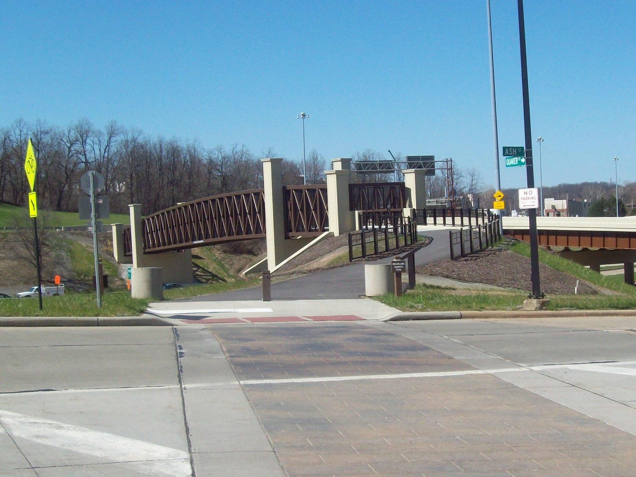
- Valley View Bridge
- Zoar, Ohio
Notes
^ A: In 2007-2008-? Tinkers Creek Aqueduct is undergoing renovation following flood damage from Tinkers Creek (Cuyahoga River) and Cuyahoga River
^ B: Ohio and Erie Canal Towpath Trail miles are measured from its original connection with Lake Erie at Lock 44, on the Cuyahoga River, and marked with a 3.3-foot-tall (1.0 m) sandstone obelisk at each mile mark.
References
- Mendinghall, Joseph S. (February 28, 1975). "National Register of Historic Places Inventory-Nomination: Ohio and Erie Canal". National Park Service.
- "National Register Information System". National Register of Historic Places. National Park Service. January 23, 2007.
- "Ohio and Erie Canal". National Historic Landmark summary listing. National Park Service. Archived from the original on 2008-06-19. Retrieved 2008-06-20.
- "History Ohio's Canals". Ohio Department of Natural Resources. Archived from the original on 2013-12-27. Retrieved 2008-06-28.
- Hagerty, J.E., McClelland C.P. and Huntington, C.C., History of the Ohio Canals, Their construction, cost, use and partial abandonment, Ohio State Archaeological and Historical Society, Columbus, OH 1905
- "Canal Maps". realestate.ohiodnr.gov.
- "Ehmann P&O". Archived from the original on October 14, 2007.
- Wendy J. Adkins (1997). "Penn. & Ohio". geocities. Archived from the original on 2009-10-20.[unreliable source?]
- "Captain Pearl R. Nye: Life on the Ohio and Erie Canal". Library of Congress. Retrieved 2007-04-21.
- Jack Gieck (1988). A photo album of Ohio's canal era, 1825-1913. Kent, Ohio: Kent State University Press. ISBN 0-87338-353-2.
- "Biography of James Garfield". whitehouse.gov. Archived from the original on 2010-08-03. Retrieved 2006-03-14 – via National Archives.
- "Life Portrait of James Garfiled". c-span.org. C-SPAN. Retrieved 3 September 2016.
HE FELL IN THE (CANAL) BY HIS ESTIMATE 16 TIMES AND WAS FISHED OUT EACH TIME. AFTER HE WAS ONLY ON THERE FOR ABOUT SIX WEEKS, CAME HOME NOT SURPRISINGLY, WITH A TERRIBLE FEVER AND THE AGUE SHIVERED AND SHOOK FOR A COUPLE OF WEEKS UNTIL HIS MOTHER GOT A HIM OFF THE CANAL AND INTO SCHOOL.
- "Kids Fishing Pond in Natural Resources Park". www.dnr.state.oh.us.
- "Canals of Ohio 1825-1913 map" (JPEG). The Ohio Historical Society, Columbus, Ohio; National Park Service, United States Department of the Interior.
- "Pennsylvania and Ohio Canal (historical)". Geographic Names Information System. United States Geological Survey, United States Department of the Interior. Retrieved 2009-05-03.
- "Sandy Beaver Canal". Geographic Names Information System. United States Geological Survey, United States Department of the Interior. Retrieved 2009-05-03.
- "Sandy Beaver Canal". Geographic Names Information System. United States Geological Survey, United States Department of the Interior. Retrieved 2009-05-03.
- "Walhonding Canal". Geographic Names Information System. United States Geological Survey, United States Department of the Interior. Retrieved 2009-05-03.
- "Ohio and Erie Canal". Cleveland Memory, Cleveland State University Libraries.
- Lock 44 manually plotted in Google Earth
- "Ohio and Erie Canal and Towpath Trail, Part 2". NorthEastOhio-RoadRunner.[permanent dead link]
- "Ohio and Erie Canal and Towpath Trail, Part 3". NorthEastOhio-RoadRunner. Archived from the original on 2008-03-08. Retrieved 2008-06-26.
- Mill Creek Aqueduct manually plotted in Google Earth
- "Ohio Canal". Geographic Names Information System. United States Geological Survey, United States Department of the Interior. Retrieved 2009-05-03.
- Eleven Mile Lock 39 manually plotted in Google Earth
- "Eleven Mile Lock 39 topographic map". USGS via Microsoft Research Maps.
- Twelve Mile Lock 38 manually plotted in Google Earth
- "Twelve Mile Lock 38 topographic map". USGS via Microsoft Research Maps.
- "Tinkers Creek Aqueduct". Geographic Names Information System. United States Geological Survey, United States Department of the Interior. Retrieved 2009-05-03.
- Fourteen Mile Lock 37 manually plotted in Google Earth
- "Fourteen Mile Lock 37 topographic map". USGS via Microsoft Research Maps.
- Pinery Dam and Feeder Lock 36 manually plotted in Google Earth
- Pinery Dam and Feeder Lock 36 topographic map
- Kettlewell Whiskey Lock 35 manually plotted in Google Earth
- Whiskey Lock 35 topographic map
- Red Lock 34 manually plotted in Google Earth
- Red Lock 34 topographic map
- "Red Lock (historical)". Geographic Names Information System. United States Geological Survey, United States Department of the Interior. Retrieved 2009-05-03.
- Wallace Lock 33 manually plotted in Google Earth
- Wallace Lock 33 topographic map
- "Wallace Lock (historical)". Geographic Names Information System. United States Geological Survey, United States Department of the Interior. Retrieved 2009-05-03.
- "Boston Lock". Geographic Names Information System. United States Geological Survey, United States Department of the Interior. Retrieved 2009-05-03.
- Lonesome Lock 31 manually plotted in Google Earth
- "Lonesome Lock 31 topographic map". USGS via Microsoft Research Maps.
- "Lonesome Lock (historical)". Geographic Names Information System. United States Geological Survey, United States Department of the Interior. Retrieved 2009-05-03.
- Peninsula Feeder Lock 30 manually plotted in Google Earth
- "Peninsula Feeder Lock 30 topographic map". USGS via Microsoft Research Maps.
- Peninsula Lock 29 manually plotted in Google Earth
- "Peninsula Lock 29 topographic map". USGS via Microsoft Research Maps.
- Peninsula Aqueduct manually plotted in Google Earth
- "Peninsula Aqueduct topographic map". USGS via Microsoft Research Maps.
- "Deep Lock (historical)". Geographic Names Information System. United States Geological Survey, United States Department of the Interior. Retrieved 2009-05-03. Deep Lock manually plotted in Google Earth
- "Deep Lock 28 topographic map". USGS via Microsoft Research Maps.
- Johnny Cake Lock 27 manually plotted in Google Earth
- "Johnny Cake Lock 27 topographic map". USGS via Microsoft Research Maps.
- "Furnace Run Aqueduct". Geographic Names Information System. United States Geological Survey, United States Department of the Interior. Retrieved 2009-05-03.
- "Pancake Lock (historical)". Geographic Names Information System. United States Geological Survey, United States Department of the Interior. Retrieved 2009-05-03.
- Pancake Lock 26 manually plotted in Google Earth
- Mudcatcher Lock 25 manually plotted in Google Earth
- Mudcatcher Lock 25 topographic map
- Niles Lock 24 manually plotted in Google Earth
- Niles Lock 24 topographic map
General references
- National Park Service, United States Department of the Interior
- "Ohio and Erie Canal Map" (JPEG). National Park Service, United States Department of the Interior.
- "Ohio and Erie Canal towpath trail". National Park Service, United States Department of the Interior.
- "Ohio and Erie Canal National Heritage Corridor, a National Park Service Discover Our Shared Heritage Travel Itinerary". National Park Service, United States Department of the Interior.
- "The Ohio & Erie Canal: Catalyst of Economic Development for Ohio, a National Park Service Teaching with Historic Places (TwHP) lesson plan". National Park Service, United States Department of the Interior.
- "Chapter 13 Transportation - Canals" (PDF). Ohio Department of Natural Resources. Archived from the original (PDF) on September 12, 2008. Retrieved 2008-07-21.
- "The Ohio and Erie Canal in Cleveland". Cleveland Memory, Cleveland State University Libraries.
External links
- Report from the 1872 Inspection of the Ohio & Erie Canal
- Images of the Ohio & Erie Canal at Summit Memory
- Ohio and Erie Canal National Heritage Corridor
- Ohio and Erie Canal Photo Essay
- "Water And Steel, Concrete And Earth", Erin O'Brien, Cleveland Free Times, July 25, 2007
- Pictures around Waverly
- Southern Ohio Museum The Ackerman Collection of Historical Photographs
- Historic Roscoe Village - A restored 1830 Ohio and Erie Canal Town, Triple Locks, Walhonding Aqueduct Bridge, Canal Boat Rides on an original section of the Ohio and Erie Canal
- Historic American Engineering Record documentation:
- HAER No. OH-59, "Ohio & Erie Canal, Links Lake Erie at Cleveland & Ohio River at Portsmouth, Peninsula, Summit County, OH", 2 photos, 1 measured drawing, 10 data pages, 1 photo caption page
- HAER No. OH-59-A, "Ohio & Erie Canal, Lock No. 29, On Cuyahoga River, 600 feet north of Main Street (Route 303), Peninsula, Summit County, OH", 5 photos, 1 measured drawing, 1 photo caption page
- HAER No. OH-59-B, "Ohio & Erie Canal, Lock No. 37, At Canal & Fitzwater Roads, Valley View, Cuyahoga County, OH", 2 photos, 1 measured drawing, 1 photo caption page
- HAER No. OH-59-C, "Ohio & Erie Canal, Lock No. 38, Canal & Hillside Roads, Valley View, Cuyahoga County, OH", 4 photos, 1 measured drawing, 1 photo caption page
- HAER No. OH-59-D, "Ohio & Erie Canal, Lock No. 39, West side of Canal Road, 3400 feet north of Stone Road, Valley View, Cuyahoga County, OH", 6 photos, 1 measured drawing, 1 photo caption page
- HAER No. OH-59-E, "Ohio & Erie Canal, Lock No. 28, East of Junction of Major & Riverview Roads, Peninsula, Summit County, OH", 3 photos, 1 photo caption page
- HAER No. OH-59-F, "Ohio & Erie Canal, Tinker's Creek Aqueduct, Canal Road, South Tinkers Creek Road, Valley View, Cuyahoga County, OH", 8 photos, 1 photo caption page
- HAER No. OH-60, "Ohio & Erie Canal, Typical Lock Gates, Canal Road between Rockside Road & Fitzwater Road, Valley View, Cuyahoga County, OH", 3 measured drawings
- HAER No. OH-61, "Ohio & Erie Canal, Furnace Run Aqueduct, 1100 feet south of Everett Road, Everett, Summit County, OH", 1 measured drawing
National Register of Historic Places in Ohio | ||
|---|---|---|
| Lists by county |
|  |
| Lists by city |
| |
| Other lists |
| |
| ||
На других языках
[de] Ohio-Erie-Kanal
Der Ohio-Erie-Kanal (engl. The Ohio and Erie Canal), auch Ohio-Kanal, war ein Kanal im US-Bundesstaat Ohio. Er verband den in den Eriesee mündenden Cuyahoga River und den Ohio River. Seit November 1966 haben die erhaltenen Abschnitte des Kanals den Status eines National Historic Landmarks und gehören zum Cuyahoga Valley National Park.[1] Mit der Anerkennung als National Historic Landmark war der Eintrag als Historic District in das National Register of Historic Places verbunden.[2]- [en] Ohio and Erie Canal
Другой контент может иметь иную лицензию. Перед использованием материалов сайта WikiSort.org внимательно изучите правила лицензирования конкретных элементов наполнения сайта.
WikiSort.org - проект по пересортировке и дополнению контента Википедии