geo.wikisort.org - River
The Nushagak River /ˈnuːʃɪɡæk/[3] (Central Yupik: Iilgayaq) is a river in southwest Alaska, United States. It begins in the Alaska Range and flows southwest 450 km (280 mi) to Nushagak Bay, an inlet of Bristol Bay, east of Dillingham, Alaska.
| Nushagak River | |
|---|---|
 Nushagak River | |
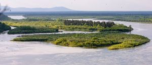
 Location of the mouth of the Nushagak River in Alaska | |
| Native name | Iilgayaq (Central Yupik) |
| Location | |
| Country | United States |
| State | Alaska |
| Physical characteristics | |
| Source | Alaska Range |
| Mouth | Nushagak Bay |
• location | Bristol Bay |
• coordinates | 58°47′58″N 158°37′57″W[1] |
• elevation | 0 m (0 ft) |
| Length | 280 mi (450 km) |
| Basin size | 13,400 sq mi (35,000 km2)[2] |
| Discharge | |
| • location | mouth[2] |
| • average | 35,315 cu ft/s (1,000.0 m3/s)[2] |
The Mulchatna River is a major tributary. Other navigable tributaries include the Nuyakuk River and the King Salmon River.
Jet-boats are commonly used to access these tributaries and the upper Nushagak. The Wood River, Iowithla River and the Kokwok River are smaller tributaries.
The villages of Portage Creek, Ekwok, Koliganek and New Stuyahok are on the river. The town of Dillingham (Pop. 2,466) is on Nushagak Bay.
The Nushagak River is downstream of the proposed Pebble Mine, whose tailings storage lake would sit at the headwaters of the Koktuli River, one of the Nushagak's tributaries. Villages on the Nushagak are among the major opponents of the proposal.
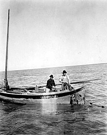
Five species of Pacific salmon (Chinook, coho, sockeye, chum, and pink) spawn in the river or its tributaries. Commercial, subsistence and sport fishing are important in the area. Most notable is the annual run of king (Chinook) salmon which occurs from mid-June to mid-July. Rainbow trout, northern pike, grayling, burbot, whitefish and Arctic char are also present in the Nushagak. It is estimated that over 50% of the world's production of wild salmon is harvested in the Nushagak River and the Bristol Bay area.
See also
- List of Alaska rivers
- List of rivers of the Americas by coastline
- Nushagak, Alaska
- Ekwok Community
References
- U.S. Geological Survey Geographic Names Information System: Nushagak River
- Benke, Arthur C.; Cushing, Colbert E. (2009). Field Guide to Rivers of North America. Academic Press. pp. 332–333. ISBN 978-0-12-378577-0. Retrieved 5 August 2013.
- "Protect Bristol Bay | No Pebble Mine | Nushagak River Adventures Lodge". YouTube.
External links
- Photos from the Nushagak River
- Pebble Mine Photos and Information
- Ekwok Alaska Airport & US Post Office on the Nushagak River
Authority control | |
|---|---|
| General |
|
| National libraries | |
На других языках
[de] Nushagak River
Der Nushagak River ist ein Zufluss der Bristol Bay im Südwesten des US-Bundesstaats Alaska.- [en] Nushagak River
[es] Río Nushagak
El río Nushagak (en inglés: 'Nushagak River'), es un río que discurre por el suroeste de Alaska, en los EE. UU.. Se inicia en el sudoeste de la cordillera de Alaska y fluye durante 450 kilómetros hasta desaguar en la bahía de Nushagak, un entrante de la bahía de Bristol, al este de Dillingham, Alaska.[ru] Нушагак
Нушагак (англ. Nushagak River) — река на юго-западе Аляски. Берёт начало в небольшой горной цепи, течёт на юго-запад и впадает чуть восточнее Диллингхема в залив Нушагак[en], бухту на севере Бристольского залива. Длина реки — 451 км; площадь бассейна — 34 700 км²[1].Другой контент может иметь иную лицензию. Перед использованием материалов сайта WikiSort.org внимательно изучите правила лицензирования конкретных элементов наполнения сайта.
WikiSort.org - проект по пересортировке и дополнению контента Википедии