geo.wikisort.org - River
The Napo River (Spanish: Río Napo) is a tributary to the Amazon River that rises in Ecuador on the flanks of the east Andean volcanoes of Antisana, Sincholagua and Cotopaxi.
This article needs additional citations for verification. (March 2007) |
| Napo river | |
|---|---|
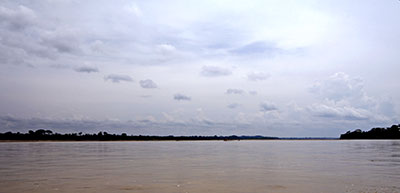 The Napo River to the east of Coca | |
 Map of the Amazon Basin with the Napo River highlighted | |
| Location | |
| Countries |
|
| Physical characteristics | |
| Source | Cotopaxi in the Andes |
| • location | Ecuador |
| • coordinates | 0°40′S 78°25′W |
| Mouth | Amazon River |
• location | 70 km (43 mi) downstream from Iquitos, Loreto Region, Peru |
• coordinates | 3°27′28″S 72°43′3″W |
| Length | 1,130 km (700 mi)[1] |
| Basin size | 103,307.79 km2 (39,887.36 sq mi)[2][3] |
| Discharge | |
| • location | Francisco de Orellana, Maynas, Loreto Region (near mouth) |
| • average | 7,147.761 m3/s (252,420.8 cu ft/s)[4] |
| Discharge | |
| • location | Mazán (Bella Vista), Loreto Region, Peru - 79,76 km upstream of mouth (basin size 100,518 km2 (38,810 sq mi)[2][5] |
| • average | (Period: 1991-2009)6,660 m3/s (235,000 cu ft/s)[6] 7,032.018 m3/s (248,333.4 cu ft/s)[7] |
| • minimum | 3,250 m3/s (115,000 cu ft/s) |
| • maximum | 11,200 m3/s (400,000 cu ft/s) |
| Discharge | |
| • location | Santa Clotilde, Maynas, Loreto Region, Peru - 256.2 km upstream of mouth (basin size 85,770 km2 (33,120 sq mi) |
| • average | (Period: 2002-2011)5,895 m3/s (208,200 cu ft/s)[2] (Period: 2001-2005)5,700 m3/s (200,000 cu ft/s)[8] |
| Discharge | |
| • location | Nueva Rocafuerte, Ecuador - 574.1 km upstream of mouth (basin size 26,879.7 km2 (10,378.3 sq mi)[9] (Period: 2001-2005)2,227 m3/s (78,600 cu ft/s)[8] |
| • average | (Period: 2001-2009)2,031 m3/s (71,700 cu ft/s) |
| Basin features | |
| Tributaries | |
| • left | Aguarico, Coca, Tamboyacu |
| • right | Yasuní, Tiputini, Curaray, Mazan |
The total length is 1,075 km (668 mi). The river drains an area of 103,307.79 km2 (39,887.36 sq mi). The mean annual discharge is 6,660 m3/s (235,000 cu ft/s)[9] (Mazán).

Geography
Before it reaches the plains it receives a great number of small streams from impenetrable, saturated and much broken mountainous districts, where the dense and varied vegetation seems to fight for every piece of ground. From the north it is joined by the Coca River, having its sources in the gorges of Cayambe volcano on the equator, and also a powerful river, the Aguarico having its headwaters between Cayambe and the Colombia frontier. From the west, it receives a secondary tributary, the Curaray, from the Andean slopes, between Cotopaxi and the Tungurahua volcano. From its Coca branch to the mouth of the Curaray the Napo is full of snags and shelving sandbanks and throws out numerous canoes among jungle-tangled islands, which in the wet season are flooded, giving the river an immense width. From the Coca to the Amazon it runs through a forested plain where not a hill is visible from the river - its uniformly level banks being only interrupted by swamps and lagoons. From the Amazon the Napo is navigable for river craft up to its Curaray branch, a distance of about 216 mi (348 km), and perhaps a bit further; thence, by painful canoe navigation, its upper waters may be ascended as far as Santa Rosa, the usual point of embarkation for any venturesome traveller who descends from the Quito tableland. The Coca river may be penetrated as far up as its middle course, where it is jammed between two mountain walls, in a deep canyon, along which it dashes over high falls and numerous reefs. This is the stream made famous by the expedition of Gonzalo Pizarro.
Tributary
Drainge basin
Discharge
| Period of data | Qmean | Smean | Qdominante |
|---|---|---|---|
| 1991/1992 | 5667 | 28,608 | 6009 |
| 1992/1993 | 7104 | 47,718 | 7447 |
| 1993/1994 | 8013 | 67,159 | 8583 |
| 1994/1995 | 6055 | 34,801 | 6525 |
| 1995/1996 | 5956 | 34,017 | 6463 |
| 1996/1997 | 6262 | 38,258 | 6790 |
| 1997/1998 | 9839 | 105,956 | 10354 |
| 1998/1999 | 6839 | 51,48 | 7686 |
| 1999/2000 | 6725 | 49,735 | 7576 |
| 2000/2001 | 6452 | 38,527 | 6810 |
| 2001/2002 | 5979 | 32,431 | 6335 |
| 2002/2003 | 5669 | 32,154 | 6312 |
| 2003/2004 | 6148 | 41,916 | 7054 |
| 2004/2005 | 6456 | 37,953 | 6767 |
| 2005/2006 | 6143 | 34,77 | 6523 |
| 2006/2007 | 6535 | 40,344 | 6942 |
| 2007/2008 | 6615 | 40,832 | 6977 |
| 2008/2009 | 7428 | 52,504 | 7749 |
| 1991-2009 | 6660 | 44,953 | 7161 |
References:
Estudio Binacional de Navegabilidad del Río Napo (Ecuador-Perú)
| Qmean | Qmax | Qmin | Qnormal | |
|---|---|---|---|---|
| Sep | 4551,3 | 5441 | 3757 | 5121,2 |
| Oct | 5344,9 | 6995 | 2894 | 4898,6 |
| Nov | 4427 | 6878 | 3023 | 5595,1 |
| Dec | 6536,8 | 9160 | 5205 | 5660,6 |
| Jan | 7998,7 | 9501 | 4868 | 4580,7 |
| Feb | 6536,8 | 8302 | 5155 | 4386,9 |
| Mar | 9557,2 | 12150 | 5417 | 5824,1 |
| Apr | 11843,7 | 12230 | 10870 | 7502,4 |
| May | 10322,7 | 10790 | 9702 | 8941,3 |
| Jun | 8878,8 | 9961 | 7011 | 9422,9 |
| Jul | 8189,3 | 9228 | 7197 | 8844,7 |
| Aug | 5182 | 7605 | 3975 | 6612,4 |
| Average | 7447,4 | 9020 | 5756 | 6449,2 |
References:
Boletin extraordinario de la evaluación hidrológica y pluviométrica en la cuenca amazónica peruana (Senamhi, 2012)
| Qmean | Qmax | Qmin | Qnormal | |
|---|---|---|---|---|
| Sep | 5037 | 7822 | 3249 | 5096 |
| Oct | 5113 | 6457 | 4632 | 4918 |
| Nov | 4130 | 5660 | 3102 | 5567 |
| Dec | 4755 | 6838 | 3568 | 5698 |
| Jan | 7589 | 9183 | 3854 | 4723 |
| Feb | 5851 | 9071 | 4170 | 4465 |
| Mar | 10060 | 10740 | 9127 | 5973 |
| Apr | 9405 | 10610 | 8675 | 7683 |
| May | 8322 | 10570 | 6932 | 8999 |
| Jun | 10495 | 11230 | 9743 | 9400 |
| Jul | 9675 | 10410 | 8402 | 8817 |
| Aug | 9001 | 9776 | 8386 | 6551 |
| Average | 7452,7 | 9030 | 6153 | 6490,8 |
References:
Boletin extraordinario de la evaluación hidrológica y pluviométrica en la cuenca amazónica peruana (Senamhi, 2013)
| Period of data | Multiannual average discharge | References |
|---|---|---|
| 1930-2006 | 6,464 m3/s (228,300 cu ft/s) | Evaluación hidrológica de las cuencas amazonicas peruanas (HiBam/Senamhi/IRD, octubre 2011) |
| 1989-2010 | 6,360 m3/s (225,000 cu ft/s); Q-dominante 6,865 m3/s (242,400 cu ft/s) | Hydrodinamic and sediment transport modelling in a bend of Napo amazonian river: Morphodynamics and infrastructure implications (IAHR, 2015) |
| 1991-2009 | 6,660 m3/s (235,000 cu ft/s) | Estudio Binacional de Navegabilidad del Río Napo (Ecuador-Perú) |
| 1997-2015 | 6,734.2 m3/s (237,820 cu ft/s) | Assessing the performance of global hydrological models for capturing peak river flows in the Amazon basin (2019) |
| 2000-2011 | 6,461 m3/s (228,200 cu ft/s) | Línea Base Ambiental (Lahmeyer Agua Energia S.A.) |
| 2001-2012 | 6,758 m3/s (238,700 cu ft/s) | Preliminary Analysis of Potential for River Hydrokinetic Energy Technologies in the Amazon Basin |
| 2001-2009 | 6,369 m3/s (224,900 cu ft/s) | Estudio Binacional de Navegabilidad del Río Napo (Ecuador-Perú) |
| 2003-2009 | 6,855 m3/s (242,100 cu ft/s); Q-min 1,875 m3/s (66,200 cu ft/s); Q-max 13,020 m3/s (460,000 cu ft/s) | Modelado hidrologico distribuido de la Cuenca Amazonica Peruana utilizando preciptación obtenida por satelite, 2013 |
| 2004-2010 | 6,609 m3/s (233,400 cu ft/s) | Suspended sediment dynamics in the Amazon River of Peru |
| 2001-2005 | 6,976 m3/s (246,400 cu ft/s) | Sediment budget of the Napo River, Amazon basin, Ecuador and Peru |
| 2004-2006 | 6,267 m3/s (221,300 cu ft/s) | Sediment budget of the Napo River, Amazon basin, Ecuador and Peru |
| 2016-2017 | 9,338 m3/s (329,800 cu ft/s); Q-min 4,654 m3/s (164,400 cu ft/s); Q-max 13,200 m3/s (470,000 cu ft/s) | Hydrological modeling of the Peruvian-Ecuadorian Amazon Basin using GPM-IMERG satellite-based precipitation dataset[permanent dead link] (2017) |
| Confluence of Amazon River: 8,936 m3/s (315,600 cu ft/s) | Inventario y evaluación nacional de aguas superficiales (ONERN, 1980) | |
| Bellavista: 7,032.018 m3/s (248,333.4 cu ft/s); Confluence of Amazon River: 7,147.761 m3/s (252,420.8 cu ft/s) | Rivers Network (2020) |
See also
References
- Ziesler, R.; Ardizzone, G.D. (1979). "Amazon River System". The Inland waters of Latin America. Food and Agriculture Organization of the United Nations. ISBN 92-5-000780-9. Archived from the original on 8 November 2014.
- "6_1-6_Linea Ambiental" (PDF). Archived from the original (PDF) on 2014-06-07. Retrieved 2021-10-15.
- "Rivers Network". 2020.
- "Rivers Network". 2020.
- "Rivers Network". 2020.
- "Estudio Binacional de Navegabilidad del río Napo". www.academia.edu.
- "Rivers Network". 2020.
- "Sediment budget of the Napo River, Amazon basin, Ecuador and Peru". www.academia.edu Hydrological …, 2009.
- "03- Navegabilidad Rio Napo - Inf Fin - Vol III - Hidraulica Fluvial" (PDF).[dead link]
Authority control | |
|---|---|
| General |
|
| National libraries | |
На других языках
[de] Río Napo
Der Río Napo (im Deutschen oft auch kurz: Napo) ist ein 950 Kilometer langer linker Nebenfluss des Amazonas. Das Einzugsgebiet umfasst 115.000 km² (nach anderen Quellen: 100.500 km²). Seine Wasserführung liegt bei 4600 m³/s,[3] nach anderen Quellen bei 6.300 m³/s.[4]- [en] Napo River
[es] Río Napo
El río Napo es un largo río sudamericano que recorre buena parte de los territorios amazónicos de Ecuador y Perú, uno de los principales afluentes directos del río Amazonas en su curso alto. Tiene una longitud de 1.130 km,[1] de los que 667 km corresponden a territorio peruano.[2][it] Rio Napo
Il Rio Napo è un fiume che nasce in Ecuador e si getta nel Rio delle Amazzoni in Perù.[ru] Напо (река)
Напо (Napo) — река в Южной Америке (Эквадор, Перу), левый приток Амазонки. Длина 1130 км[1] (из них 667 км — в Перу[2]).Другой контент может иметь иную лицензию. Перед использованием материалов сайта WikiSort.org внимательно изучите правила лицензирования конкретных элементов наполнения сайта.
WikiSort.org - проект по пересортировке и дополнению контента Википедии