geo.wikisort.org - River
The McKinley River (Lower Tanana: Henteel no' Tl'o) is a 58-mile (93 km) tributary of the Kantishna River in central Alaska in the United States.[3] It drains an area on the north slope of the Alaska Range on the south edge of the Tanana Valley southwest of Fairbanks.[4] The river issues from Muldrow Glacier in the northern Alaska Range in Denali National Park and Preserve, northeast of Denali.[4] It flows through the tundra north of the Alaska Range in a generally northwest direction, joining Birch Creek to form the Kantishna River near Chilchukabena Lake.[4]
| McKinley River | |
|---|---|
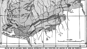 Kantishna Region Geologic map showing the location of the Muldrow Glacier origin of the river | |
 Location of the mouth of the McKinley River in Alaska | |
| Location | |
| Country | United States |
| State | Alaska |
| District | Denali Borough |
| Physical characteristics | |
| Source | Muldrow Glacier |
| • location | Denali National Park and Preserve |
| • coordinates | 63°21′51″N 150°25′59″W[1] |
| • elevation | 3,117 ft (950 m)[2] |
| Mouth | Kantishna River[3] |
• location | confluence with Birch Creek, 23 miles (37 km) east of Lake Minchumina |
• coordinates | 63°51′59″N 151°33′20″W[1] |
• elevation | 646 ft (197 m)[1] |
| Length | 58 mi (93 km)[3] |
The river was named McKinley Fork by A.H. Brooks in 1905. Other names or variants include Henteeth No' Tl'o and Hintusno' Dikats.[1]
See also
References
- "McKinley River". Geographic Names Information System. United States Geological Survey. March 31, 1981. Retrieved October 20, 2013.
- Derived by entering source coordinates in Google Earth.
- Orth, Donald J.; United States Geological Survey (1971) [1967]. Dictionary of Alaska Place Names: Geological Survey Professional Paper 567 (PDF). University of Alaska Fairbanks. United States Government Printing Office. p. 611. Archived from the original (PDF) on October 17, 2013. Retrieved October 15, 2013.
- Alaska Atlas & Gazetteer (7th ed.). Yarmouth, Maine: DeLorme. 2010. pp. 102–03. ISBN 978-0-89933-289-5.
На других языках
[de] McKinley River
Der McKinley River ist der 93 km lange rechte Quellfluss des Kantishna River in Alaska (USA).- [en] McKinley River
Текст в блоке "Читать" взят с сайта "Википедия" и доступен по лицензии Creative Commons Attribution-ShareAlike; в отдельных случаях могут действовать дополнительные условия.
Другой контент может иметь иную лицензию. Перед использованием материалов сайта WikiSort.org внимательно изучите правила лицензирования конкретных элементов наполнения сайта.
Другой контент может иметь иную лицензию. Перед использованием материалов сайта WikiSort.org внимательно изучите правила лицензирования конкретных элементов наполнения сайта.
2019-2026
WikiSort.org - проект по пересортировке и дополнению контента Википедии
WikiSort.org - проект по пересортировке и дополнению контента Википедии