geo.wikisort.org - River
Madidi (Spanish pronunciation: [maˈðiði]) is a river located in the La Paz Department of Bolivia. It is tributary of the Beni River and a part of the Amazon Basin. It runs through the Madidi National Park.
| Madidi River | |
|---|---|
 The Madidi River in Madidi National Park | |
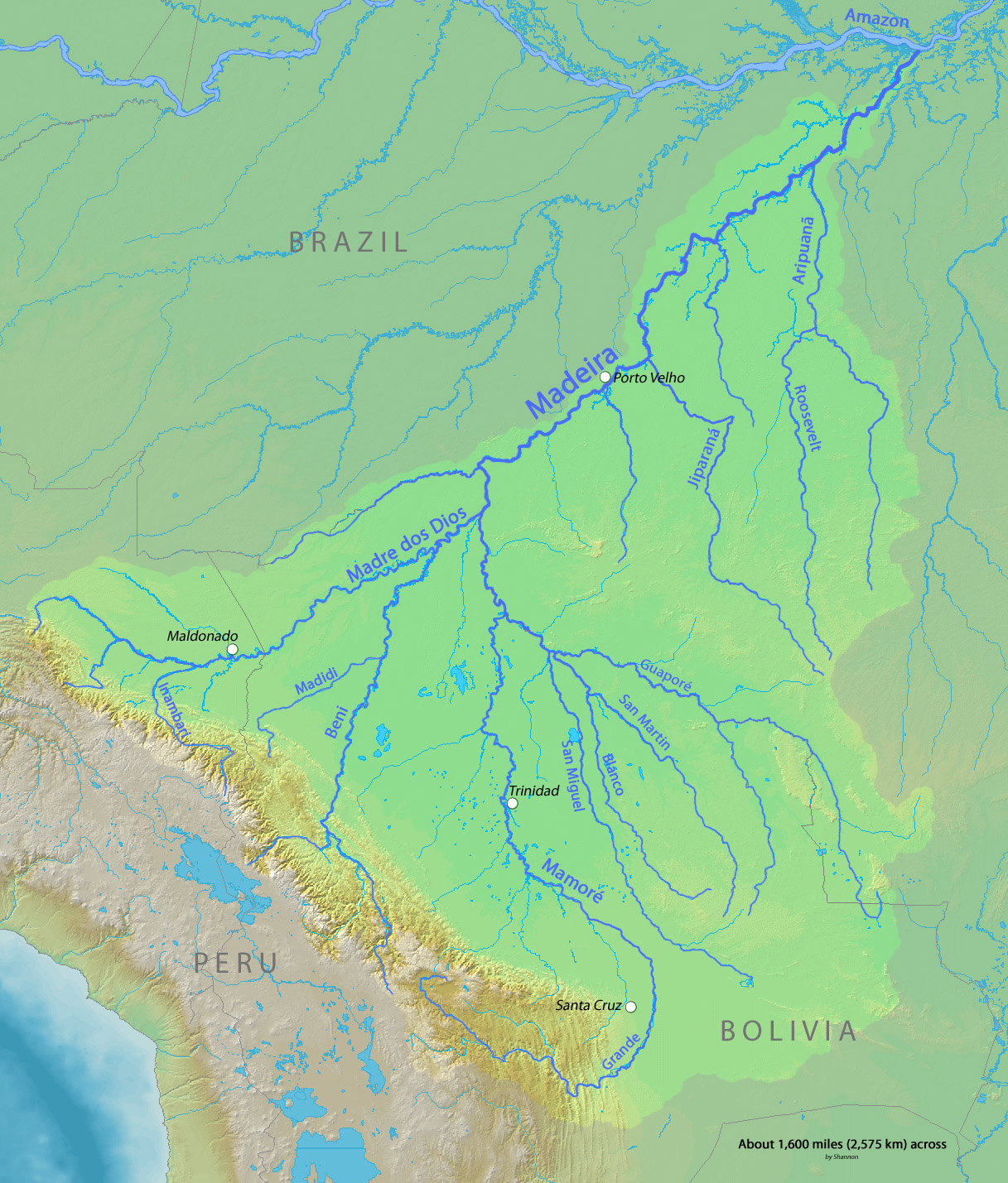 Map of the Madeira River watershed with Madidi River in the southwest | |
| Location | |
| Country | Bolivia |
| Physical characteristics | |
| Source | |
| • location | Bolivia |
| • elevation | 1,060 m (3,480 ft) |
| Mouth | Beni River |
• location | Bolivia |
• coordinates | 12°33′58″S 66°57′52″W |
• elevation | 159 m (522 ft) |
| Length | 350 km (220 mi)[1] |
References
- Ziesler, R.; Ardizzone, G.D. (1979). "Amazon River System". The Inland waters of Latin America. Food and Agriculture Organization of the United Nations. ISBN 92-5-000780-9. Archived from the original on 21 October 2013.
This La Paz Department geography article is a stub. You can help Wikipedia by expanding it. |
На других языках
[de] Río Madidi
Der Río Madidi ist ein linker Nebenfluss des Río Beni im Norden des Departamento La Paz im Tiefland des Andenstaates Bolivien. Über seine Länge gibt es sehr unterschiedliche Angaben[1][2], je nachdem, welche Quellflüsse dazugezählt werden. Dazu mäandriert der Río Madidi sehr stark und verändert dabei ständig seinen Lauf.- [en] Madidi River
[es] Río Madidi
El río Madidi es un río boliviano perteneciente a la cuenca del río Amazonas, parte de la cuenca alta del río Beni. Tiene una longitud de 350 km,[1] aunque con sus fuentes, alcanza los 595 km, siendo uno de los ríos más largos que discurre íntegramente por el país. Corre siempre por el departamento de La Paz y es el principal río del Parque Nacional Madidi, un gran parque declarado en 1995 de 18.957,4 km².[it] Madidi (fiume)
Il Madidi (in spagnolo Río Madidi) è un fiume della Bolivia che scorre nel Dipartimento di La Paz. È il principale fiume che scorre nel parco nazionale omonimo. Nasce ad un'altitudine di circa 1 000 metri ai piedi delle Ande, e scorre prima in direzione nord-est, poi in direzione nord-ovest, per confluire infine, dopo aver percorso 595 km, nel fiume Beni. Il fiume ha un andamento meandrico e forma piccole paludi lungo tutto il suo percorso.Текст в блоке "Читать" взят с сайта "Википедия" и доступен по лицензии Creative Commons Attribution-ShareAlike; в отдельных случаях могут действовать дополнительные условия.
Другой контент может иметь иную лицензию. Перед использованием материалов сайта WikiSort.org внимательно изучите правила лицензирования конкретных элементов наполнения сайта.
Другой контент может иметь иную лицензию. Перед использованием материалов сайта WikiSort.org внимательно изучите правила лицензирования конкретных элементов наполнения сайта.
2019-2026
WikiSort.org - проект по пересортировке и дополнению контента Википедии
WikiSort.org - проект по пересортировке и дополнению контента Википедии