geo.wikisort.org - River
The Lom (Bulgarian: Лом [ˈɫɔm], Latin: Almus) is a river in northwestern Bulgaria, a right tributary of the Danube flowing into it 1 km east of the town of Lom.
| Lom | |
|---|---|
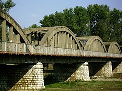
 The Italian-built bridge over the Lom at Kriva Bara | |
| Location | |
| Country | Bulgaria |
| Physical characteristics | |
| Mouth | |
• location | Danube |
• coordinates | 43.8377°N 23.2493°E |
| Length | 92.5 km (57.5 mi)[1] |
| Basin size | 1,160 km2 (450 sq mi)[1] |
| Basin features | |
| Progression | Danube→ Black Sea |
The river takes its source from the foot of Midzhur (2,168 m), the highest peak of western Stara Planina, on the Bulgarian-Serbian border, and mainly flows northeast until its upper course, where it heads north. It passes the villages of Gorni Lom, Dolni Lom, Sredogriv, Falkovets, Ruzhintsi, Drazhintsi, Belo Pole, Roglets, Drenovets, Topolovets, Knyazheva Mahala, Kriva Bara, Vasilovtsi, Staliyska Mahala, Traykovo, as well as three quarters of the town of Lom: Momin Brod, Dalgoshevtsi and Golintsi.
References
- Statistical Yearbook 2017, National Statistical Institute (Bulgaria), p. 17
На других языках
- [en] Lom (river)
[it] Lom (fiume)
Il Lom (in bulgaro: Лом?, in latino: Almus) è un fiume della Bulgaria nord-occidentale, affluente di destra del Danubio, nel quale sfocia 1 km ad est rispetto alla città di Lom.[ru] Лом (река)
Лом — река на северо-западе Болгарии, правый приток Дуная. Исток на склонах горы Миджур (Восточно-Сербские горы, горная система Стара-Планина) у границы заповедника Чупрене близ границы с Сербией.Текст в блоке "Читать" взят с сайта "Википедия" и доступен по лицензии Creative Commons Attribution-ShareAlike; в отдельных случаях могут действовать дополнительные условия.
Другой контент может иметь иную лицензию. Перед использованием материалов сайта WikiSort.org внимательно изучите правила лицензирования конкретных элементов наполнения сайта.
Другой контент может иметь иную лицензию. Перед использованием материалов сайта WikiSort.org внимательно изучите правила лицензирования конкретных элементов наполнения сайта.
2019-2025
WikiSort.org - проект по пересортировке и дополнению контента Википедии
WikiSort.org - проект по пересортировке и дополнению контента Википедии