geo.wikisort.org - River
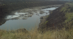
The Kuchurhan (Ukrainian: Кучурган; Romanian: Cuciurgan) is a river in Eastern Europe. It is a tributary of the Turunchuk (a branch of the Dniester) which begins on the Podolian Upland in Ukraine. It then flows SSE and forms part of the border between Transnistria in Moldova and the Odesa Oblast in Ukraine.[1][2] The river is 109 kilometres (68 mi) long and drains 2,090 square kilometres (810 sq mi).[3]
| Kuchurhan Cuciurgan | |
|---|---|
 | |
| Native name | |
| Location | |
| Country | Ukraine, Moldova |
| Physical characteristics | |
| Mouth | Turunchuk |
• coordinates | 46.5539°N 29.9285°E |
| Length | 109 km (68 mi) |
| Basin size | 2,090 km2 (810 sq mi) |
| Basin features | |
| Progression | Turunchuk→ Dniester→ Dniester Estuary→ Black Sea |
A dam has been built on the river just north of the Dniester, forming the Kuchurhan Reservoir. The village of Kuchurhan in Ukraine is located near the river just north of the reservoir and is the site of an important border crossing into Transnistria.
References
- Map in Drainage Basin of the Black Sea, UNECE Publication (2007), Section II, Chapter 5, p. 141
- Description in Drainage Basin of the Black Sea, UNECE Publication (2007), Section II, Chapter 5, p. 143
- Transboundary Diagnostic Study for the Dniester River Basin, OSCE/UNECE Report (2005), p. 28
External links
- Our Waters: Joining Hands Across Borders - First Assessment of Transboundary Rivers, Lakes and Groundwaters, UNECE (2007)
- Transboundary Diagnostic Study for the Dniester River Basin, OSCE/UNECE Project: Transboundary Co-operation and Sustainable Management of the Dniester River (November 2005)
На других языках
[de] Kutschurhan (Fluss)
Der Kutschurhan (ukrainisch Кучурган; russisch Кучурган .mw-parser-output .Latn{font-family:"Akzidenz Grotesk","Arial","Avant Garde Gothic","Calibri","Futura","Geneva","Gill Sans","Helvetica","Lucida Grande","Lucida Sans Unicode","Lucida Grande","Stone Sans","Tahoma","Trebuchet","Univers","Verdana"}Kutschurgan, rumänisch Cuciurgan) ist ein linker, 119 km langer Nebenfluss des Dnisters in der ukrainischen Oblast Odessa, der streckenweise die Staatsgrenze zur Republik Moldau bildet.[1]- [en] Kuchurhan (river)
[es] Río Kuchurhan
El río Kuchurhán o Kuchurgán (en ucraniano, Кучурган (y ruso); en rumano, Cuciurgan; en alemán, Kutschurgan) es un corto río de Europa Oriental, un afluente del río Dniéster que comienza en la meseta de Podolia en Ucrania. Luego fluye en dirección SSE y forma la frontera entre la Transnistria, en Moldavia, y el óblast de Odesa, en Ucrania.[1] Tiene 109 km de longitud y drena una cuenca de 2090 kilómetros cuadrados.[ru] Кучурган (река)
Кучурга́н — река, разделяющая Приднестровье и Украину, левый приток Турунчука (рукава Днестра). Впадает в Кучурганский лиман. Высота устья 1,1 м над уровнем моря[1]. Длина реки — 109 км, площадь водосбора — 2090 км².Текст в блоке "Читать" взят с сайта "Википедия" и доступен по лицензии Creative Commons Attribution-ShareAlike; в отдельных случаях могут действовать дополнительные условия.
Другой контент может иметь иную лицензию. Перед использованием материалов сайта WikiSort.org внимательно изучите правила лицензирования конкретных элементов наполнения сайта.
Другой контент может иметь иную лицензию. Перед использованием материалов сайта WikiSort.org внимательно изучите правила лицензирования конкретных элементов наполнения сайта.
2019-2026
WikiSort.org - проект по пересортировке и дополнению контента Википедии
WikiSort.org - проект по пересортировке и дополнению контента Википедии