geo.wikisort.org - River
Dniester Estuary, or Dniester Liman (Ukrainian: Дністровський лиман; Romanian: Limanul Nistrului) is a liman, formed at the point where the river Dniester flows into the Black Sea. It is located in Ukraine, in Odessa Oblast, and connects Budjak to the Ukrainian mainland. The city of Bilhorod-Dnistrovskyi lies on its western shore and Ovidiopol on its eastern shore. Shabo, situated downstream of Bilhorod-Dnistrovskyi, is known for its wine. The estuary hosts the Bilhorod-Dnistrovsky Seaport.
| Dniester Estuary | |
|---|---|
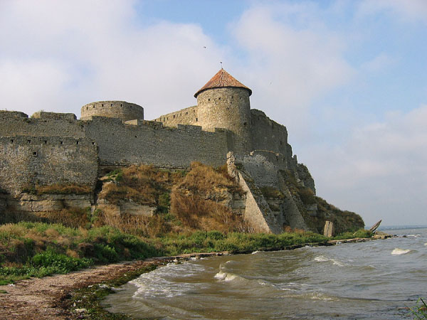 The coast of the estuary near the castle of Bilhorod-Dnistrovskyi | |
 Dniester Estuary | |
| Location | Black Sea |
| Coordinates | 46°14′N 30°21′E |
| River sources | Dniester |
| Ocean/sea sources | Atlantic Ocean |
| Basin countries | Ukraine |
| Max. length | 45.2 km (28.1 mi) |
| Max. width | 12 km (7.5 mi) |
| Surface area | 360–408 km2 (139–158 sq mi) |
| Average depth | 1.8 m (5 ft 11 in) |
| Max. depth | 2.7 m (8 ft 10 in) |
| Water volume | 0.2 km3 (0.048 cu mi) |
| Settlements | Bilhorod-Dnistrovskyi, Ovidiopol, Shabo, Zatoka |
Ramsar Wetland | |
| Official name | Northern Part of the Dniester Liman |
| Designated | 23 November 1995 |
| Reference no. | 765[1] |
The area of the liman varies between 360 and 408 km2, it is 42.5 km long and has maximum width of 12 km. The average depth is 1.8 m, the maximum depth 2.7 m.
On the spit separating the liman from the open Black Sea to the south is the resort town of Zatoka. The only entirely Ukrainian road connecting to Budjak is the H33 along the spit; to avoid the marshes at the northern end of the liman, Highway M15 has to cross into Moldova.
2022 Russian invasion of Ukraine
On 2 May 2022, during the invasion, a Russian rocket strike hit a strategically important bridge on the estuary.[2]
See also
References
- "Northern Part of the Dniester Liman". Ramsar Sites Information Service. Retrieved 25 April 2018.
- Reuters, Thomson (2022-05-04). "Russian rocket strike hits strategic bridge in southwest Ukraine - local authorities". Reuters. Archived from the original on 2022-05-02. Retrieved 2022-05-03.
External links
- Datasheet from www.wetlands.org (pdf file)[permanent dead link]
- (in Russian) 1:100,000 topographic map of the liman - northern section
- (in Russian) 1:100,000 topographic map of the liman - southern section
Authority control | |
|---|---|
| General |
|
| National libraries | |
This article about a location in Odesa Oblast is a stub. You can help Wikipedia by expanding it. |
This Black Sea-related article is a stub. You can help Wikipedia by expanding it. |
На других языках
[de] Dnister-Liman
Der Dnister-Liman (ukrainisch Дністровський лиман .mw-parser-output .Latn{font-family:"Akzidenz Grotesk","Arial","Avant Garde Gothic","Calibri","Futura","Geneva","Gill Sans","Helvetica","Lucida Grande","Lucida Sans Unicode","Lucida Grande","Stone Sans","Tahoma","Trebuchet","Univers","Verdana"}Dnistrowskyj Lyman) ist ein Mündungsarm des Flusses Dnister in das Schwarze Meer. Der nördliche Teil des Limans ist ein geschütztes Ramsar-Feuchtgebiet.- [en] Dniester Estuary
[es] Limán del Dniéster
El limán del Dniéster (en ucraniano, Дністровський лиман; en rumano, limanul Nistrului) es un limán, formado en el punto en el que el río Dniéster desemboca en el mar Negro. Se encuentra en Ucrania, en la óblast de Odesa. La ciudad de Bílhorod-Dnistrovsky queda en su orilla occidental y Ovídiopol en la oriental. Shabo, situada corriente abajo de Bílhorod-Dnistrovsky, es conocida por su vino.[ru] Днестровский лиман
Днестро́вский лима́н (укр. Дністровський лиман) — залив на северо-западном побережье Чёрного моря, в который впадает река Днестр. Расположен в Одесской области Украины.Другой контент может иметь иную лицензию. Перед использованием материалов сайта WikiSort.org внимательно изучите правила лицензирования конкретных элементов наполнения сайта.
WikiSort.org - проект по пересортировке и дополнению контента Википедии