geo.wikisort.org - River
The Iomrautvaam (Russian: Иомраутваам; Chukot: Емрауткенваам) is a river in Chukotka Autonomous Okrug, Russia. The length of the river is 103 kilometres (64 mi) and the area of is drainage basin 1,310 square kilometres (510 sq mi).[1]
| Iomrautvaam Иомраутваам / Емрауткенваам | |
|---|---|
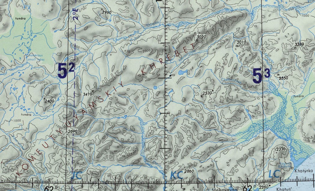 Course of the Iomrautvaam in the upper right | |
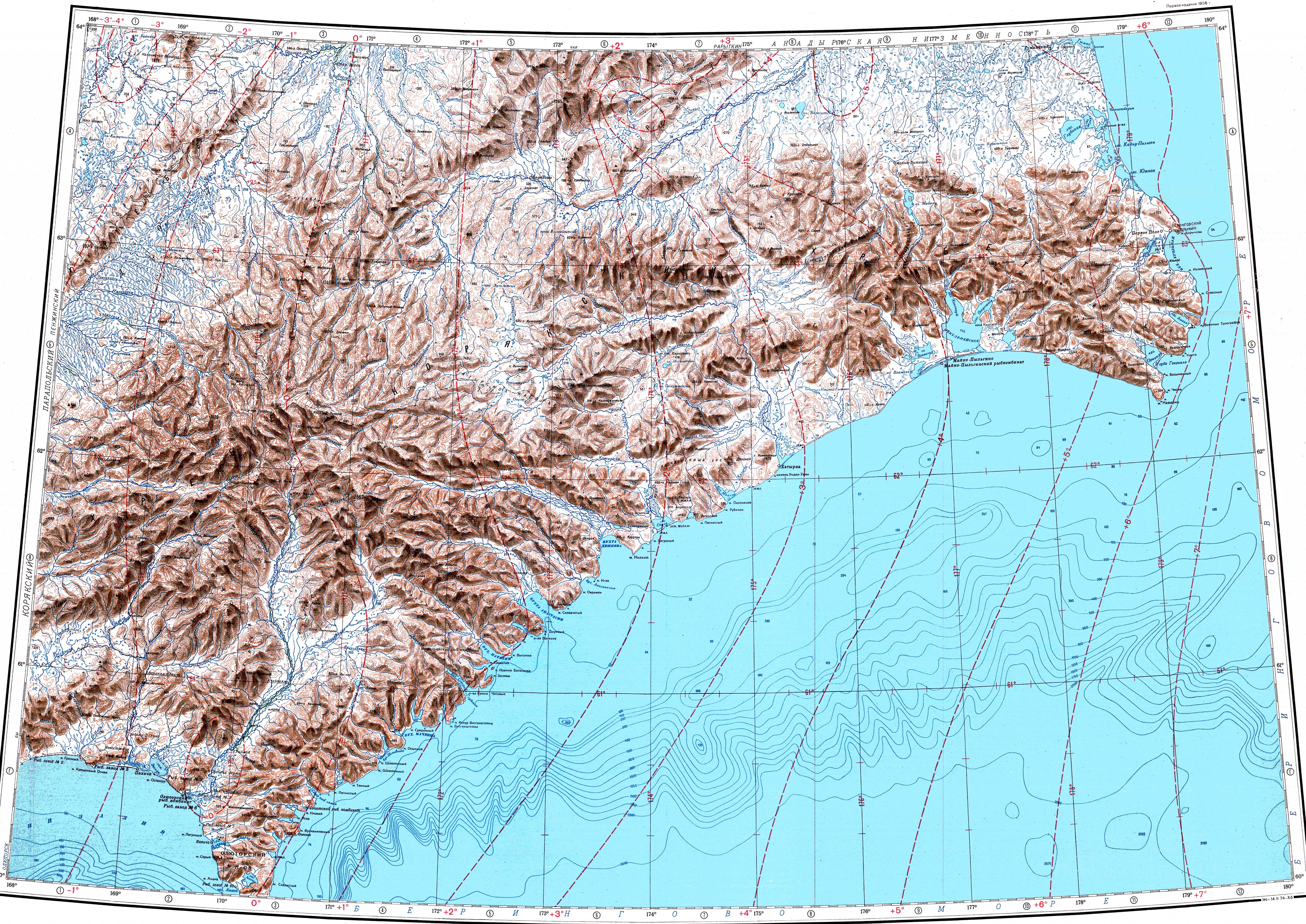
 Mouth location in Chukotka  Iomrautvaam (Far Eastern Federal District) | |
| Location | |
| Country | Russia |
| Federal subject | Chukotka Autonomous Okrug |
| District | Anadyr District |
| Physical characteristics | |
| Source | |
| • location | Komeutyuyam Range |
| • elevation | ca 700 metres (2,300 ft) |
| Mouth | Khatyrka |
• coordinates | 62°41′26″N 174°51′45″E |
• elevation | 60 metres (200 ft) |
| Length | 103 km (64 mi) |
| Basin size | 1,310 km2 (510 sq mi) |
| Basin features | |
| Progression | Khatyrka → Bering Sea |
The Iomrautvaam is the longest tributary of the Khatyrka river.[2]
Course
The Iomrautvaam has its source in the Komeutyuyam Range of the Koryak Highlands. It flows in a roughly northeastern direction in the northern section of the range. Finally it meets the right bank of the Khatyrka 100 kilometres (62 mi) from its mouth, close to the northeastern end of the ridge.[2][3][4][5]
Khatyrka meteorite
The Khatyrka meteorite, a unique-type of meteorite[6] fell in the area of the Iomrautvaam river basin at 62°39′11″N 174°30′02″E. It was found during an expedition to Chukotka in the summer of 2011 buried in a 7,000-year-old layer of dirt and was named Khatyrka meteorite.[7][8]
 |
 |
Flora and fauna
The river basin is characterized by tundra vegetation, including mosses, lichens, dwarf shrubs, and sedges.[9]
See also
- Khatyrkite
- List of rivers of Russia
References
- "Река Иомраутваам (Емрауткенваам) in the State Water Register of Russia". textual.ru (in Russian).
- Atlas of Russia
- "Топографска карта P-59_60 - Topographic USSR Chart (in Russian)". Retrieved 19 February 2022.
- Google Earth
- Water of Russia - Хатырка
- Cosmic sleuthing: An origin story for a really weird meteorite
- Khatyrka meteorite, Iomrautvaam - Mindat.org
- Звизда Т. В., Мануйлов А. А., Василенко А. М. Отчет о геологической съемке масштаба 1:50000 и поисках месторождений полезных ископаемых в бассейне нижнего течения р. Иомраутваам на территории листов Р-60-38-В, Г; 39-В. Анадырь, 1977. 221 с.
- V. Yu. Neshataeva, Vegetation cover of the North of the Kamchatka Okrug (Kamchatsky Krai) and its geobotanical zoning // Ecology and geography of plants and plant communities: Proceedings of the IV International Scientific Conference. - Yekaterinburg, 2018. - April 16. — ISBN 978-5-7741-0341-6
External links
- Astronomy.com - An old meteor yields a new surprise: a never-before-seen material
- Collisions in outer space produced an icosahedral phase in the Khatyrka meteorite never observed previously in the laboratory
- Khatyrka meteorite found to have third quasicrystal
- The Penzhina-West Kamchatka folded zone and the Ukelayat-Sredinnyi block in the structure of the Koryak Highland and Kamchatka
Другой контент может иметь иную лицензию. Перед использованием материалов сайта WikiSort.org внимательно изучите правила лицензирования конкретных элементов наполнения сайта.
WikiSort.org - проект по пересортировке и дополнению контента Википедии