geo.wikisort.org - River
The Huron River is a 14.9-mile-long (24.0 km)[1] waterway in the north central Ohio in the United States. The watershed drains large portions of Erie County and Huron County, the northeast corners of Seneca County and Crawford County, and northern portions of Richland County.
| Huron River | |
|---|---|
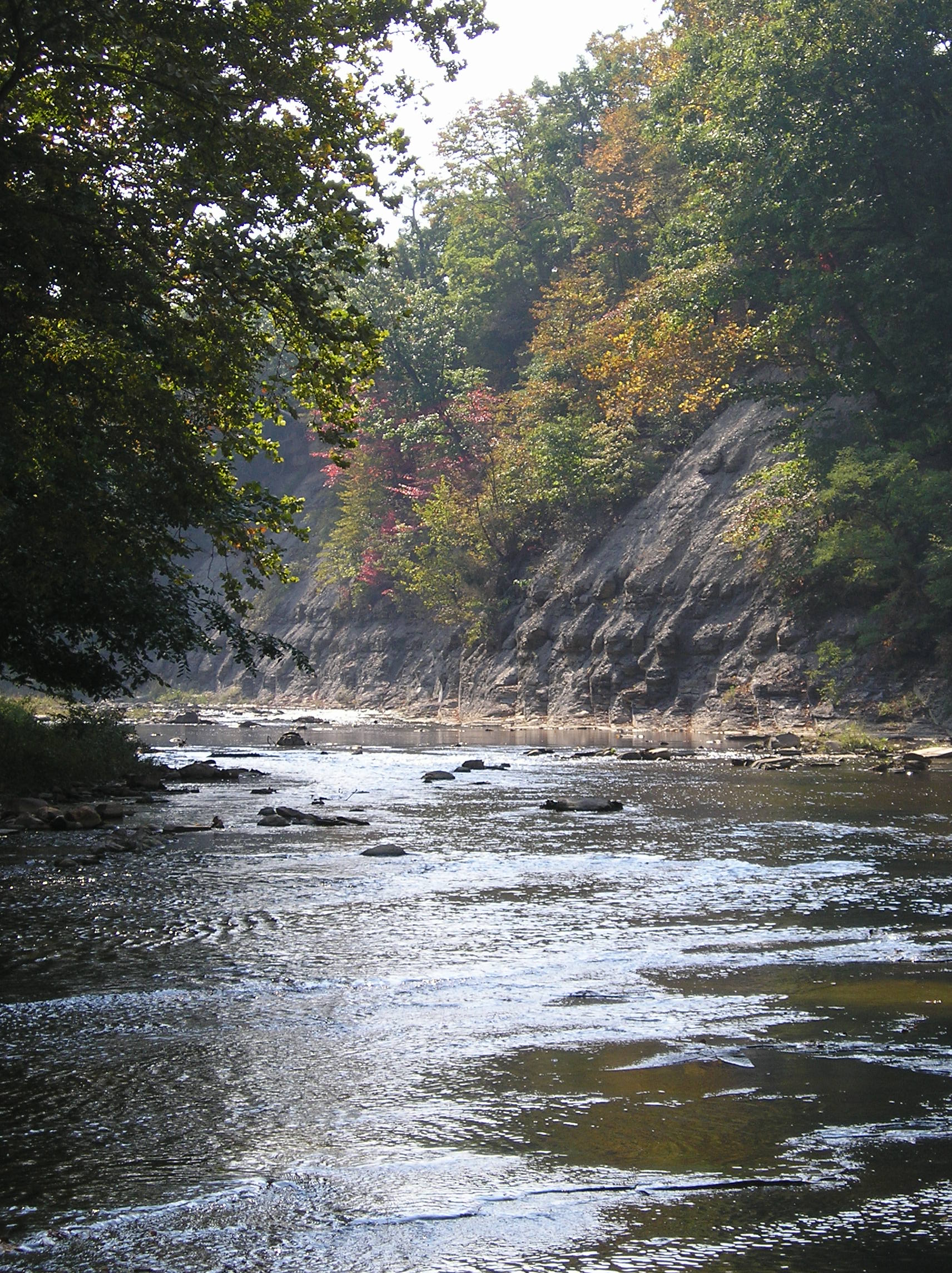 An early autumn scene of the west branch of the Huron River, near the towns of Milan, Monroeville, and Norwalk in north central Ohio. | |
| Location | |
| Country | United States |
| Physical characteristics | |
| Source | |
| • location | East of Shiloh, Ohio |
| • elevation | 1,090 ft (330 m) |
| Mouth | |
• location | Lake Erie at Huron, Ohio |
• elevation | 571 ft (174 m) |
| Length | 15 miles (24 km) |
| Basin size | 406 sq mi (1,050 km2) |


The mouth is on Lake Erie at the city of Huron. The main branch of the river is formed when the East and West branches merge near Milan.
The East Branch, 31.8 miles (51.2 km) long,[1] rises west of Fitchville and flows west to North Fairfield, where it bends north and flows through Peru and Norwalk before reaching Milan.
The West Branch is 54.5 miles (87.7 km) long.[1] It rises about 4 miles (6.4 km) south of Greenwich and four miles east of Shiloh, near the intersection of Gilger Road and Noble Road in northern Richland County's Blooming Grove Township. This is within a few miles of the headwaters of both the southwest branch of the Vermilion River (which also flows north to Lake Erie) and Shipp Creek, which is part of the Ohio River watershed via the Black Fork, Mohican, Walhonding, and Muskingum rivers. The West Branch of the Huron flows north and west from Blooming Grove Township through Huron County's Ripley Township, then back into Richland County's Cass Township and into Plymouth. It is here where the river bends north to flow across the Richland/Huron county line into Huron County's New Haven Township and into New Haven. It passes to the east of Willard, although other tributaries rise north of Willard. Still in Huron County, the West Branch continues north through Greenfield Township, Peru Township, and Ridgefield Township. The West Branch continues north into Monroeville and through the balance of Ridgefield Township. Next, the river crosses from Huron County into Erie County and then bends in an easterly direction through southern Oxford Township before reaching the confluence with the East Branch in the Milan State Wildlife Area.
Tributaries
- Christiana Creek
- Clayton Ditch
- Cole Creek
- Frink Run
- Haas Ditch
- Jacobs Creek
- Marsh Run (see note)
- Megginson Creek
- Milan Village Creek
- Mud Brook
- Mud Run
- Norwalk Creek
- Old Woman Creek
- Rattlesnake Creek
- Sandhill Creek
- Schoeffel Ditch
- Seymour Creek
- Shriner Run
- Slate Run
- Walnut Creek
Note: Willard Marsh, within the Willard Marsh State Wildlife Area, feeds into both the West Branch of the Huron River and the Honey Creek tributary of the Sandusky River. Also, there are numerous creeks, streams, and ditches that are unnamed tributaries in the Huron River basin.
Variant names
According to the Geographic Names Information System, the Huron River has also been known as:[2]
- Hurons River
- Notowacy Thepy [or Naudowessie Sipi ]
- Petquotting [a name adapted from the Moravian village here, 1787–1791.]
- Riviere Huron [or "Riviere aux (Rx) Hurons"]
- Bald Eagle Creek [named for a very large nest of bald-eagles at the river's mouth, in the 1700s]
- Huron Creek
Similarly, the West and East branches have been referred to as the West and East forks.
- Also shown on early maps as named the "Guahadahuri".
- The word "Huron" refers to a Native-American tribe who were also known as the Wyandots (sometimes spelled "Wendots" or "Junundats"). This tribe had many villages in the area of Sandusky Bay, in the latter-1700s.
The Huron River had been given that name by European explorers at least by 1778, when it appears as such on a map by Hutchins. A much earlier map, by Evans in 1755, names it as the "Guahadahuri". (On that Evans map, because of the river's significant depth and navigability even at that early time, it was the only river denoted between Sandusky Bay and the Cuyahoga, but accurately being approx. one-fifth of the distance between the two.) Also in 1755, Pennsylvanian James Smith, who had been captured by Native-Americans and brought to this river to live among them, recorded the river's name as the "Canesadooharie". Whichever one, or both, "guahadahuri" or "canesadooharie", was the more phonetically accurate of a Native-American word, but the word's translation seems lost to obscurity. In 1760, explorer George Croghan refers to the name of this river, also phonetically from its Native-American/Chippewa tribe name, as "Notowacy Thepy"; John Heckewelder recorded it as "Naudowessie Sipi", meaning "the River ("sipi") of the Huron ("Naudowessie") tribe". Some maps of the later-1700s also show the Huron River as "Bald Eagle Creek"; named for a large eagle's nest at its mouth at that time (although one later mapmaker from that time, erroneously denoted "Bald Eagle Creek" and "Guahadahuyi" as being two separate rivers).
- In 1787, the Moravian missionary, David Zeisberger, led a group of Christian-converted Native-Americans from their settlement on the Cuyahoga River, to a new settlement called first Petquotting (but later named 'New Salem' in 1790) on the Huron River, about 3 miles north of (now) Milan, Ohio. They remained until 1791 when forced by local Native-American unrest, they relocated to Canada; but in 1804, some of the Christian-converted Natives, under the direction of G.S. Oppelt, returned to a new different settlement here (also named Petquotting) and it eventually became the village of Milan, Ohio.
- Throughout the latter-1700s, the northern part of the river was a well-known outpost for many French-Canadian traders, including Gabriel Hunot who ran an Indian-trading-post there in the 1780s, and the later John B. Flammand (or "Flemming") about 1805. ---
[sources: Indian Captivities (pp. 191–201) by Drake (publ.1852 by Derby and Miller); and Diary(1787-1791) of David Zeisberger, (publ.1885 by Robert Clarke and Co., Cinti.; Heckewelder's History, Manners, and Customs of the Indian Nations; publ.1876; and Diary(1804-1806) of G.S. Oppelt, Moravian Archives, Bethlehem, PA]
Road intersections
West Branch
Here is a detailed account of which roads cross over the West Branch of the Huron River; beginning at the headwaters near Shiloh in Richland County and ending at the confluence with the east branch near Milan in Erie County.
Richland County
Blooming Grove Township
- Noble Road
- Pennel Road
- Baseline Road
Huron County
Ripley Township
- Ashland Railway, formerly CSX Transportation/Baltimore and Ohio
- Edwards Road
- Plymouth East Road
- Old State Road
- New State Road
- Wheeling and Lake Erie Railway, formerly Akron, Canton and Youngstown Railway
- Plymouth East Road
- Townline Road 111
- Baseline Road
Village of Plymouth
- Broadway Street
- North Street
- Plymouth East Road
New Haven Township
- Skinner Road
 US 224
- Klein Road
- Greenbush Road
- Boughtonville Road
- CSX Transportation, formerly Baltimore and Ohio Railroad
- Townline Road 12
Greenfield Township
- Olive Road
- Maple Ridge Road
 SR 61
SR 61 SR 162
- Hanville Corners Road
- Peru Center Road
- Bauman Road
Peru Township
- Troy Mills Road
- Fern Road
- Snyder Road
- Peru West Section Line Road
- Hettle Road
- Terry Road
Ridgefield Township
- Standardsburg Road
Village of Monroeville
- North Coast Inland Trail, formerly New York Central Railroad
- Wheeling and Lake Erie Railway
 US 20 (Main Street)
- River Road
Ridgefield Township
- Lamereaux Road
Erie County
Oxford Township
- Huber Road
- Lovers Lane Road
Milan Township
- Confluence with the east branch of the Huron River
East Branch
Here is a detailed account of which roads cross over the East Branch of the Huron River; beginning at the headwaters near Fitchville in Huron County and ending at the confluence with the west branch near Milan in Erie County.
Huron County
Fitchville Township
- Crescent Road
- SR 162
- SR 162
- Greenwich Milan Townline Road
Fairfield Township
- Edwards Road
- Delta Road
- Fairfield Angling Road
- Old State Road
Village of North Fairfield
- New State Road (Main Street)
Fairfield Township
- SR 162
- Hanville Corners Road
- Townline Road 131
Bronson Township
- Ridge Road
- Townline Road 113
Peru Township
- SR 61
- Geiger Road
- Remelle Road
- Johnson Road
Ridgefield Township
- Brown Road

 US 20 / SR 18 Byp.
City of Norwalk
- Old West Main Street
- SR 61
- Wheeling and Lake Erie Railway

- North Coast Inland Trail, formerly New York Central Railroad
- Washington Road
Norwalk Township
- Lovers Lane Road
- Schaffer Road
Erie County
Milan Township
- Confluence with the west branch of the Huron River
Main Stem
Here is a detailed account of which roads cross over the main stem of the Huron River; beginning at the confluence of the East and West branches near Milan in Erie County and ending at Lake Erie near Huron in Erie County.
Erie County
Milan Township


 US 250 / SR 13 / SR 113 (concurrent on the same four-lane road)
- (US Geological Survey stream gauge located just downstream of this bridge)


 I-80 / I-90 / Ohio Turnpike (concurrent on the same six-lane road)
- Norfolk Southern Railway, formerly Nickel Plate Road
- Old Mason Road (bridge destroyed on 5 July 1969 flood)
- Mason Road
Huron Township
 SR 2
SR 2
City of Huron
- Norfolk Southern Railway, formerly Conrail/New York Central
 US 6 (Cleveland Road)
- Lake Erie
Other information
- At one point in Huron County's Peru Township, (approximately 7 linear miles away from the confluence) the East and West branches are only separated by approximately 0.64 miles (1.03 km). This is near the intersection of Johnson Road and Peru Center Road.
- An area near the confluence of Seymour Creek and the West Branch (on Lamereaux Road) is said to be haunted. This area also has history from the War of 1812 era. The Haunting at Blue Bridge
See also
References
- U.S. Geological Survey. National Hydrography Dataset high-resolution flowline data. The National Map Archived 2012-03-29 at the Wayback Machine, accessed May 19, 2011
- U.S. Geological Survey Geographic Names Information System: Huron River
External links
| Authority control |
|---|
На других языках
[de] Huron River (Ohio)
Der Huron River ist ein 96 km langer Zufluss des Eriesee an dessen Südufer im nördlichen US-Bundesstaat Ohio.- [en] Huron River (Ohio)
Другой контент может иметь иную лицензию. Перед использованием материалов сайта WikiSort.org внимательно изучите правила лицензирования конкретных элементов наполнения сайта.
WikiSort.org - проект по пересортировке и дополнению контента Википедии