geo.wikisort.org - River
The Goldenke is a river of Lower Saxony, Germany.
This article does not cite any sources. (September 2020) |
| Goldenke | |
|---|---|
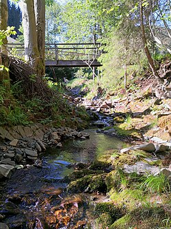
 The Goldenke in Sieber | |
| Location | |
| Country | Germany |
| State | Lower Saxony |
| Location | Göttingen district |
| Physical characteristics | |
| Source | |
| • location | By the Goldenkerklippe on the ridge of Auf dem Acker |
| • coordinates | 51°43′54″N 10°24′52″E |
| • elevation | 800 m above sea level |
| Mouth | |
• location | into the River Sieber in the village of Sieber |
• coordinates | 51°41′55″N 10°25′41″E |
• elevation | 336 m above sea level |
| Length | 4 km |
| Basin size | 5.9 km2 (2.3 sq mi) |
| Basin features | |
| Progression | Sieber→ Oder→ Rhume→ Leine→ Aller→ Weser→ North Sea |
It is a 4 km (2.5 mi) long tributary of the Sieber, north of the village of Sieber in the district of Göttingen. It rises at a height of 800 metres in the vicinity of the Hanskühnenburg on the ridge of Auf dem Acker, by the Goldenkerklippe crags. It then flows mainly in a southerly direction and empties into the River Sieber in the village of the same name.
See also
На других языках
[de] Goldenke
Die Goldenke ist ein 4 Kilometer langer Nebenfluss der Sieber, nördlich der Ortschaft Sieber im Landkreis Göttingen in Niedersachsen. Sie entspringt auf 800 Meter Höhe in der Nähe der Hanskühnenburg beim Höhenzug „Auf dem Acker“, an der „Goldenkerklippe“, fließt meistens in südliche Richtung und mündet in dem Ort Sieber in die Sieber.- [en] Goldenke
Текст в блоке "Читать" взят с сайта "Википедия" и доступен по лицензии Creative Commons Attribution-ShareAlike; в отдельных случаях могут действовать дополнительные условия.
Другой контент может иметь иную лицензию. Перед использованием материалов сайта WikiSort.org внимательно изучите правила лицензирования конкретных элементов наполнения сайта.
Другой контент может иметь иную лицензию. Перед использованием материалов сайта WikiSort.org внимательно изучите правила лицензирования конкретных элементов наполнения сайта.
2019-2025
WikiSort.org - проект по пересортировке и дополнению контента Википедии
WikiSort.org - проект по пересортировке и дополнению контента Википедии