geo.wikisort.org - River
The Glomma, or Glåma, is Norway's longest and most voluminous river. With a total length of 621 kilometres (386 miles), it has a drainage basin that covers fully 13% of Norway's surface area, all in the southern part of the country.[2]
| Glomma / Glåma | |
|---|---|
 The Glomma at the Solbergfoss Hydroelectric Power Station | |
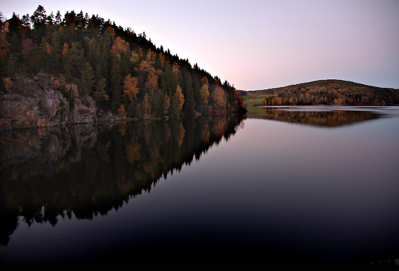
 The course of the Glomma | |
| Etymology | Old Norse, Glaumr, from raumr: "noise," "racket" |
| Location | |
| Country | Norway |
| Physical characteristics | |
| Source | Aursund |
| • location | Røros, Trøndelag, Norway |
| • coordinates | 62°37′06″N 11°48′11″E |
| • elevation | 690 m (2,260 ft) |
| Mouth | Fredrikstad |
• location | Fredrikstad, Østfold, Norway |
• coordinates | 59°13′04″N 10°55′51″E |
• elevation | 0 m (0 ft) |
| Length | 621 km (386 mi) |
| Basin size | 42,000 km2 (16,000 sq mi) |
| Discharge | |
| • average | 720 m3/s (25,000 cu ft/s) |
| • maximum | 4,700 m3/s (170,000 cu ft/s) |
| Basin features | |
| Tributaries | |
| • left | Vorma |
| • right | Rena |
| Designation | |
Ramsar Wetland | |
| Official name | Glomådeltaet |
| Designated | 12 November 2010 |
| Reference no. | 1954[1] |
Geography

At its fullest length, the river runs from the lake Aursund near Røros in Trøndelag and runs into the Oslofjord at Fredrikstad. Major tributaries include the Vorma River, which drains Lake Mjøsa, joining the Glomma River at Årnes in Nes. The Lågen drains into Lake Mjøsa, collecting drainage from the large Gudbrandsdalen and significantly increasing the Glomma's flow.[3]
Because it flows through some of the richest forest districts, it has historically been Norway's leading log-floating river. The combination of raw materials, water power, and easy transport has over the centuries encouraged industry along the Glomma. Some of the country's largest manufacturing and processing concerns are found around its mouth, where supplies of timber and hydropower have been backed by excellent port facilities.

The upper limit of the Glomma valley farms is variable, but typically runs about 500 metres (1,600 ft) in Østerdalen, slightly lower than in the Gudbrandsdalen, which reflects the colder climate. The treeline, with a light birch forest, rises to about 900 metres (3,000 ft) in Østerdalen. Above Røros the forest is restricted to the valley floor.
The upper river valleys of Norwegian rivers have distinctive names which are vestiges of earlier cultural distinctions such as building styles, traditional clothing or bunad and domestic crafts. The upper valley of the Glomma is the Østerdal (or East Valley).
Upon entering Lake Øyeren at Fetsund, the Glomma has formed Europe's largest inland delta which reaches the opposite side of the lake, across its short axis. Some of the vast amount of silt that the Glomma deposits in Lake Øyeren is extracted to manufacture LECA building blocks widely used for in the construction of foundations in Norway.
Name
The form Glomma is used in Østfold and Akershus counties, while in Innlandet and Trøndelag counties the river is called (and written) Glåma. An older form was Glaumr; another, in Old Norse, was Raumelfr, meaning a "loud noise" or "thunder" + "river".[4]
Several places are named after the river, for instance Glåmdal and Glåmos.
See also
- Category:Populated places on the Glomma River
References
- "Glomådeltaet". Ramsar Sites Information Service. Retrieved 25 April 2018.
- "Til kilden". June 2012.
- Fullerton, Brian; Williams, Alan F. (1972). Scandinavia: An Introductory Geography. New York: Praeger Publishers.
- Tolkien, Christopher (trans.), The Saga of King Heidrek the Wise (London: Nelson, 1960), p. 67 fn. 4.
External links
 Media related to Glomma at Wikimedia Commons
| Authority control: National libraries |
|---|
На других языках
[de] Glomma
Die Glomma (alternative Schreibweise Glåma) ist mit einer mittleren Wasserführung von fast 700 m³/s der größte Strom Skandinaviens und mit einer Länge von 601 Kilometern der längste Fluss Norwegens.- [en] Glomma
[es] Río Glomma
El río Glomma o Glåma es el río más largo y de mayor caudal de Noruega, con 604 km de longitud y 698 m³/s de caudal medio. Su cuenca, de 42 000 km², comprende el 13 % del total del país, todo ella en la parte sur. Desemboca en la ciudad de Fredrikstad en el fiordo de Oslo, en aguas del Skagerrak, el estrecho marino que comunica el mar del Norte con el mar Báltico.[it] Glomma
Il Glomma (detto talvolta anche Glåma) è il fiume più lungo che scorre in Norvegia e in tutta la penisola scandinava.[ru] Гломма
Гло́мма[1][2] (Глома[источник не указан 184 дня]; устар. Гломен[3], Гломмен[4]; норв. Glomma[2], Glåma) — река в восточной Норвегии. Самая длинная река в Норвегии (604 км). Бассейн Гломмы занимает около 13 % всей поверхности страны. Площадь водосборного бассейна — 42 441 км² (из них 422 км² на территории Швеции). Норвежское картографическое ведомство (Statens kartverk) признаёт официальными оба диалектных наименования реки — Glåma с долгим гласным (в верховьях реки, в фюльке Трёнделаг и Иннландет) и Glomma с кратким (в низовьях — фюльке Акерсхус и Эстфолл).Другой контент может иметь иную лицензию. Перед использованием материалов сайта WikiSort.org внимательно изучите правила лицензирования конкретных элементов наполнения сайта.
WikiSort.org - проект по пересортировке и дополнению контента Википедии